Low Danube levels in Hungary
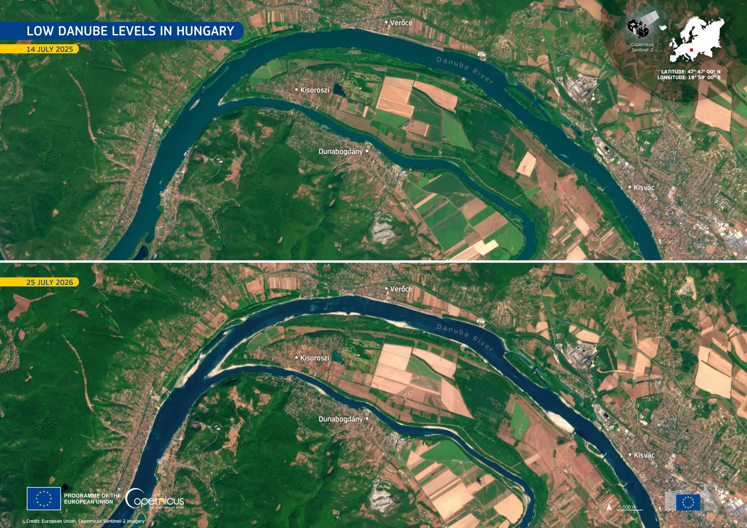
Following a prolonged dry spell and intense summer heat, low water levels are being reported along the Danube River in northern Hungary. This reach forms part of the Danube Bend, where the river divides around a long, wooded island bordered by farmland and settlements. Low water levels also affected navigation and river tourism, with sightseeing services to northern Hungarian towns being suspended since mid-July.
This comparison uses images acquired by the Copernicus Sentinel-2 satellites on 14 July 2025 and 25 July 2026. The 2026 image shows exposed pale sediment bars along several bends. The surrounding landscape forms a patchwork of cultivated fields, built-up areas, and transport infrastructure on both sides of the river.
Copernicus satellite data help authorities map exposed riverbanks and track changes in surface-water extent during prolonged low-flow periods. The resulting information can support assessments of navigation conditions, freshwater habitats, and water management needs during low-flow periods.