Do you want to become part of the Hydrological Forecast Centre - Analytics and Dissemination (DISS) for CEMS EFAS and GloFAS? The CEMS Hydrological Forecast Centre – Analytics and Dissemination (DISS) provides a daily analysis of the hydrological predictions coming from the EFAS including the issuing of Flood Notifications to the end-users.
Results (2167)
Event
The Copernicus Marine Service will host an online webinar dedicated to journalists and media professionals, showcasing the wide range of tools, resources, and ocean data available to support inspiring ocean stories.
Image of the Day
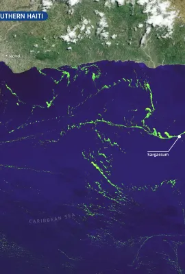
Sargassum blooms are seasonal accumulations of floating algae which can occur across the Caribbean Sea. This bloom has been larger than usual between April and June 2026, raising concern because of the impact this has on tourism, fisheries, and coastal communities.
Image of the Day
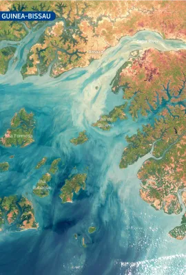
The Bijagós Archipelago, a system of 88 islands off the coast of Guinea-Bissau in West Africa, has been designated by UNESCO as the Bolama-Bijagós Biosphere Reserve. Its mangroves and surrounding waters support rich birdlife, fish, reptiles, mammals, and important green sea turtle nesting sites are highly sensitive to environmental change.
Image of the Day
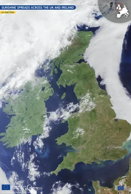
Between 23 and 25 June 2026, a broad area of clear weather brought blue skies across much of the United Kingdom and Ireland, providing us with an unusually cloudless view of the landscape from space. Such weather is relatively uncommon across these islands, where Atlantic weather systems frequently bring extensive cloud cover.
Showing 1-5 of 2167 results