
OBSERVER: How Earth Observation supports compliance assurance across EU policies
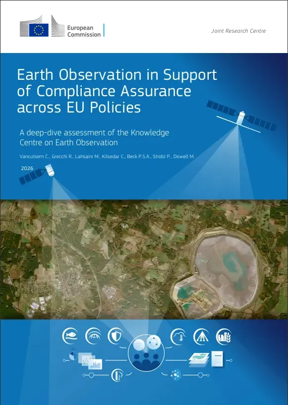
EU legislation is only as strong as our ability to verify compliance with it. The European Commission estimates the annual cost of non-compliance with EU environmental legislation at EUR 50 billion, with enforcement increasingly dependent on consistent evidence gathering across the Union. Earth Observation can provide part of this evidence. The third ‘Deep Dive’ of the European Commission’s Knowledge Centre on Earth Observation (KCEO) examines how far Earth Observation can meet the operational needs of authorities monitoring and enforcing EU legislation, from the Common Agricultural Policy and maritime surveillance to climate reporting. In this Observer, we look at what satellite monitoring already delivers, its current limitations, and the report's recommendations for addressing them.
Enforcing environmental legislation across 27 Member States is already a sizeable task. Reliance on ground-based monitoring alone makes this task even more difficult. The third Deep Dive from the European Commission’s Knowledge Centre on Earth Observation (KCEO) assesses Earth Observation (EO) technology and capacity against the operational needs of authorities responsible for monitoring and enforcing EU legislation. The report concludes that EO already supports compliance across several established policy domains, and that the data already available could be further leveraged to strengthen enforcement.
Compliance assurance, the promotion, monitoring, and enforcement of adherence to EU legislation, is an obligation grounded in the EU Treaties and a standing responsibility of the European Commission. It rests on three pillars: promoting compliance, monitoring it, and enforcing it when requirements are not met. The Action Plan on Environmental Compliance and Governance has estimated the annual cost of non-implementation of EU environmental law at EUR 50 billion and set out nine concrete actions to address it.
How Earth Observation already delivers
The report identifies five domains in which EO has reached operational maturity. Across these domains, satellite monitoring can provide repeatable and verifiable evidence over large areas, with a single dataset often serving several policy areas at once.
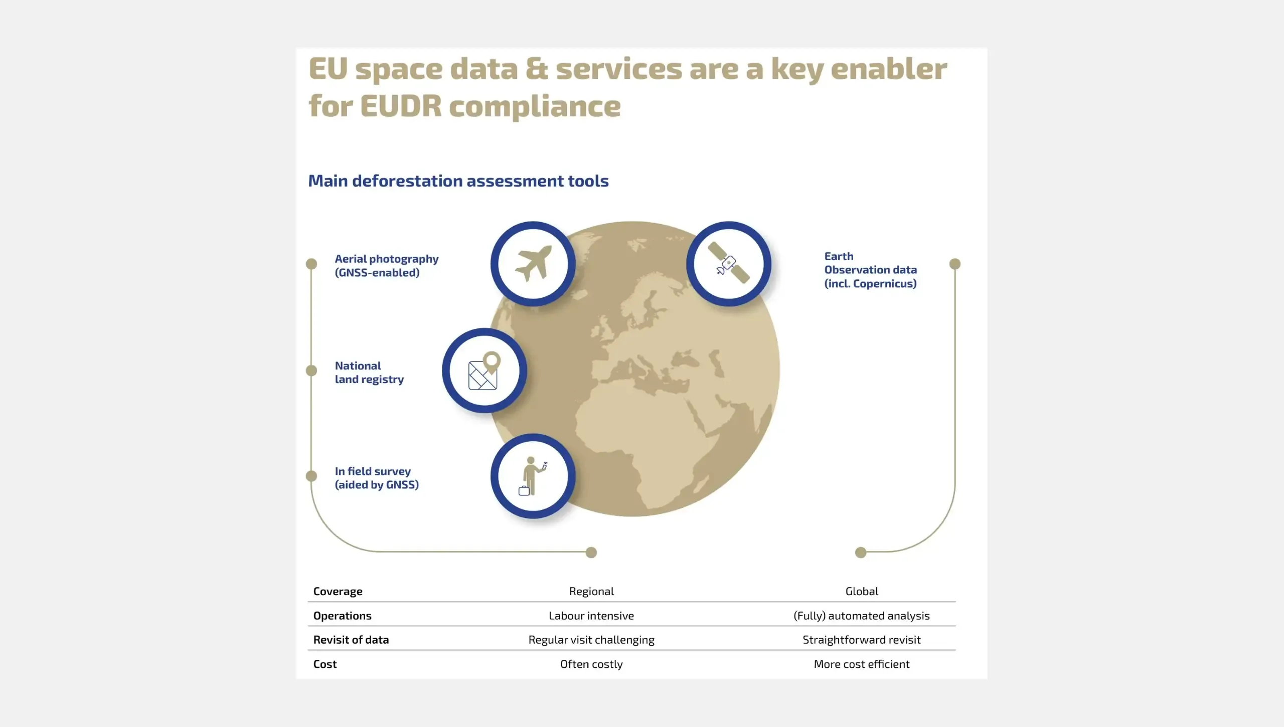
Under the Common Agricultural Policy (CAP), the Area Monitoring System uses Copernicus Sentinel satellite time series to check farmland against eligibility and conditionality rules across the Union. At sea, Copernicus Maritime Surveillance supports enforcement of the International Convention for the Prevention of Pollution from Ships (MARPOL) through the detection of illegal discharges and the identification of responsible vessels. The Copernicus Security Service provides geospatial evidence for environmental crime investigations, in application areas such as illegal mining, unauthorised logging, illegal, unregulated, or unreported fishing, as well as waste dumping. For forests, EO-derived forest-cover products support the due-diligence obligations of the EU Deforestation Regulation (EUDR). For climate reporting, EO-based activity data contribute to the reports which Member States submit under the rules governing land use, land-use change, and forestry (LULUCF).
Emerging needs and current limits
Beyond these established domains, the report examines six emerging use cases: thermal performance of buildings, urban greenhouse gas emissions and air quality, energy-sector emissions, peatland restoration, water quality, and monitoring of critical raw material sites. Together, they address 16 policy objectives, for which available EO products align with operational requirements to varying degrees, generally meeting needs only partially rather than fully.
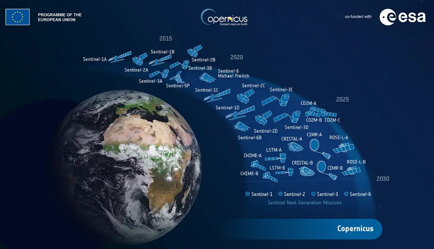
Effective monitoring of compliance within these applications areas demands both fine detail, at or below 10 m spatial resolution, and frequent revisits, yet current infrastructure cannot consistently provide both across the European Union. The report describes this constraint as the resolution-frequency dichotomy. The Copernicus Sentinel Expansion Missions, including the Land Surface Temperature Monitoring mission, the Copernicus Hyperspectral Imaging Mission, and the Copernicus Anthropogenic Carbon Dioxide Monitoring mission, are expected to close part of this gap, but not all of it.
Four further barriers add to these technical limitations. Pixel-level uncertainty is rarely quantified, with only about 5% of the analysed Copernicus Land Monitoring Service datasets providing documented uncertainty layers suitable for legal and compliance applications. There is also no coherent EU framework for the legal admissibility of EO evidence. Institutional capacity remains limited in Member States and within the European Commission. Finally, integrating satellite data with in situ data and models remains difficult.
From capability to compliance
The report puts forward recommendations organised along three pathways, distinguished by who acts and what needs to change.
The first is last-mile implementation: making fuller use of what Copernicus can already provide. This refers to operational uptake of the existing Copernicus Thematic Hubs (which serve the health, energy, arctic, coastal zones, and cultural heritage user communities), data harmonisation which combines satellite and in situ measurements, capacity building for Member State agencies and enforcement authorities, and formal recognition of Earth Observation within EU compliance frameworks. The revised LULUCF Regulation, with its 2028 mandate for georeferenced land-use tracking, is cited as the leading precedent for that recognition.
The second is the evolution of Copernicus: strengthening services to reduce the processing and analysis required from users. Priorities include (1) analysis-ready and dynamic products, (2) systematic very high-resolution coverage building on the pan-European 2 m mosaic which the report identifies as feasible, (3) embedded per-pixel uncertainty layers which meet the standards required for legal use, and (4) mission continuity to ensure availability of the long time series on which compliance baselines depend.
The third is priority research: developing capabilities which are not yet operational. This covers automated EU-scale change detection, incorporating the explainability required for regulatory acceptance, multi-source data fusion, and metrology-based methods for quantifying uncertainty.
Technical capability alone does not ensure compliance-grade monitoring. Turning data into such monitoring would also depend on coordinated progress across service evolution, methodological standards, institutional capacity, legal frameworks, and sustained engagement between the parties involved.
Looking ahead
Earth Observation already contributes to the enforcement of EU legislation in areas including agriculture, maritime monitoring, forests, and carbon accounting. The assessment indicates that further progress depends on implementation and coordination, as well as on the development of additional satellite capabilities. The full report is available at: https://data.europa.eu/doi/10.2760/3964286.