Ancient volcanoes shape New Zealand’s Banks Peninsula
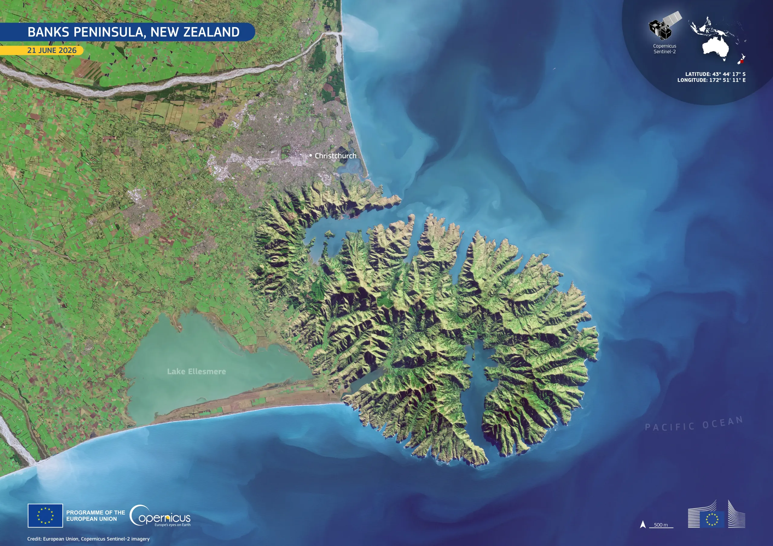
Banks Peninsula extends into the Pacific Ocean from the eastern coast of New Zealand’s South Island, beside Christchurch, the largest city on the island. Formed from the eroded remains of two extinct volcanoes, the peninsula has steep ridges, indented bays, and a rugged coastline.
This image, acquired by one of the Copernicus Sentinel-2 satellites on 21 June 2026, shows Banks Peninsula bordered by the turquoise waters of the Pacific. Christchurch is visible to the north-west, while Lake Ellesmere appears to the south-west. To the west, the Canterbury Plains form a patchwork of agricultural fields, contrasting with the peninsula’s steep, hilly interior.
The Copernicus Sentinel-2 satellites provide high-resolution optical imagery which supports the monitoring of coastal zones, land cover, and vegetation.