Cape Fold Mountains shape South Africa’s Western Cape
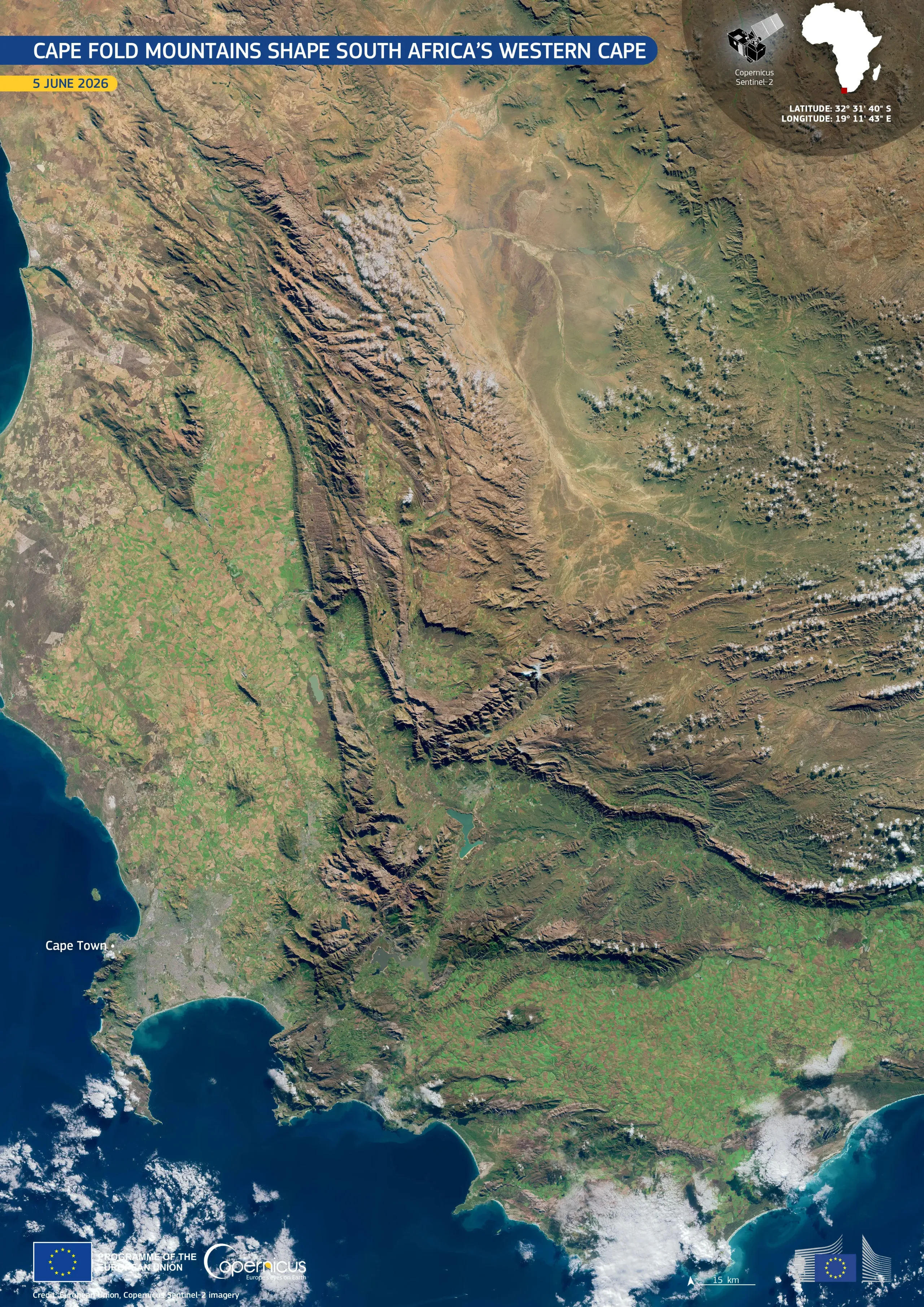
The Cape Fold Mountains extend across south-western South Africa, forming a series of parallel ridges between the Atlantic coast and the country’s drier interior. Their valleys and surrounding lowlands, including those around Cape Town, sustain cities, agriculture, and distinctive ecosystems.
This natural-colour image, acquired by one of the Copernicus Sentinel-2 satellites on 5 June 2026 during the southern-hemisphere winter, shows the mountains running northwards and eastwards from the Cape Peninsula. Dark blue ocean waters frame the coast, while bright and muted green tones mark cultivated land and vegetation across the coastal plains and valleys. Brown and ochre colours dominate the rugged ridges and arid plateaus further inland, with scattered white clouds over higher ground.
Copernicus data support the monitoring of vegetation, agricultural land, and mountain ecosystems, contributing to land management, water-resource planning, and environmental conservation.