Copernicus Sentinel-6B enters operational service
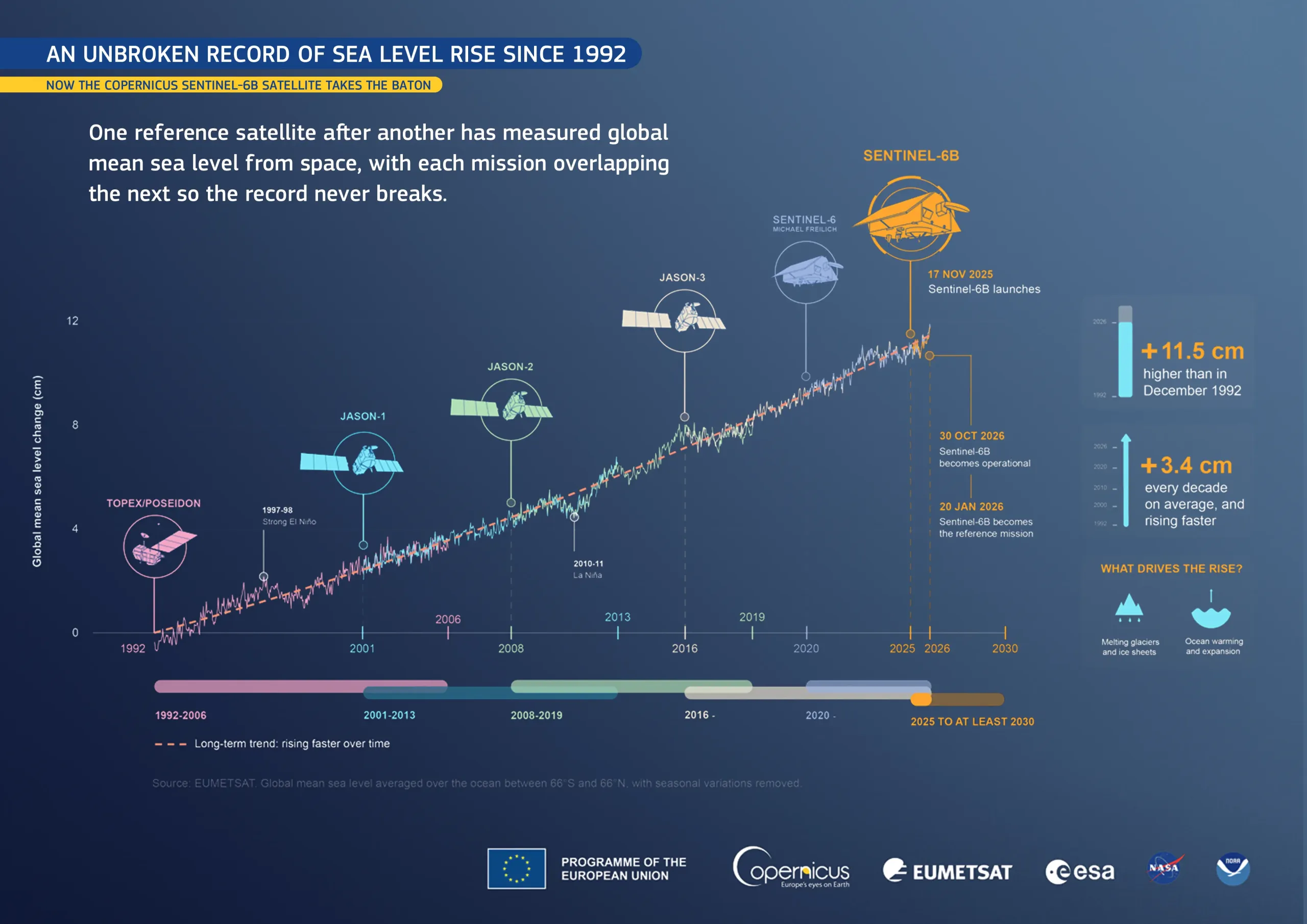
On 29 October 2026, Copernicus Sentinel-6B, the latest Copernicus satellite dedicated to measuring sea level, entered operational service, nearly a year after its launch on 17 November 2025. It joins its twin, Copernicus Sentinel-6 Michael Freilich (Copernicus Sentinel-6A), which has been in orbit since November 2020. Copernicus Sentinel-6B will continue the record of global sea level measurements, which began in 1992, into the 2030s.
This infographic shows how global mean sea level, the average height of the ocean surface worldwide, has changed since satellite measurements began. Since December 1992, the global average has risen by more than 11.5 cm, at an average rate of 3.4 cm per decade. Two processes mainly drive this increase: melting glaciers and ice sheets, which add water to the ocean, and the expansion of seawater as it warms.
Copernicus Sentinel-6B measures the height of the sea surface across up to 95% of the ice-free ocean every 10 days. Its data will support long-term climate monitoring, improve ocean and weather forecasting, and provide essential information for coastal protection and maritime safety.
More information on Sentinel-6B is available here.