Drought affects Guatemala’s Dry Corridor
Guatemala has been affected by scarce rainfall during the 2026 wet season, coinciding with the development of El Niño conditions in the equatorial Pacific Ocean. These dry conditions particularly affected the country’s Dry Corridor, a region characterised by a long dry season and recurrent droughts. According to Guatemala’s National Institute of Seismology, Volcanology, Meteorology and Hydrology (INSIVUMEH), rainfall was about 33% below average for the period in this area.
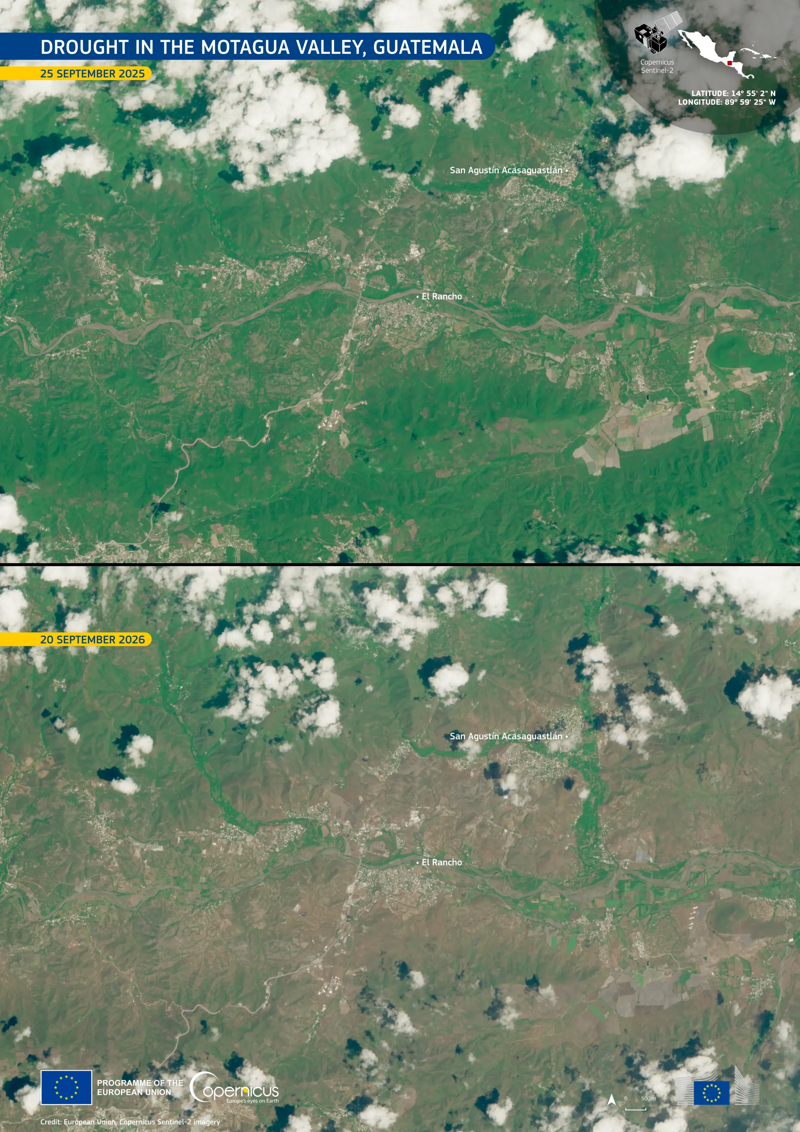
These Copernicus Sentinel-2 images illustrate the contrast in the centre of the Motagua Valley, an area within Guatemala’s Dry Corridor, in the department of El Progreso, about 60 kilometres north-east of Guatemala City. The top image, acquired on 25 September 2025, shows dense green vegetation across the valley floor and the surrounding hills. In contrast, the bottom image, acquired on 20 September 2026, shows slopes in brown tones, with green reduced to narrow strips along the Motagua River and its tributaries.
Copernicus Sentinel-2 imagery supports the monitoring of the status of vegetation and croplands, contributing to drought assessment, food security analyses, and water resource planning.