Europe's major rivers at record low water levels
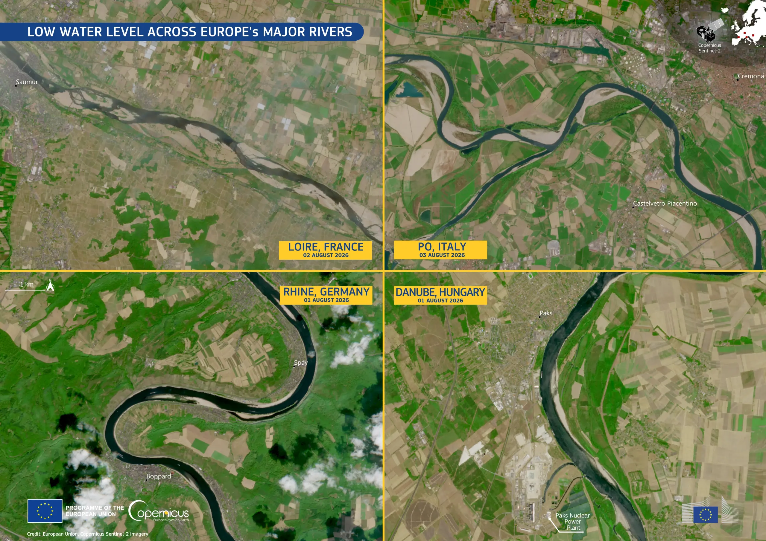
Copernicus Sentinel-2 images acquired between 1 and 3 August 2026 reveal exceptionally low water levels along sections of four of Europe's largest rivers: the Loire near Saumur in France, the Po near Cremona in Italy, the Rhine near Boppard in Germany, and the Danube near Paks in Hungary. Extensive sandbanks and gravel bars, normally hidden beneath the water, are clearly visible in each scene, illustrating the widespread impact of the prolonged drought which is affecting much of Europe.
The consequences extend well beyond the riverbanks. On the Rhine, reduced water levels are limiting cargo transport and disrupting industrial supply chains across central Europe. Along the Danube, the image shows the Paks Nuclear Power Plant, where low river discharge is creating serious operational challenges for reactor cooling. In Italy, the level of the Po River continues to cause mounting pressure on irrigation, hydropower generation, and freshwater availability, while the Loire reflects hydrological conditions consistent with the severe hydrological stress affecting large parts of western Europe.
The Copernicus product portfolio includes two Drought Observatories, managed by the Copernicus Emergency Management Service, which provide, respectively, drought indicators and early warning for droughts in Europe (EDO) and worldwide (GDO).