Fifty years of urban growth in Paris, France
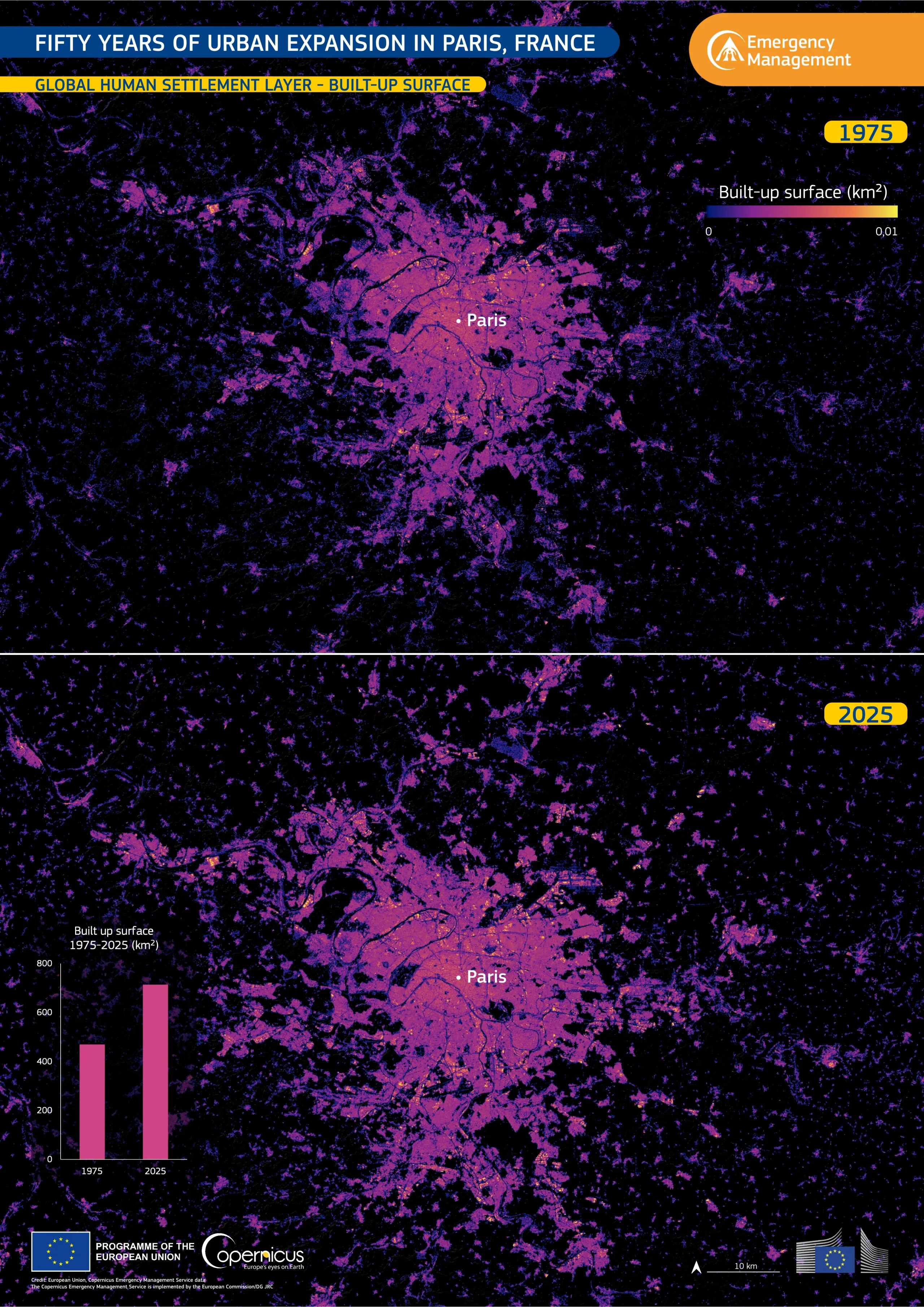
Celebrated every year on 31 October, World Cities Day highlights the importance of sustainable and resilient urban development. Planning for such development requires an understanding of how cities have expanded over time. Paris, France, and its surroundings provide a clear example, with built-up areas spreading across the region over the past five decades.
This visualisation is based on data from the Global Human Settlement Layer (GHSL) of the Copernicus Emergency Management Service. The two maps show the extent of built-up areas across Paris and its suburbs in 1975 and 2025. Over this period, the total built-up surface within the mapped area grew by more than 50%, from about 470 km² to roughly 710 km². The newly built-up land alone covers more than twice the area of the city of Paris.
Copernicus data support assessments of exposure to natural hazards by helping locate built-up areas in hazard-prone zones. These assessments help authorities prioritise risk reduction measures and plan more resilient cities. More information about GHSL and its applications is available here.