Four years after the major wildfires of 2022, fire returns to the Landes de Gascogne, France
In the summer of 2022, the Landes de Gascogne forest in south-western France was hit by the country's largest wildfires in decades, with more than 30,000 hectares burnt around Landiras and La Teste-de-Buch. Four years later, wildfires returned on a larger scale. A fire which began near Saumos on 22 July 2026 spread north of the Arcachon Basin, while a second broke out the following day near Biscarrosse, in the neighbouring Landes department. Together they had burnt about 42,000 hectares by 27 July, the largest area affected by wildfire in France since 1949.
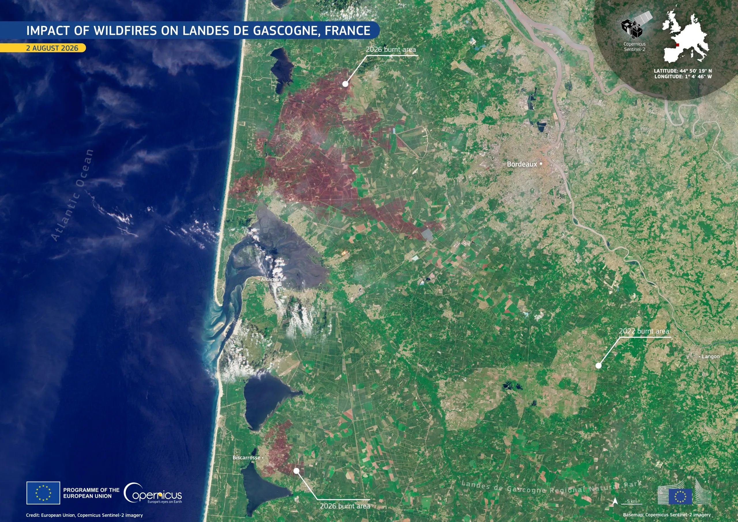
This natural-colour image, acquired by one of the Copernicus Sentinel-2 satellites on 2 August 2026, shows both scars in dark reddish-brown: the larger Saumos scar extending inland from the coast, and the smaller Biscarrosse scar lying beside the coastal lakes. To the south-east, the 2022 Landiras scar remains distinguishable in paler tones, four years later.
Copernicus Sentinel-2 data provide key information for mapping fire damage, assessing ecosystem recovery, and supporting forest management and wildfire risk reduction across Europe.