Green corridors in Münster, Germany
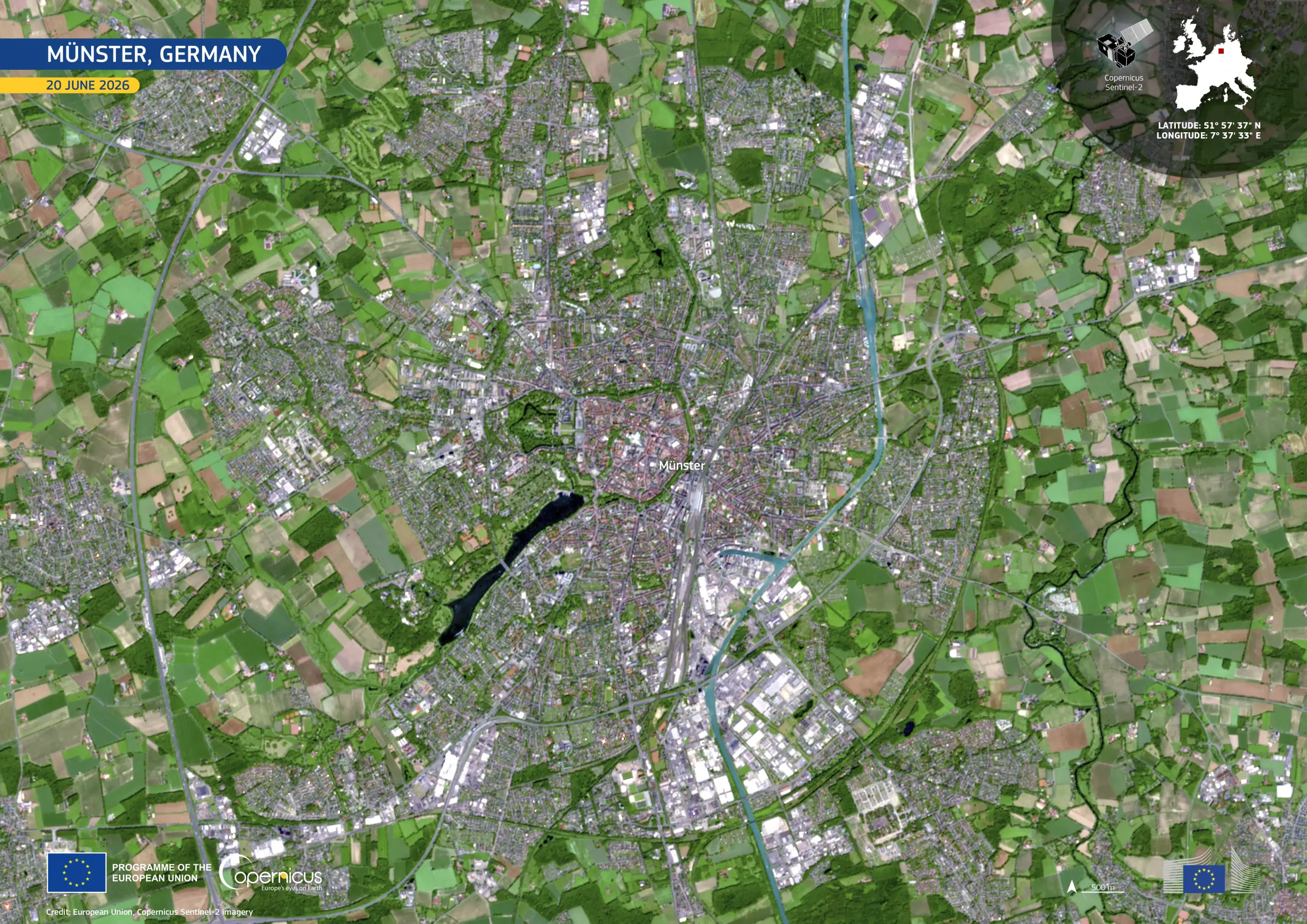
The city of Münster, in North Rhine-Westphalia, Germany, lies at the heart of the Münsterland region. It is one of Germany’s leading cities for cycling, with more bicycles than residents. Its historic centre is encircled by the 4.5-kilometre Promenade, a green route created along the former city fortifications and now used primarily by pedestrians and cyclists.
This image, acquired by one of the Copernicus Sentinel-2 satellites on 20 June 2026, shows the city and its rural surroundings in natural colour. Densely built areas appear in grey and pale red tones, while fields, parks, and wooded areas form an extensive green mosaic. Lake Aasee is visible south-west of the city centre, and the Dortmund–Ems Canal traces a blue corridor through the eastern part of the city.
Copernicus Sentinel-2 data support the monitoring of urban development, vegetation, and land use, contributing to sustainable planning, environmental management, and regional landscape assessment.