A parade of hurricanes crosses the Pacific Ocean
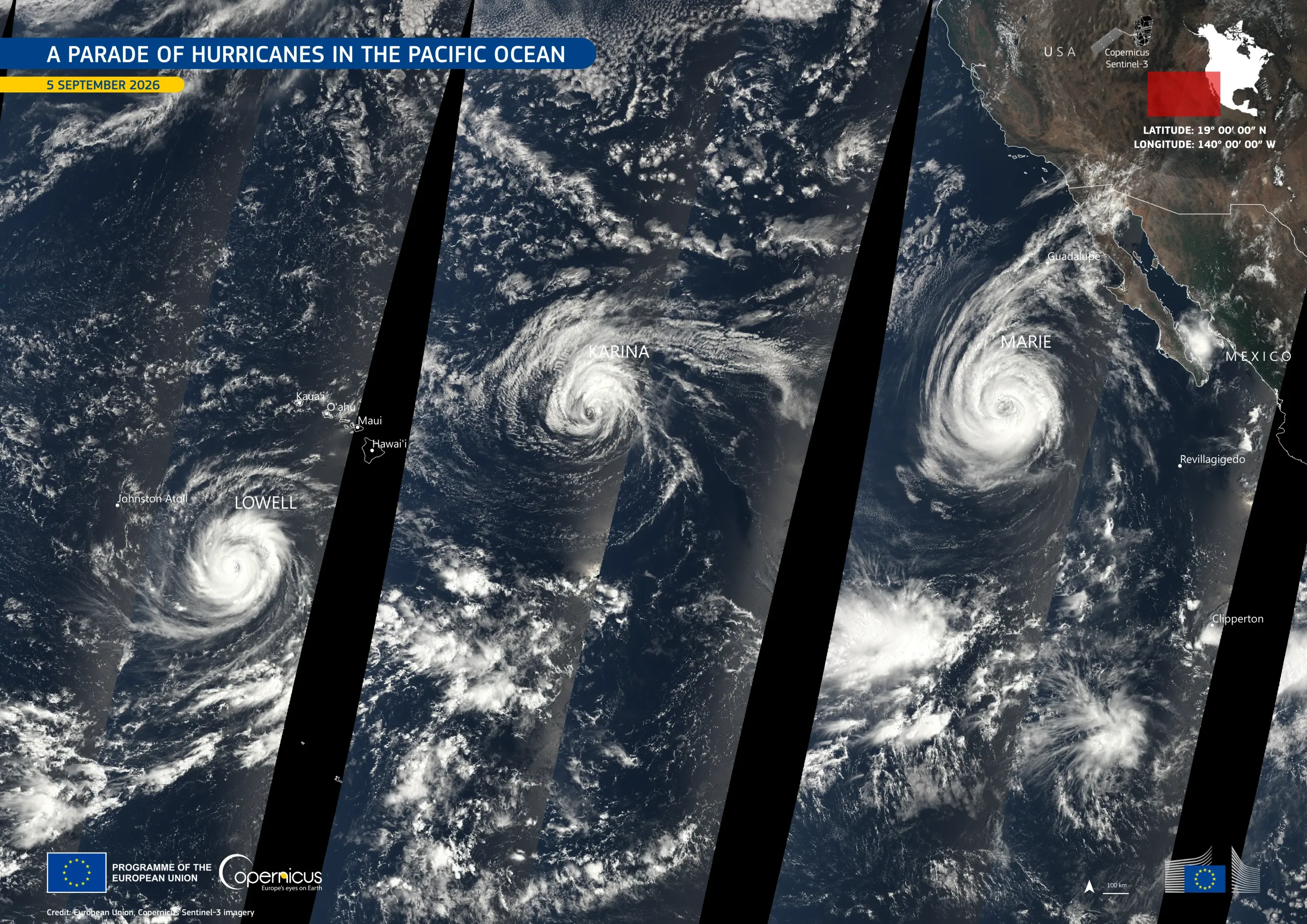
For the first time since 2015, three hurricanes were active simultaneously over the North Pacific Ocean in early September 2026, spread over about 4,500 km from west of Baja California to south of Hawaii. Lowell, the strongest, reached Category 5 on 5 September with maximum sustained winds of 260 km/h. Karina, at the centre of the group, peaked at Category 4 with 215 km/h two days earlier, and Marie, the latest, became a hurricane on 3 September.
This large view of the Pacific Ocean is based on Copernicus Sentinel-3 acquisitions made on 5 September 2026, from 16:29 to 22:31 UTC. The storms were imaged from 18:07 to 20:56 UTC, each a bright white spiral over deep blue water, and the black stripes mark where consecutive orbits did not overlap.
Copernicus Sentinel-3 data support the monitoring of cloud structure and sea-surface conditions over the oceans, contributing to maritime safety, weather forecasting, and coastal risk assessment.