Super Typhoon Champi generates 10-metre waves east of the Philippines
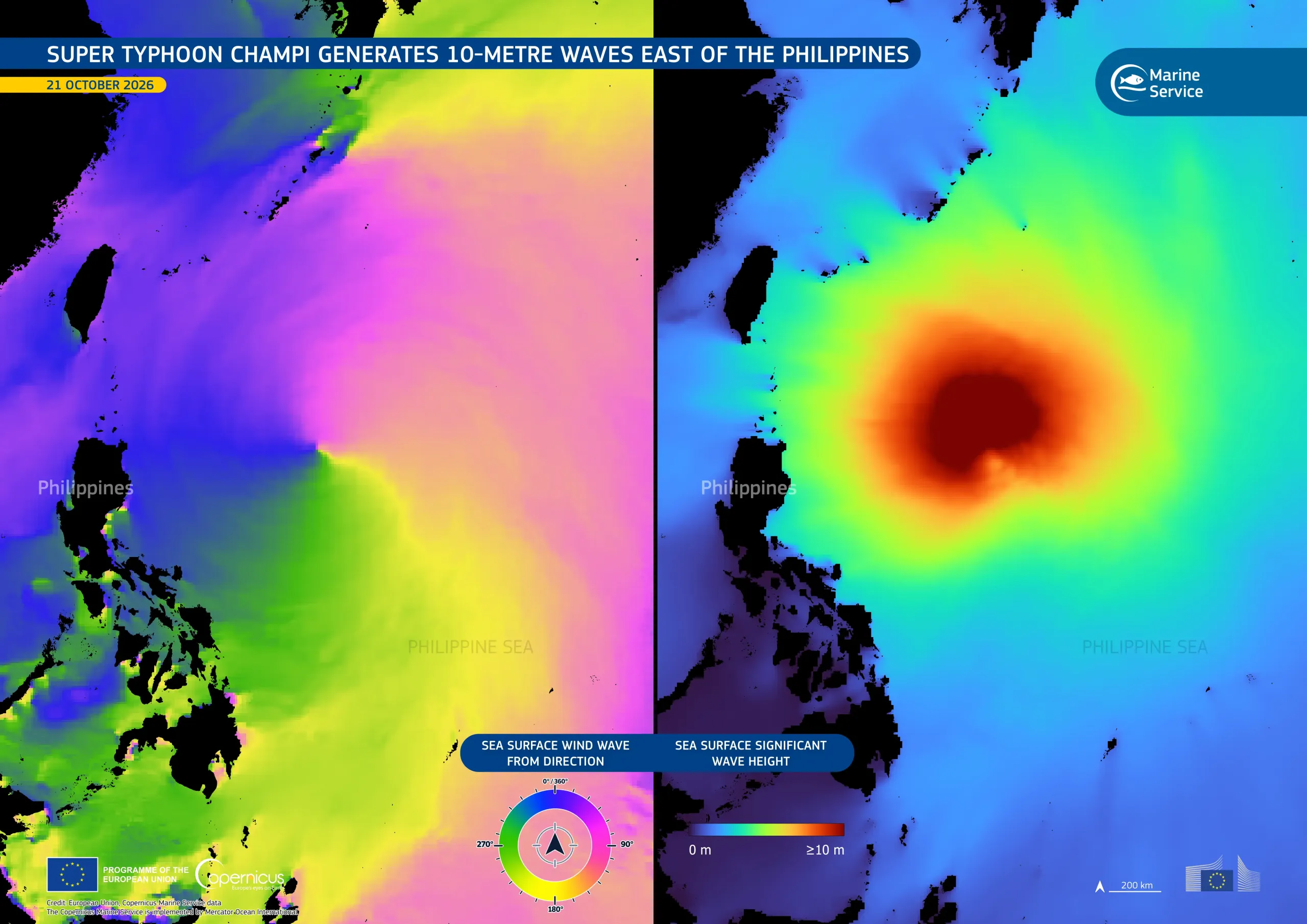
On 21 October 2026, Super Typhoon Champi, known in the Philippines as Rosal, was moving west-northwest across the Philippine Sea, about 850 km east of northern Luzon, the largest island of the Philippines. The storm had reached the equivalent of Category 5 on the Saffir-Simpson scale, the top category, with maximum sustained winds of 296 km/h. These were the strongest sustained winds recorded for any tropical cyclone worldwide in 2026.
These data visualisations, based on Copernicus Marine Service data for 21 October 2026, illustrate the storm's effect on ocean surface conditions. The image on the left shows the direction of wind-generated waves at the sea surface, which spiral around the storm’s centre, following the anticlockwise circulation typical of tropical cyclones in the Northern Hemisphere. The image on the right shows significant wave height, a standard measure of sea state corresponding to the average height of the highest one-third of waves. Dark red areas near the storm’s centre indicate a significant wave height of 10 metres.
The Copernicus Marine Service provides ocean monitoring and forecasting data which help track extreme marine conditions, supporting maritime safety, storm impact assessment, and coastal preparedness.