Sediment plumes along Spain’s eastern coast after Storm Adam
Between 18 and 20 October 2026, intense rainfall caused by Storm Adam caused widespread flooding across the Valencia Region in eastern Spain, particularly in the coastal districts of La Safor and Marina Alta. The Spanish State Meteorological Agency recorded 663.8 mm of rain in 37 hours in Pego, in the province of Alicante, nearly as much as the town normally receives in a whole year. Floodwaters affected several municipalities, including Gandia, Oliva, and Pego, inundating roads, agricultural land, and residential areas.
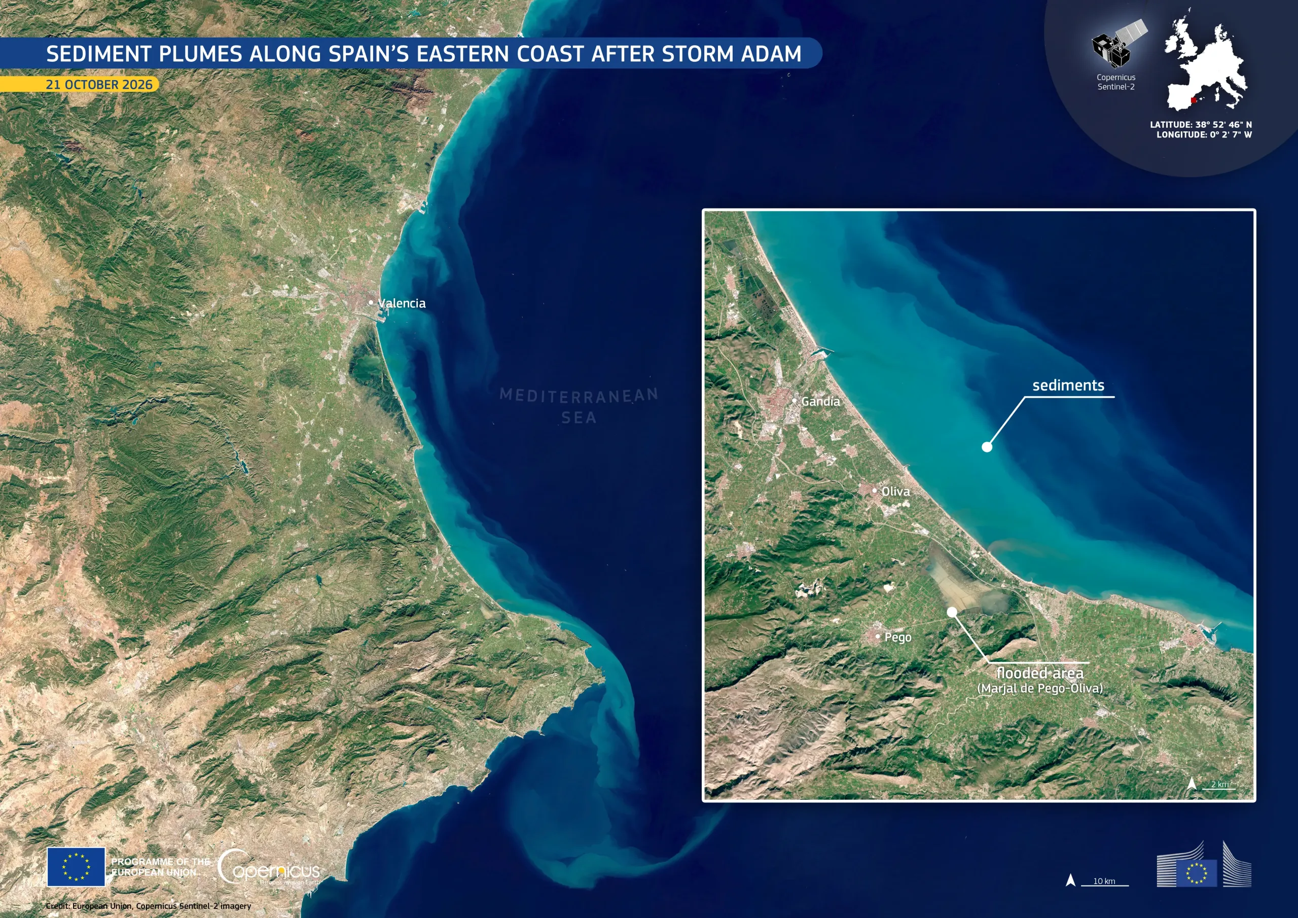
This image, acquired by one of the Copernicus Sentinel-2 satellites on 21 October 2026, shows the coastline of eastern Spain from the city of Valencia southwards. Sediment carried to the sea by rivers and surface runoff forms turquoise plumes, which contrast with the darker blue offshore waters of the Mediterranean Sea. The inset shows brown, sediment-laden water across the Marjal de Pego-Oliva, a protected coastal wetland which is normally partly waterlogged.
At the request of Spanish authorities, the Copernicus Emergency Management Service provided flood extent and damage assessment emergency mapping products for the areas of La Safor and Marina Alta to support emergency response. More information here.