Severe v-shaped thunderstorm over northern Italy
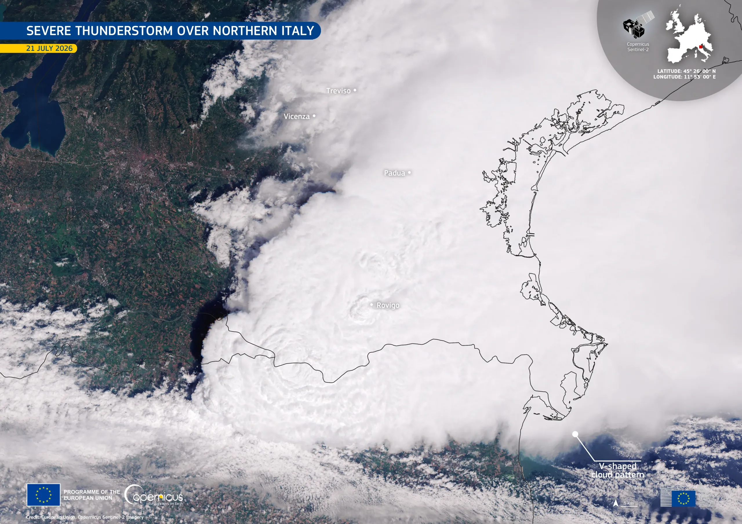
A large convective storm dominates this natural-colour Copernicus Sentinel-2 image acquired on 21 July 2026 at 10:05 UTC, spreading across the Po Valley towards the Adriatic Sea in northern Italy. A characteristic feature is the storm's distinctive V-shaped cloud pattern. It forms when powerful rising air carries the storm cloud to high altitudes, at which strong winds split and flow around the cloud top. This pattern is often associated with intense thunderstorms capable of producing destructive wind gusts, large hail, and torrential rainfall.
The storm developed in the early hours of 21 July and, during its evolution, hit several provinces, with Vicenza, Padua, Rovigo, and Treviso among the most affected. Its intensity was likely caused by the interaction between a fresh Arctic air mass advancing into the Mediterranean and a warm, moisture-rich air mass over northern Italy formed as a consequence of the recent heatwave. This temperature contrast created unstable atmospheric conditions, generating the energy enabling rapid thunderstorm development.
Copernicus Sentinel-2 imagery complements meteorological observations by revealing cloud-top structures such as V-shaped signatures. These observations help scientists better understand severe convective storms and support the monitoring of increasingly frequent extreme weather events.