Smoke and haze over Pakistan and northern India
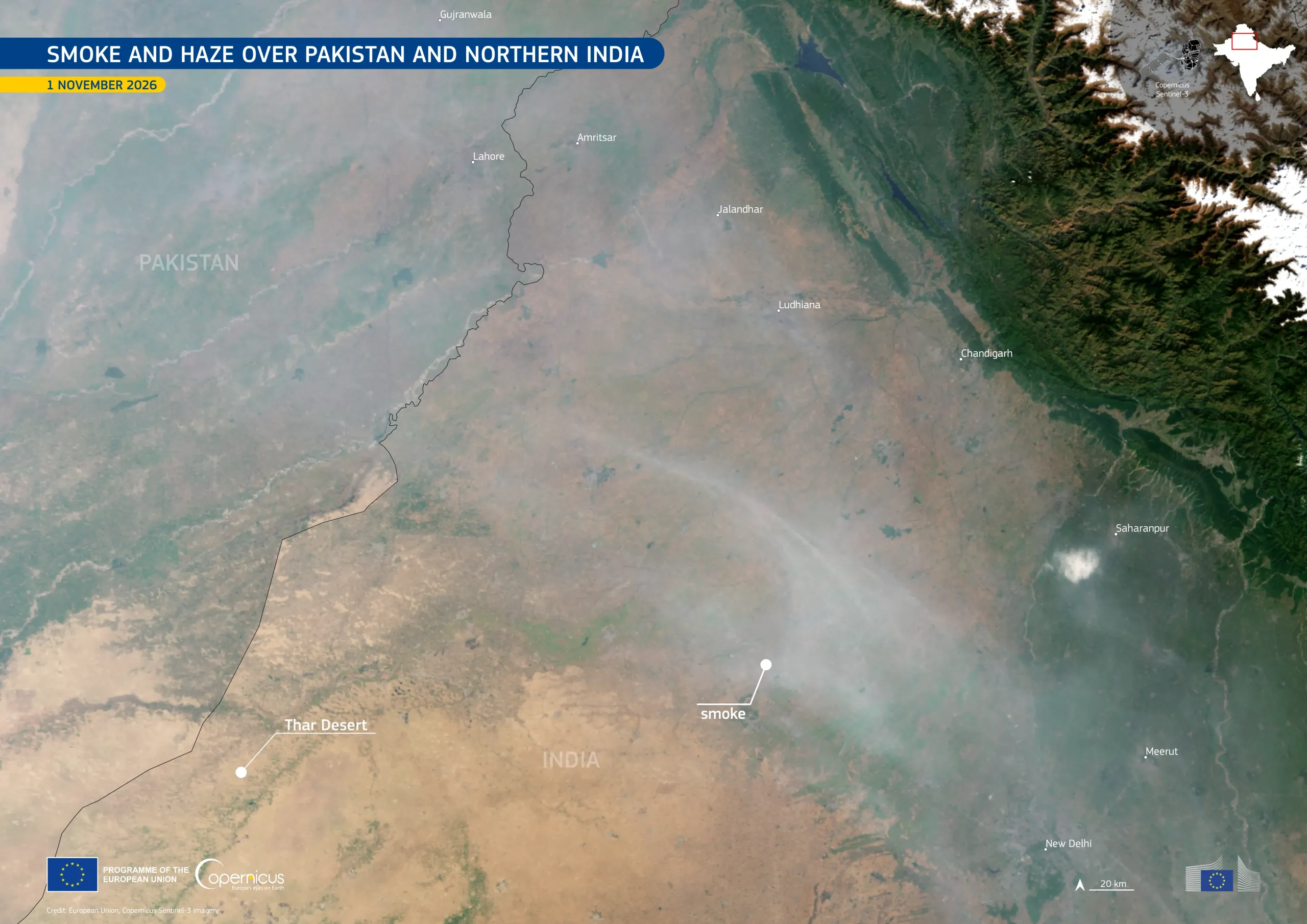
The Indo-Gangetic Plain extends along the southern foot of the Himalayas, across Pakistan and northern India, and is one of the most densely populated regions in the world. In autumn, smoke and haze often cover large parts of the plain. Agricultural burning, urban and industrial emissions, and atmospheric conditions which limit the dispersion of pollutants contribute to this phenomenon.
This image, acquired by one of the Copernicus Sentinel-3 satellites on 1 November 2026, shows a grey-white veil of smoke and haze over the plain, from the area around Lahore to New Delhi. The veil stands out against the dark forested foothills and the snow-covered peaks of the Himalayas. Further south, the sandy tones of the Thar Desert remain more clearly visible.
Copernicus Sentinel-3 data help to observe smoke and haze over large areas, while the Copernicus Atmosphere Monitoring Service (CAMS) provides information on atmospheric pollutants and their transport, supporting air quality monitoring and public health assessments.