The stunning landscapes of Budapest, Hungary
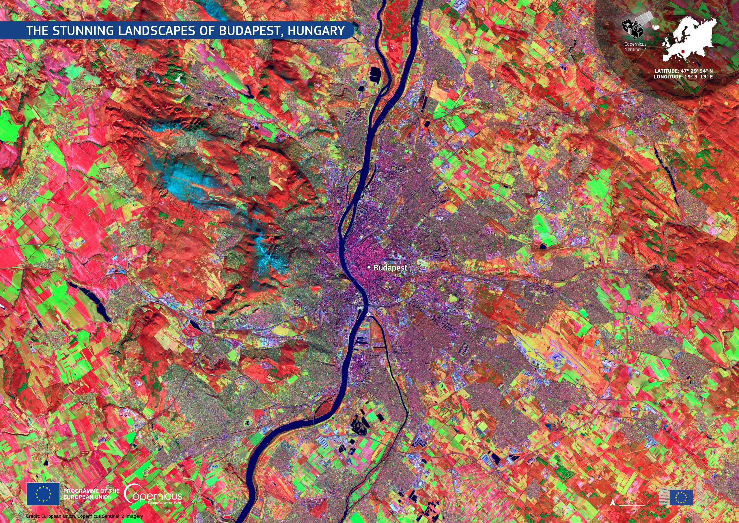
Budapest, Hungary’s capital and largest city, is situated along the banks of the Danube River, which divides the city between Buda and Pest. The western bank, Buda, is characterised by hilly terrain and natural landscapes, and is connected by numerous bridges to the eastern Pest, which is predominantly flat and urbanised. The city is surrounded by mountains and thermal springs, contributing to its unique geography.
In this false-colour image, acquired in wintertime by one of the Copernicus Sentinel-2 satellites, the urban centre of Budapest is shown in purple, while cultivated fields around the city are visible in green. The snow on the mountains to the west of Buda can be seen in blue, while forests are shown in deep red.
The open data from the Copernicus Sentinel satellites provides insights on urban growth and green areas, supporting the development and monitoring of innovative solutions for smart cities, urban planning, and environmental management.