Wildfire in la Vall d'Uixó, Spain
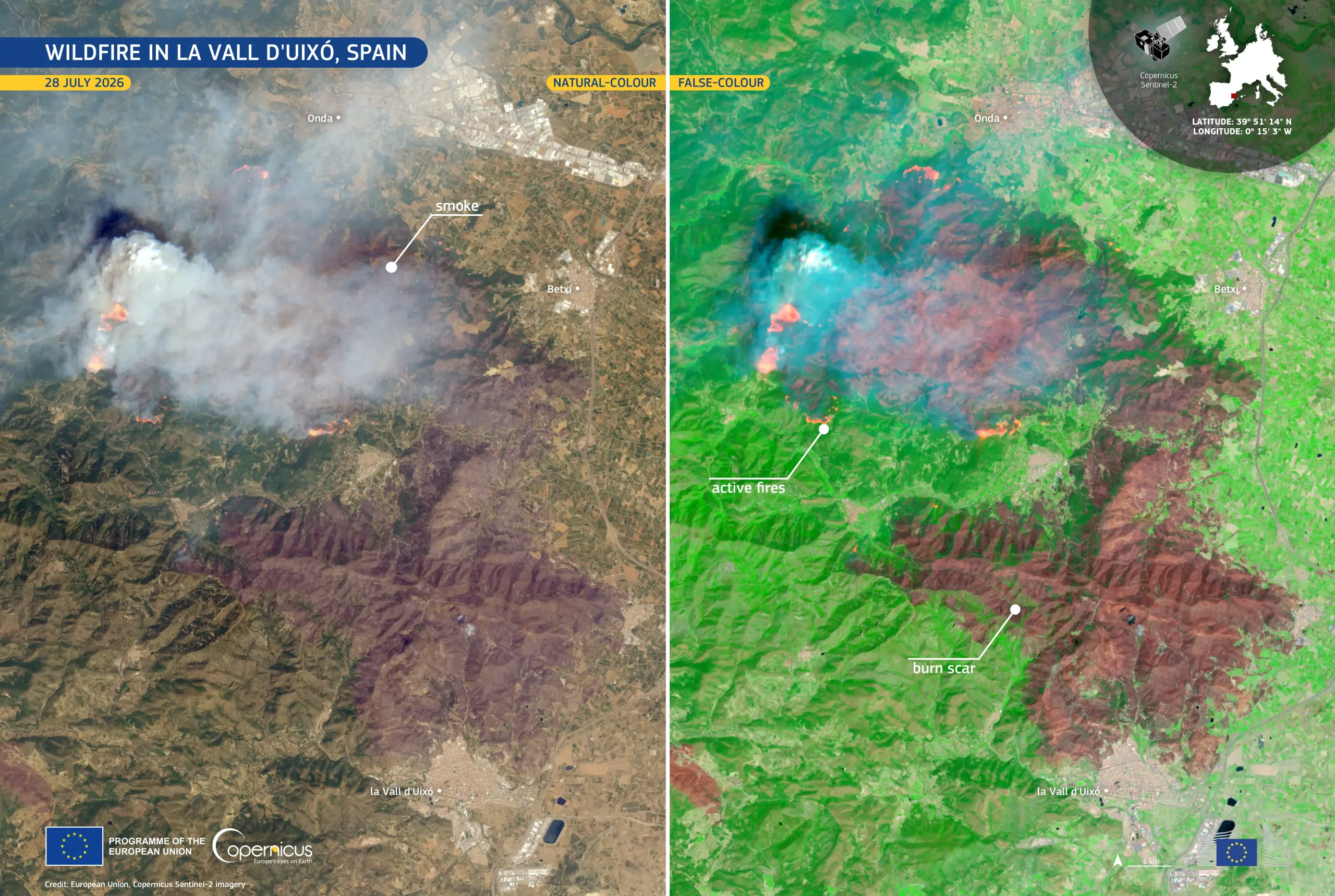
A wildfire broke out on 25 July 2026 near la Vall d'Uixó, in the province of Castellón in eastern Spain. By 27 July, the fire had burnt more than 7,200 hectares, prompting the evacuation of people from several municipalities.
This image, acquired by one of the Copernicus Sentinel-2 satellites on 28 July 2026, is presented in both natural and false colour. In the natural-colour view, on the left, a dense smoke plume engulfs the skies over the affected area. The false-colour view, on the right, composed using spectral bands capable of penetrating the haze, reveals the extent of the reddish-brown burn scar beneath the smoke plume, with active fires appearing as bright orange patches and surrounding vegetation shown in vivid green.
The Copernicus Emergency Management Service (CEMS) Rapid Mapping component has been activated (EMSR905) to provide geospatial information on the fire extent and a damage assessment. More information is available here.