Wildfire smoke drifts from Canada over the Atlantic Ocean
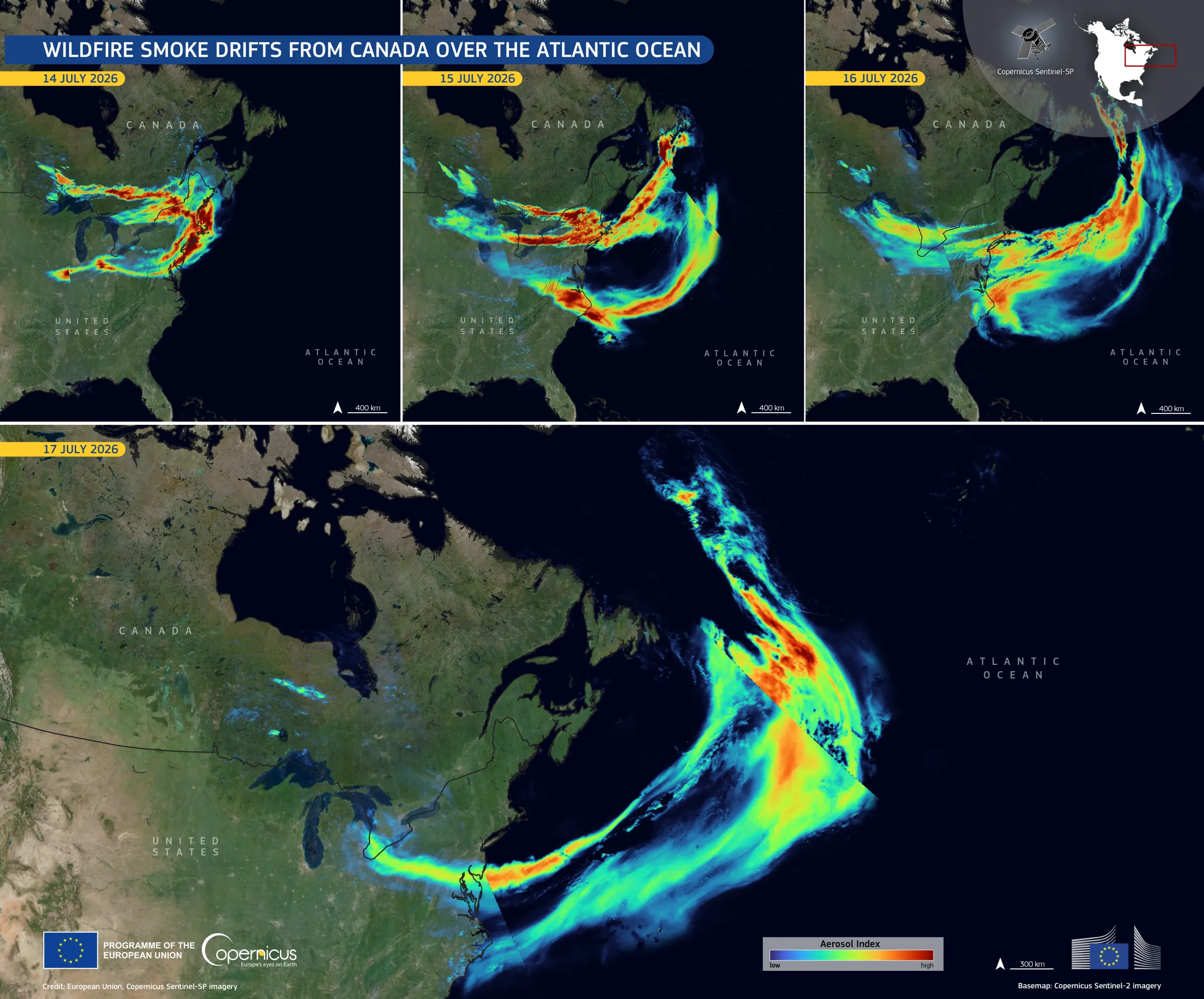
Wildfires burning across central Canada in mid-July 2026 have released large quantities of smoke into the atmosphere, affecting large areas in eastern Canada, the eastern United States, and the adjacent Atlantic Ocean. Air-quality warnings linked to the smoke were issued in cities including Ottawa, Toronto, and New York.
This time series, based on data acquired by the Copernicus Sentinel-5P satellite between 14 and 17 July 2026, shows how the smoke plume developed, as measured by the Aerosol Index, a measure of the amount of light-absorbing particles, such as smoke and dust, suspended in the atmosphere. The highest values, shown in orange and red, indicate elevated concentrations of airborne particles. Over the four-day period, the plume moved eastwards across Canada and the United States before curving over the Atlantic, carried far from its source by prevailing winds.
Copernicus Sentinel-5P provides daily observations of atmospheric composition, supporting the monitoring of aerosols, smoke transport, and air-quality conditions over wide areas.