Wildfires Burn More Than 10,000 Hectares in Greece
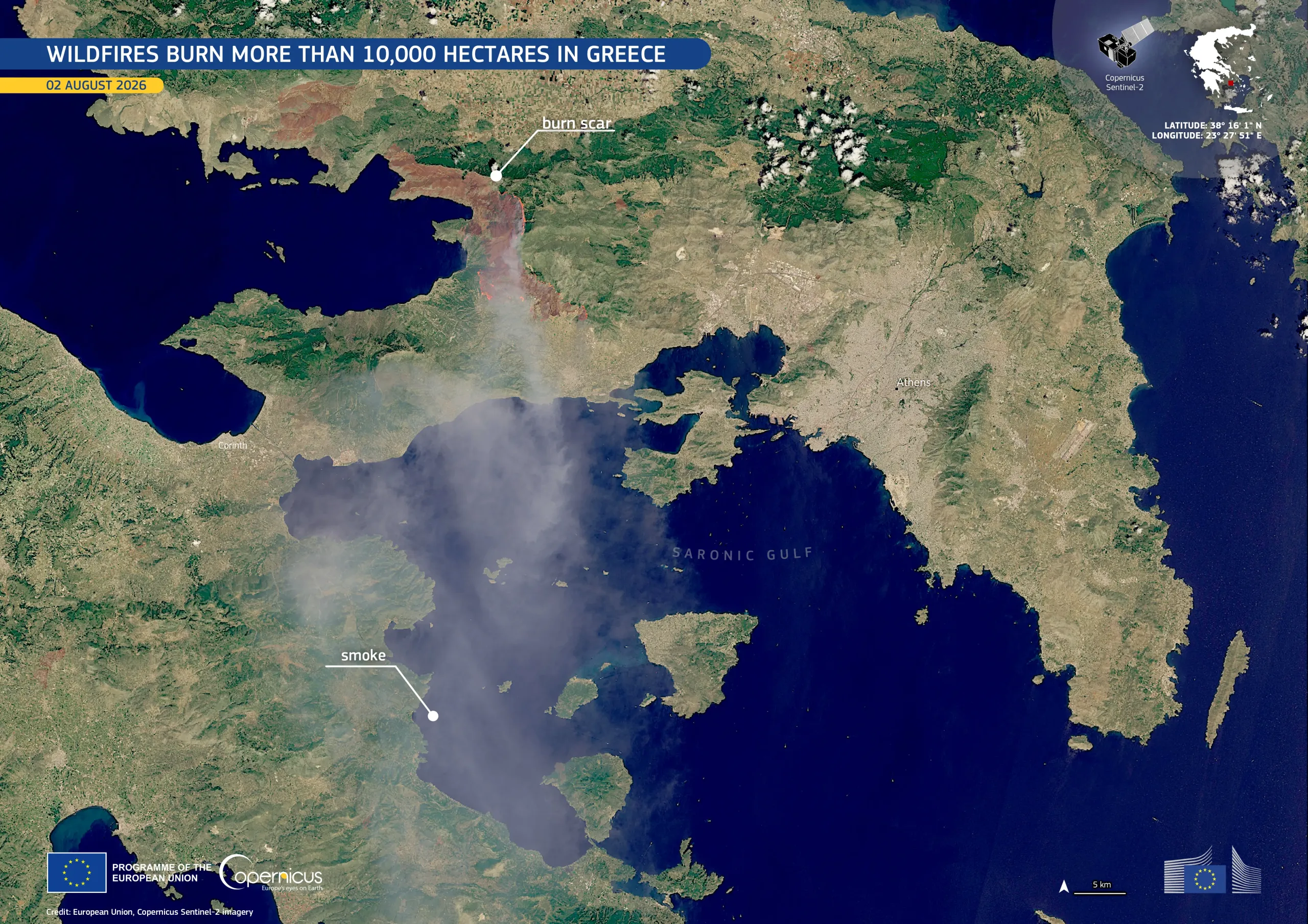
A major wildfire broke out on 31 July 2026 near Psatha and Porto Germeno, west of Athens, in western Attica. It has burned more than 10,000 hectares, prompting an emergency response involving hundreds of firefighters, fixed-wing aircraft, and helicopters. Authorities ordered evacuations in several communities, and according to the Hellenic Fire Service more than 100 homes were destroyed or damaged.
This image, acquired by one of the Copernicus Sentinel-2 satellites on 2 August 2026, shows the affected area on the northern shore of the Gulf of Corinth. The extensive burn scar appears in reddish-brown, while a dense smoke plume extends more than 70 km south-east across the Saronic Gulf.
The Copernicus Emergency Management Service (CEMS) Rapid Mapping component has been activated (EMSR909) to provide geospatial information on the fire extent and a damage assessment. More information is available here.