European Union flag
English
EU Space Policy

Explore EU Space

Results (293)
Image of the day
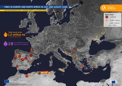
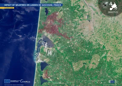
Map of fires in Europe and North Africa in July-August 2026
Earth Observation
… Fires affected large areas of Europe and North Africa during the summer of 2026, with … Europe and North Africa … Severe fires affected Europe and North Africa in July and August 2026 … Fires affected large areas of Europe and North Africa during the summer of 2026, with …
Image of the day
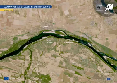
Sentinel-2 image of drought in Romania and Bulgaria
Earth Observation
… of the prolonged drought across Central and Eastern Europe. In late August 2026, the river's flow at the Romanian … Low Danube water levels in Eastern Europe … of the prolonged drought across Central and Eastern Europe. … Low Danube water levels in Eastern Europe
Image of the day
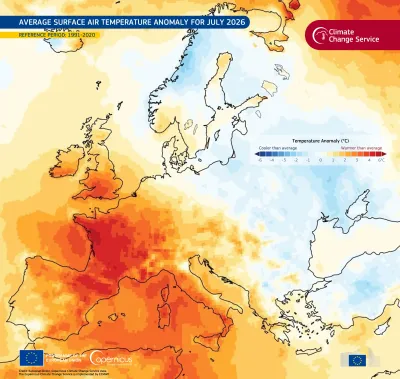
Map of Europe showing average surface air temperature anomalies for July 2026 compared with 1991–2020 average. Western and southern Europe are mostly warmer than average, with the strongest warming in France and the western Mediterranean shown in dark red. Northern and eastern Europe are generally near average to cooler than average, with blue areas around Scandinavia, the Baltic, and eastern Europe. Temperature anomalies range from −6°C to +6°C.
Earth Observation
… July 2026 was the second warmest July on record in western Europe*. The average surface air temperature across the … shows the average surface air temperature anomalies across Europe in July 2026. A clear west-east contrast is visible, … Finland.  More information is available here .   *Western Europe is defined as land areas within 11°W–15°E and …
Image of the day
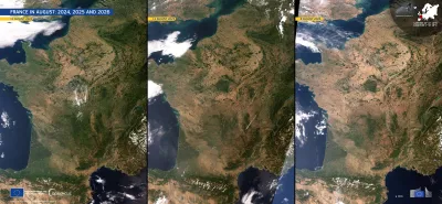
Three side-by-side satellite images of France and surrounding regions in August 2024, 2025, and 2026, showing progressively dry, brown conditions across much of the country. The panels are dated 11 August 2024, 12 August 2025, and 8 August 2026, respectively. Cloud cover varies between the images, while the Atlantic Ocean, Mediterranean Sea, Alps, and Pyrenees are visible. Branding identifies the imagery as from the European Union’s Copernicus Sentinel-3 mission.
Earth Observation
… (CEMS), provides systematic updated drought monitoring for Europe, supporting early warning, impact assessment, and …
Image of the day
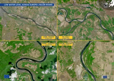
Four-panel satellite image titled “Low Water Level Across Europe’s Major Rivers,”  showing river conditions in early August 2026. The panels show the Loire in France, the Po in Italy, the Rhine in Germany, and the Danube in Hungary. In each image, dark, narrow river channels are bordered by broad light-colored sandbars and exposed riverbeds, illustrating unusually low water levels. Labels identify each river, country, and date, with Copernicus and European Union branding visible.
Earth Observation
… exceptionally low water levels along sections of four of Europe's largest rivers: the Loire near Saumur in France, the … impact of the prolonged drought which is affecting much of Europe. The consequences extend well beyond the riverbanks. … and disrupting industrial supply chains across central Europe. Along the Danube, the image shows the Paks Nuclear …
Image of the day
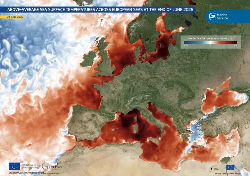
June 2026 was the second-warmest June globally
Earth Observation
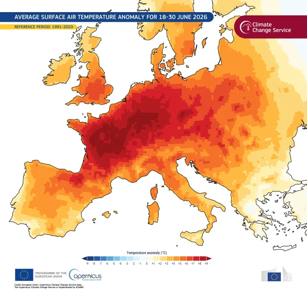
… An intense heatwave affected much of Western and Central Europe during the second half of the month, breaking many … daily maximum temperature in several countries. Western Europe, the region most affected by the heatwave, recorded … temperature anomalies across parts of Central and Western Europe from 18 to 30 June. The map shows marked temperature …
Image of the day
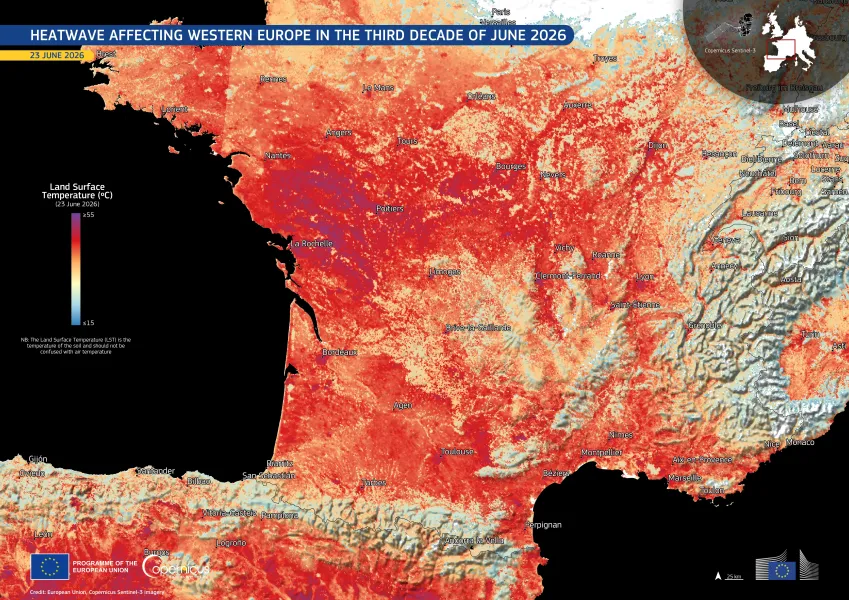
Heatwave
Earth Observation
… A severe heatwave is currently affecting western Europe, France and Spain being the most affected countries. … Heatwave affecting Western Europe in the third decade of June 2026 … A severe heatwave is currently affecting western Europe, France and Spain being the most affected countries. …
Image of the day
Warm Spell Europe
Earth Observation
… 16 May and 2 June 2026, a heatwave affected large parts of Europe. Such prolonged warm spells can exacerbate drought … This data visualisation shows the heatwave over western Europe on 28 May 2026 through the warm spell intensity index, … analytical tools, and reports on drought conditions across Europe and beyond. More information on the last Report …

Showing 1-20 of 293 results