European Union flag
English
EU Space Policy

Explore EU Space

Results (1264)
Image of the day
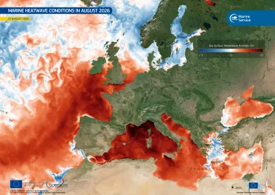
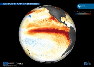
This data visualisation, based on data from the Copernicus Marine Service, shows sea surface temperature anomalies on 25 August 2026
Earth Observation
El Niño is a recurring climate phenomenon associated with unusually warm surface waters in the central and eastern equatorial Pacific Ocean. As the warm phase of the El Niño–Southern Oscillation…
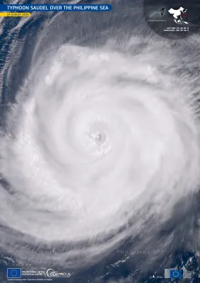
Image of the day
Image of Typhoon Saudel over the Philippine Sea
Earth Observation
Saudel is a Category 4 typhoon currently tracking across the northwestern Pacific Ocean. On 24 August 2026, it moved across the Philippine Sea, passing southwest of Iwo To, a remote Japanese island,…
Image of the day
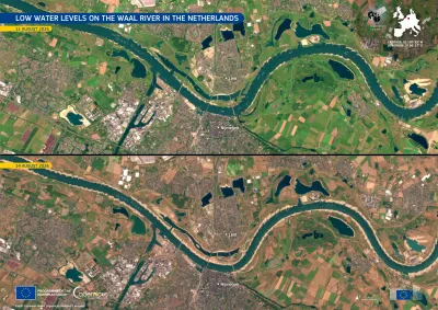
Copernicus Sentinel-2 images showing drought on the Waal river in the Netherlands.
Earth Observation
The Waal, in eastern Netherlands, is the largest Dutch branch of the Rhine and an important inland shipping route. Prolonged dry conditions across the Rhine basin have reduced flows to exceptionally…
Image of the day
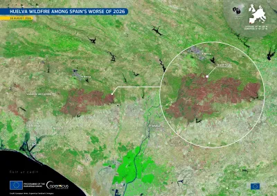
Copernicus Sentinel-2 image showing the Huelva wildfire's burn scar.
Earth Observation
On 6 August 2026 a major wildfire broke out near Niebla, in the province of Huelva, southern Spain. After more than a week of firefighting operations, authorities declared the blaze stabilised on 16…
Image of the day
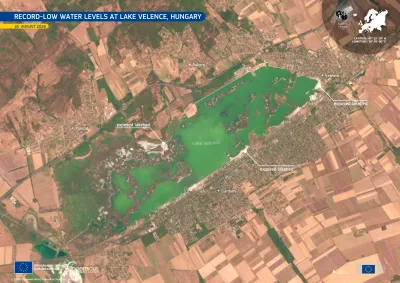
Copernicus Sentinel-2 image acquired on 16 August 2026 showing Lake Velence in central Hungary. The green-coloured lake is surrounded by agricultural land and the settlements of Velence, Gárdony and Sukoró, with shallow shoreline areas visible around parts of the lake.
Earth Observation
Lake Velence, Hungary’s third-largest lake, located southwest of Budapest, is affected by record-low water levels following prolonged dry conditions. By 1 August 2026, its water level fell below the…
Image of the day
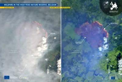
Copernicus Sentinel-2 image of the wildfire in the High Fens Nature Reserve, eastern Belgium, showing a broad plume of grey smoke spreading across the landscape, with bright white clouds nearby and active fire fronts visible in red-orange tones.
Earth Observation
A wildfire broke out on 14 August 2026 in the High Fens nature reserve, in the province of Liège, in eastern Belgium. By 16 August, around 3,000 hectares had burned, making it Belgium’s largest…
Image of the day
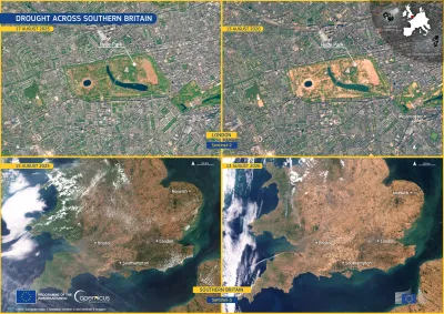
Four-panel satellite comparison showing drought conditions in southern England in August 2026.
Earth Observation
Over the summer of 2026, dry conditions have been affecting the United Kingdom. According to the European Drought Observatory (EDO), 25% of the territory of England was in Alert conditions and 65% in…
Image of the day
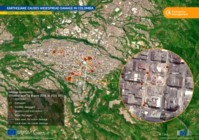
Map of Pereira, Colombia, showing earthquake-related damage identified by the Copernicus Emergency Management Service following the 10 August 2026 magnitude 7.4 earthquake.
Earth Observation
On 10 August 2026, a magnitude 7.4 earthquake struck western Colombia, causing severe damage across the region. According to the latest reports, the earthquake has resulted in 289 casualties and…
Image of the day
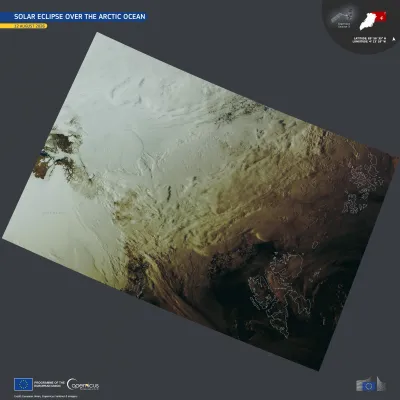
Satellite image of the eclipse shadow , spanning from northern Greenland to the Svalbard Archipelago and Franz Josef Land.
Earth Observation
On 12 August 2026, a total solar eclipse crossed the Arctic Ocean, eastern Greenland, western Iceland, and the northern half of Spain. The area covered by the full eclipse was at most 294 kilometres…
Image of the day
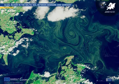
Satellite image of the Baltic Sea between Denmark and Germany on 8 August 2026, showing extensive green algal blooms swirling in large spiral patterns across the dark blue water. Clouds partially cover the surrounding coastlines, with Denmark visible to the northwest and Germany to the south.
Earth Observation
Cyanobacteria blooms return to the Baltic Sea every summer, when warm water, light winds, and nutrients carried in from land cause this type of algae to multiply. On 11 August, health authorities in…
Image of the day
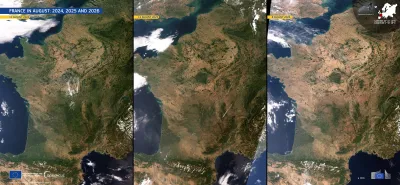
Three side-by-side satellite images of France and surrounding regions in August 2024, 2025, and 2026, showing progressively dry, brown conditions across much of the country. The panels are dated 11 August 2024, 12 August 2025, and 8 August 2026, respectively. Cloud cover varies between the images, while the Atlantic Ocean, Mediterranean Sea, Alps, and Pyrenees are visible. Branding identifies the imagery as from the European Union’s Copernicus Sentinel-3 mission.
Earth Observation
A severe drought has been affecting large parts of France this summer. According to the European Drought Observatory (EDO), more than 85% of the country was under drought warning or alert conditions…
Image of the day
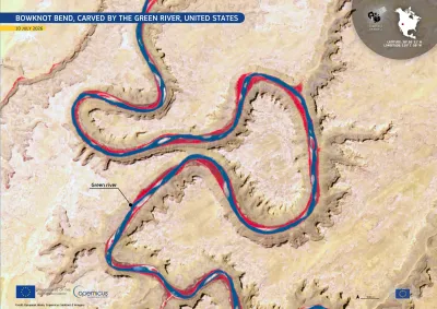
Satellite image of Bowknot Bend on the Green River in the United States, showing the river winding through a series of tight, looping meanders carved into pale desert canyon terrain. The river appears dark blue with bright red margins in the false-color imagery. A label identifies the Green River, with location coordinates and a 500 m scale shown on the map.
Earth Observation
Bowknot Bend lies in the arid landscape of eastern Utah, north of Canyonlands National Park, in the United States. It marks the point where the Green River flows into a deeply entrenched meander,…
Image of the day
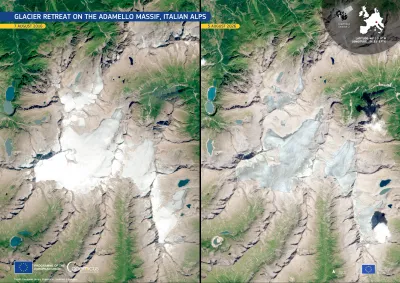
Side-by-side Copernicus Sentinel-2 satellite images of the Adamello Massif in the Italian Alps, comparing 7 August 2016 (left) with 5 August 2026 (right). The 2026 image shows substantial glacier retreat and thinning, with much less continuous white ice and snow and more exposed rock and fragmented glacier surfaces.
Earth Observation
The Adamello Glacier is the largest in the Italian Alps, centred on the plateau of Pian di Neve between Lombardy and Trentino. The 2025–-2026 winter brought little snow over to the massif, exposing…
Image of the day
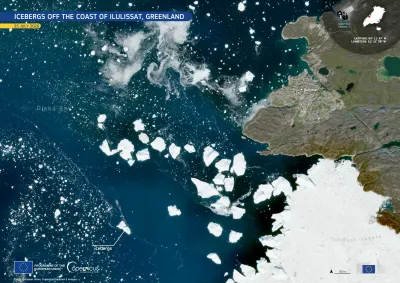
Satellite image of the coast near Ilulissat, Greenland, on 25 July 2026. Dark blue waters of Disko Bay are scattered with dozens of bright white icebergs of varying sizes drifting away from the mouth of Ilulissat Icefjord, which is covered by a large expanse of sea ice at the lower right. The town of Ilulissat appears along the rocky coastline on the right, with labels identifying the bay, icefjord, and icebergs. An inset map marks the location in Greenland, and Copernicus Sentinel-2 branding, coordinates,
Earth Observation
This natural-colour image, acquired by one of the Copernicus Sentinel-2 satellites on 25 July 2026, shows several icebergs drifting across the dark blue waters of Disko Bay, western Greenland. Dense…

Showing 21-40 of 1264 results