Explore EU Space

Results (2101)
RSS feed of these results
Use Cases
Finding new ways
Earth Observation
Earth Observation
Copernicus
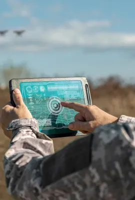
The Copernicus Security Service (CSS) is helping peacekeepers prepare for different scenarios through detailed use cases as part of the Support to EU External and Security Actions (SESA) component…
Use Cases
Mediterranean wildfires
Earth Observation
Earth Observation
Copernicus
Wildfires in Europe are becoming more severe and more frequent. That’s why the mapping and monitoring products provided by the Copernicus Emergency Management Service (CEMS) will become increasingly…
Use Cases
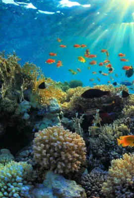
Coral Reefs
Earth Observation
Earth Observation
Copernicus
Coral reefs are the most biodiverse marine ecosystems on Earth. In addition to serving as a habitat and food resource for 25% of marine species, they provide the world with nearly EUR 2.5 billion in…
Use Cases
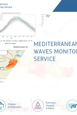
Mediterranean Heat Waves Monitoring
Earth Observation
Earth Observation
Copernicus
Mediterranean Heat Waves Monitoring Service The Mediterranean Heat Waves Monitoring Service provides daily and historical information about the intensity and extent of the Marine Heat Waves (MHW) in…
Use Cases
BLUEFIN TUNA MONITORING
Earth Observation
Earth Observation
Copernicus
BLUEFIN TUNA MONITORING IN THE MEDITERRANEAN SEA SOCIB (Balearic Islands Coastal Observing and Forecasting System) and IEO (INSTITUTO ESPAÑOL DE OCEANOGRAFÍA) have developed a habitat model for…
Use Cases
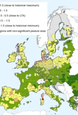
Map of relative index of pasture productivity over Europe, comparing February-March 2018 with the historical statistics (1999-2017)
Earth Observation
Earth Observation
Copernicus
CROP MONITORING IN EUROPE The European Commission’s Joint Research Centre (JRC) acquires and shares relevant data and develops tools and methods for Monitoring Agriculture ResourceS (MARS), which…
Use Cases
SPOT – User-friendly oil spill model
Earth Observation
Earth Observation
Copernicus
SPOT – User-friendly oil spill model To minimize the terrible impact generated by oil spills in the oceans, it is important to intercept and collect them in time before they spread and reach the…
Use Cases
TIDAL ENERGY ASSESSMENT
Earth Observation
Earth Observation
Copernicus
TIDAL ENERGY ASSESSMENT - TIDEA To date, there is no global solution providing a first level of information for ocean renewable energy site assessments for tidal energy devices (tidal current speed,…
Use Cases
Land
Earth Observation
Earth Observation
Copernicus
Urban Atlas Green infrastructure will play a key role in achieving EU policy objectives in a variety of interconnected environmental areas, especially when using nature based solutions to preserve…
Use Cases
EGNOS visibility map
Earth Observation
Earth Observation
Copernicus
EU-DEM EGNOS visibility map was computed using the Digital Elevation Model over Europe (EU-DEM). The map shows all areas within the Digital Elevation Model over Europe where there is no visibility of…
Image of the day
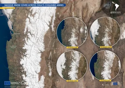
Snow Andes
Earth Observation
Earth Observation
Copernicus
In August 2026, snow cover across the western Andes in Chile’s Coquimbo Region stood at twice its usual extent. According to the Centre for Advanced Studies in Arid Zones (CEAZA), the monthly median…
Image of the day
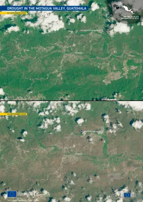
Before-and-after Copernicus Sentinel-2 satellite images of the Motagua Valley in Guatemala, showing the area around San Agustín Acasaguastlán and El Rancho. The 25 September 2025 image shows predominantly green vegetation, while the 20 September 2026 image shows much drier, brown vegetation across the valley and surrounding hills, illustrating the effects of drought.
Earth Observation
Earth Observation
Copernicus
Guatemala has been affected by scarce rainfall during the 2026 wet season, coinciding with the development of El Niño conditions in the equatorial Pacific Ocean. These dry conditions particularly…

Showing 1981-2000 of 2101 results