Explore EU Space

Results (2100)
RSS feed of these results
Image of the day
Caldas Novas State Park
Earth Observation
Earth Observation
Copernicus
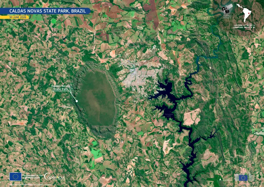
Caldas Novas State Park is located in the Brazilian state of Goiás, near the city of Caldas Novas. The park lies within the Cerrado, a tropical savannah region known for its high biodiversity and…
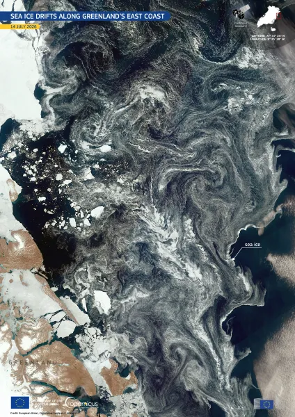
Image of the day
Greenland Sea ice
Earth Observation
Earth Observation
Copernicus
The waters along Greenland's east coast are shaped by strong ocean currents which transport Arctic sea ice southwards from the Greenland Sea and into the Denmark Strait.
Funding Opportunities
Earth Observation
Earth Observation
Copernicus
Do you want to become part of the Hydrological Forecast Centre - Analytics and Dissemination (DISS) for CEMS EFAS and GloFAS? The CEMS Hydrological Forecast Centre – Analytics and Dissemination (DISS) provides a daily analysis of the hydrological predictions coming from the EFAS including the issuing of Flood Notifications to the end-users. Further
Image of the day
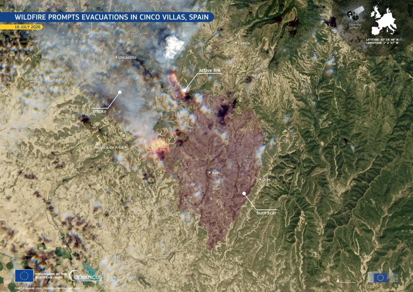
Cinco Villas Wildfire
Earth Observation
Earth Observation
Copernicus
A wildfire broke out near the town of Orés, in the province of Zaragoza, Spain, on 15 July 2026. Driven by strong winds and low humidity, it spread rapidly across the Cinco Villas region.
Image of the day
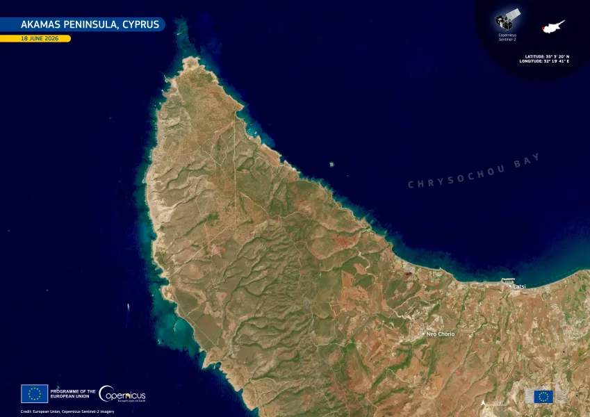
Akamas Peninsula
Earth Observation
Earth Observation
Copernicus
Stretching along the north-west coast of Cyprus, the Akamas Peninsula forms a rugged coastal landscape bordering Chrysochou Bay. The area is recognised for its ecological value, supporting diverse…
Image of the day
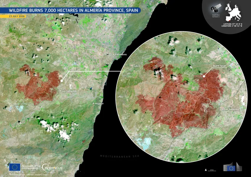
Wildfire Andalucia
Earth Observation
Earth Observation
Copernicus
A wildfire broke out near the municipality of Los Gallardos, in the province of Almería, Spain, on 9 July 2026. Strong winds contributed to its rapid spread through dry vegetation. The fire burned…
Image of the day
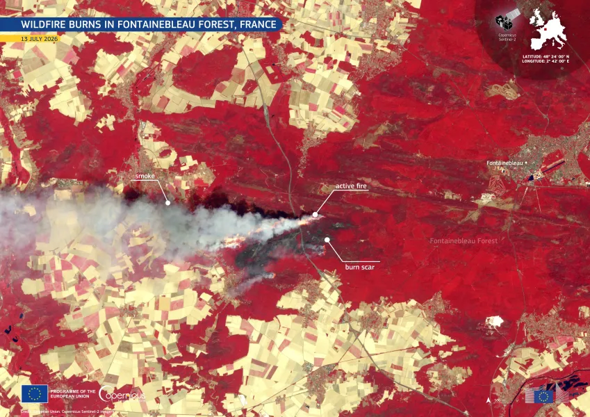
This false-colour image, acquired by one of the Copernicus Sentinel-2 satellites on 13 July 2026, shows healthy vegetation, including the Fontainebleau Forest, in red tones while surrounding agricultural fields appear in pale beige. A dense, grey-white smoke plume extends westwards from the active fire, shown in bright orange. A dark burn scar marks recently affected woodland near the forest’s western edge.
Earth Observation
Earth Observation
Copernicus
On 12 July 2026, a wildfire spread through part of Fontainebleau Forest in Seine-et-Marne, northern France, approximately 60 kilometres south-east of Paris. The fire prompted evacuations and…
Image of the day
Gulf_of_Saint-Malo
Earth Observation
Earth Observation
Copernicus
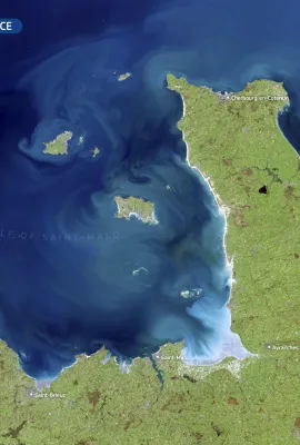
The Gulf of Saint-Malo lies between Brittany and Normandy, in north-western France. It is known for strong tidal dynamics, which influence coastal waters, sediment transport, and the surrounding…
Events
WEkEO Data Viewer step by step live tutorial
Earth Observation
Earth Observation
Copernicus
This webinar is designed to help participants become familiar and confident with the use of the WEkEO Data Viewer. Attendees will explore Light and Expert versions of the viewer, learn how to access,…
Image of the day
Naarden
Earth Observation
Earth Observation
Copernicus
Naarden, in the Netherlands, is one of Europe’s best-preserved examples of a fortified town, with its distinctive star-shaped layout still intact.
Events
Artificial intelligence and earth observation: From innovation to services
Earth Observation
Earth Observation
Copernicus
The target audience for the workshop includes Copernicus and DestinE users, Earth observation and digital service providers, policy makers, industry, academia, IT experts, etc.
Image of the day
Saharan dust plume
Earth Observation
Earth Observation
Copernicus
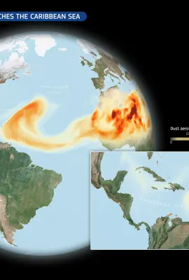
At the end of May 2026, a large Saharan dust plume stretched from the west coast of Africa towards the Americas. Countries such as Cabo Verde saw declining air quality as the dust plume passed over…
Image of the day
Actinoclouds
Earth Observation
Earth Observation
Copernicus
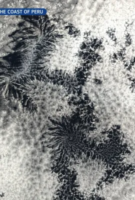
Actinoform clouds are cloud formations with a distinctive radial shape, creating patterns which resemble giant flowers spread across the atmosphere. They usually form within large layers of marine…
Image of the day
Wörthersee
Earth Observation
Earth Observation
Copernicus
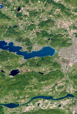
Lake Wörthersee lies in the Klagenfurt Basin of Carinthia, southern Austria, between low wooded ridges shaped by Alpine geology and glacial processes.

Showing 161-180 of 2100 results