
Copernicus Sentinel-3C satellite delivers its first views of Earth
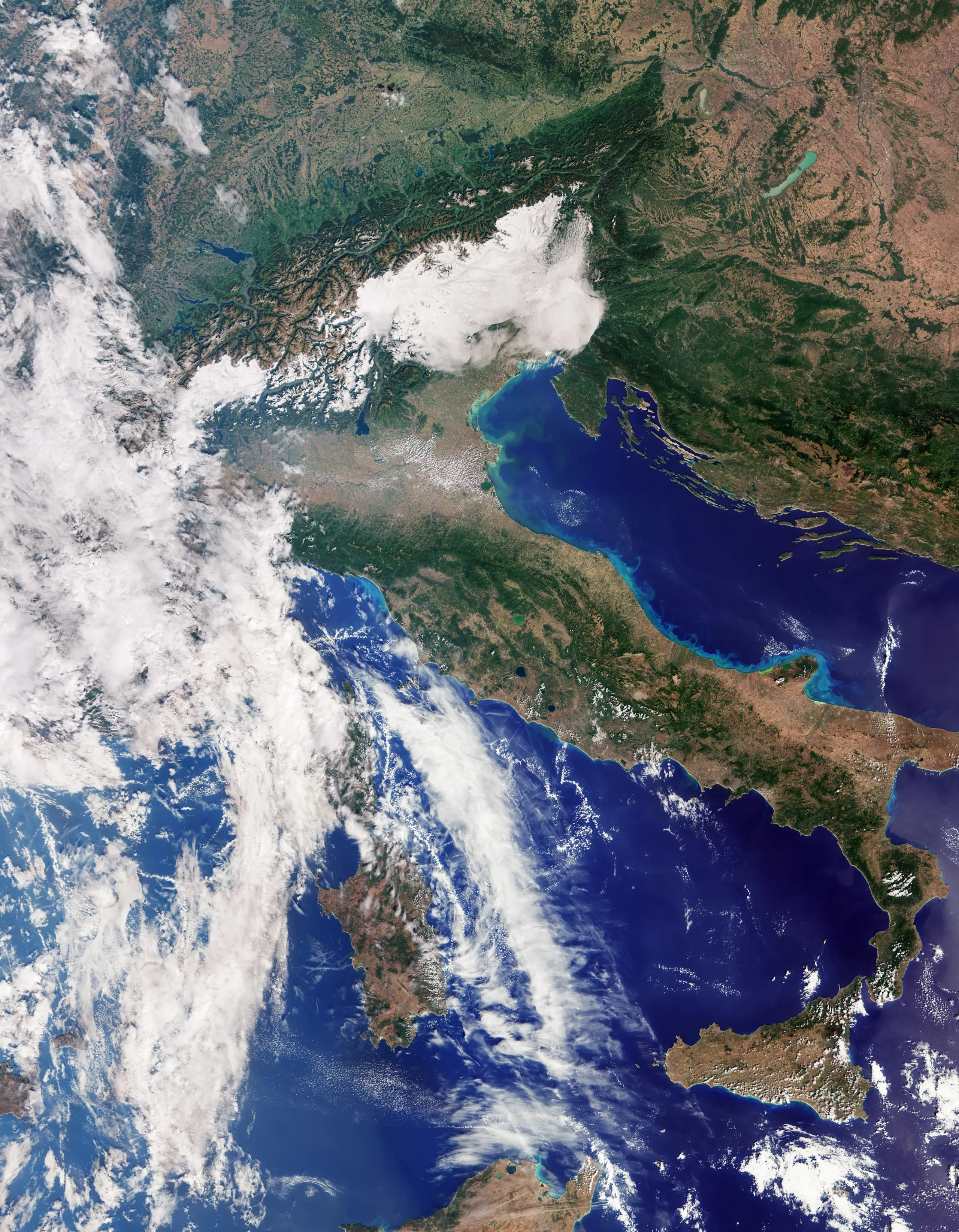
Just two weeks after its launch aboard Vega-C, the Copernicus Sentinel-3C satellite has returned its first images and measurements of Earth, marking an important milestone for the EU’s Copernicus programme.
Copernicus provides free and open Earth observation data to support decision-making and address environmental and societal challenges. Sentinel-3 is one of its key missions, providing systematic observations of our oceans, seas, land and ice.
The first data from Sentinel-3C show Italy, the Arctic and the Caribbean, while its radar altimeter has already measured sea-surface height and the elevation of the Greenland ice sheet. These early results confirm that the satellite’s instruments are performing well as commissioning continues.
A first look at our planet
The first images from Sentinel-3C offer a glimpse of the range of environments the satellite will observe as part of the Copernicus programme.
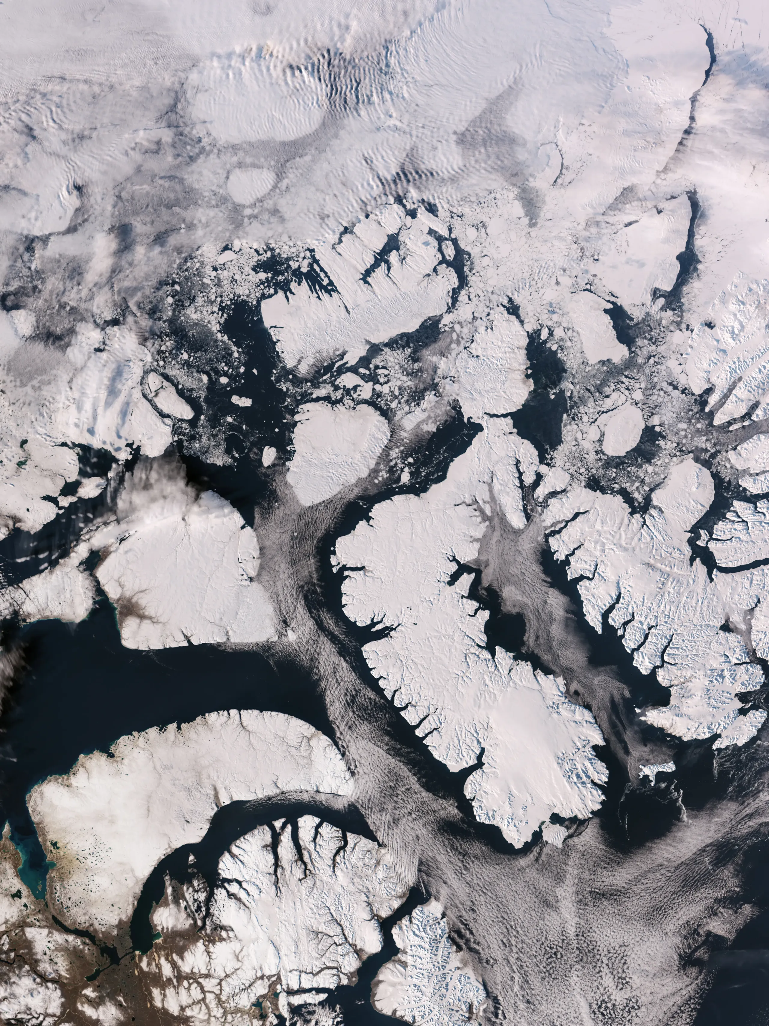
Arctic
Captured on 30 September, the image of the Canadian Arctic Archipelago, west of Greenland, shows snow and ice-covered islands, rugged coastlines and surrounding sea ice. These observations are particularly valuable in a rapidly changing Arctic, where monitoring the extent and condition of snow, ice and coastal areas helps scientists better understand environmental and climate change.
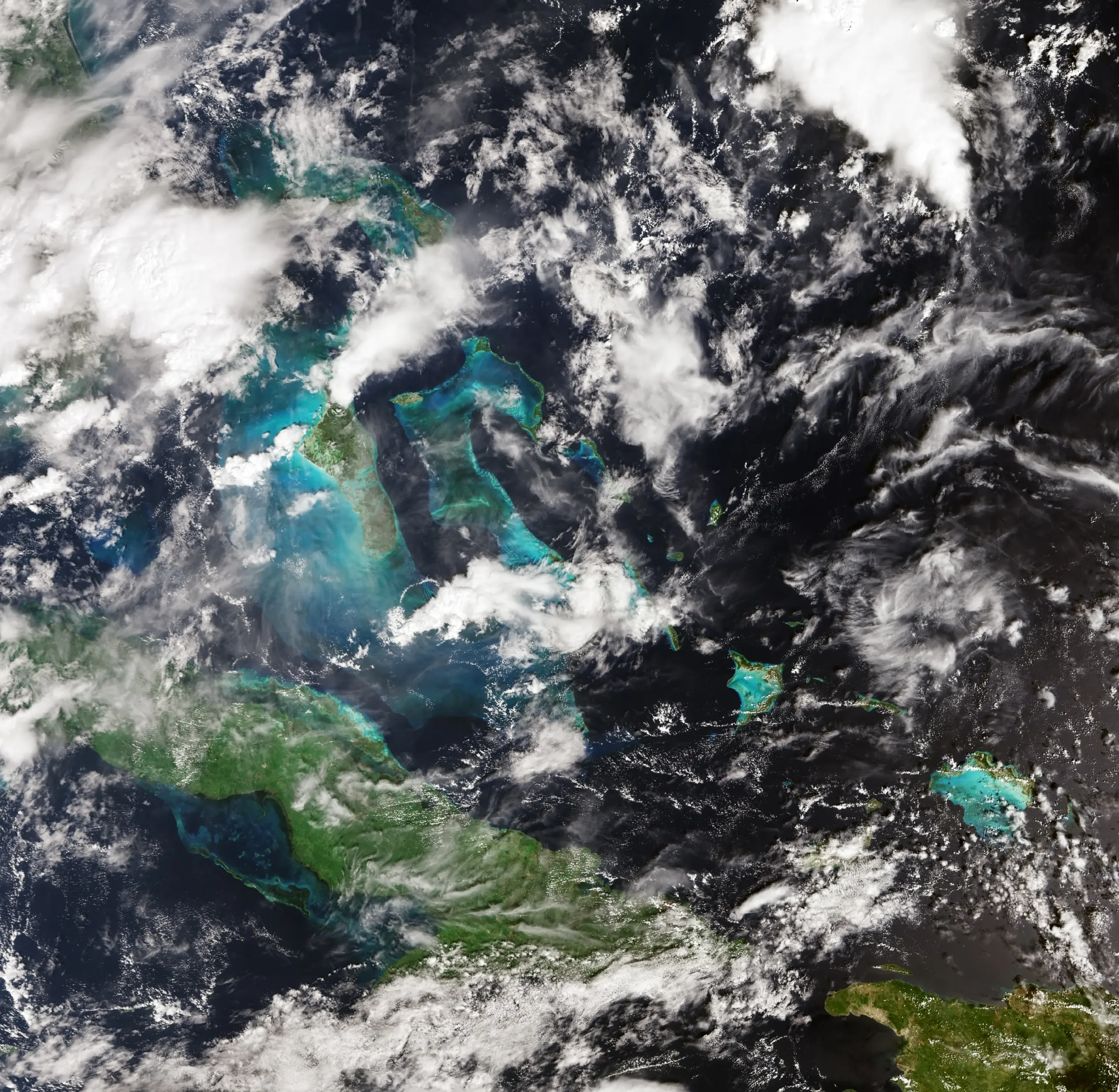
Caribbean
Captured on 29 September, the image shows Cuba and the Bahamas surrounded by contrasting turquoise and deep blue waters. Beyond their striking colours, these observations help monitor the condition of coastal and marine environments. Sentinel-3C’s instruments also measure sea-surface height, providing data that can contribute to monitoring sea-level rise and changes affecting coastal and island regions.
What’s new?
Sentinel-3 satellites are normally operated in a two-satellite configuration. With the arrival of Sentinel-3C, however, the European Commission has approved a new configuration in which the satellite will operate alongside both Sentinel-3A and Sentinel-3B.
The decision reflects the added value that a third satellite can bring. The Commission has concluded that the benefits of increased coverage and more frequent observations outweigh the additional operational costs.
Together, Sentinel-3A, Sentinel-3B and Sentinel-3C will provide more frequent observations of land, oceans, seas and the atmosphere. This will support a wide range of applications, from monitoring sea-level rise, marine pollution and wildfires to tracking drought, vegetation and air quality.
For users of Copernicus data, this means access to more up-to-date and frequent observations, strengthening applications such as land monitoring, emergency response and analysis of climate change impacts.
By operating alongside the existing Sentinel-3 satellites and complementing other Copernicus missions, including Sentinel-6 and the upcoming CRISTAL mission, Sentinel-3C will further strengthen Europe’s ability to monitor, understand and respond to a changing planet.
The first images are only the beginning. As Sentinel-3C continues its commissioning phase, its data will become an increasingly valuable addition to the Copernicus family, helping Europe better understand our planet and anticipate the changes taking place across it.
A truly European effort
Sentinel-3C is the result of a truly European effort, bringing together different European institutions and capabilities. The European Commission leads and manages the Copernicus programme, setting its priorities and ensuring that the programme delivers value for citizens and decision-makers. The European Space Agency (ESA) develops and builds the satellite technology, while EUMETSAT is responsible for the routine operations of the Sentinel-3 satellites and for ensuring the delivery of data and services to users. Together, this European value chain turns investment in space technology into reliable information that helps monitor our planet and support action on the ground.