OBSERVER: How EU Space benefits EU citizens
The EU space policy and programmes support a wide range of services used across Europe every day, from environmental monitoring and emergency response to satellite navigation, secure communications, and space safety. Its components, Copernicus, Galileo and EGNOS, Space Situational Awareness, GOVSATCOM, and soon IRIS², provide shared European capabilities which no single Member State could deliver in the same way alone. By pooling expertise, investments, infrastructure, and requirements, the EU and its Member States make space-based data and services more scalable, comparable, interoperable, and widely available across Europe and beyond. Although much of this infrastructure is invisible to the public, it supports services which citizens rely on in their daily lives. In this Observer, we explore how the EU space policy and programmes support people, public authorities, businesses, and critical infrastructure across Europe.
The services delivered through the EU space policy and programmes support better decision-making and more effective operations across nearly every sector of modern life in Europe. From informing environmental monitoring and agricultural planning, to enabling more precise navigation for emergency services and supporting more secure communications for governments and critical infrastructure, these services contribute to safer travel, more resilient food production, and more informed responses to natural disasters.
They help researchers monitor environmental change over decades, give businesses and entrepreneurs access to high-quality open data, and strengthen Europe's capacity to protect its citizens, borders, and critical systems. For most people, this infrastructure remains invisible. What they experience is a timely weather alert, a flight which lands safely, or a rescue team which reaches them in time: all outcomes made possible by a shared European investment in space.
Understanding and monitoring the Earth
Across Europe, climate change is contributing to longer droughts, more intense rainfall events, and shifting seasons. Tracking how these changes develop over time requires consistent, long-term observation. Copernicus, the Earth Observation (EO) component of the EU Space Programme, provides this through the Copernicus Climate Change Service (C3S), which maintains datasets of climate variables such as surface air temperatures, precipitation, and ice coverage, which span decades. This data supports climate research, environmental monitoring, and national climate adaptation planning across Europe, helping scientists and public authorities assess events such as record-breaking summer heatwaves in the context of long-term trends.
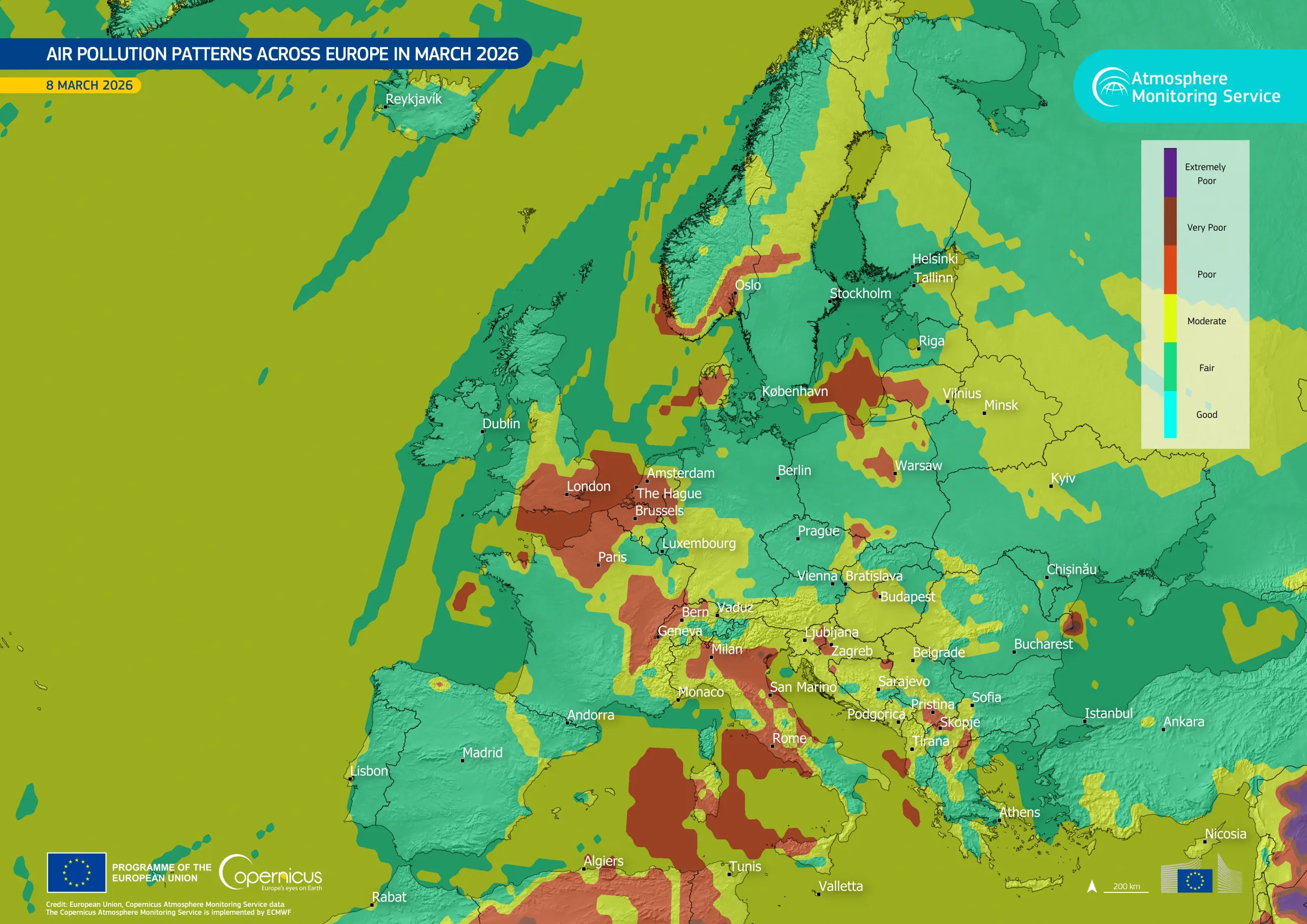
For the tens of millions of Europeans who live with asthma or other respiratory conditions, access to reliable air quality information carries direct health implications. This information reaches them through daily air quality forecasts produced by the Copernicus Atmosphere Monitoring Service (CAMS), which covers the entire European continent. CAMS data and products are used by more than 2,500 entities, including weather and media platforms such as Windy.com, Euronews, The Weather Channel, and CNN, while applications including DiscovAir, PASYFO, and SunSmart use CAMS data to provide information on air quality, pollen concentrations, and UV radiation. According to current estimates, more than 100 million people currently receive daily air quality information based on CAMS data and forecasts.
Beyond the atmosphere, Copernicus also monitors the state of the oceans, coastlines, and land surface. The Copernicus Marine Service (CMEMS) supports maritime safety, coastal management, fisheries, and the tracking of marine heatwaves and pollution events, helping the communities and operators which depend on healthy marine environments. The Copernicus Land Monitoring Service (CLMS) produces geospatial products supporting the monitoring of land cover, croplands, urbanisation, and ground movement across the continent, informing EU policies including the Common Agricultural Policy and the EU Biodiversity Strategy for 2030. Galileo and EGNOS positioning services support precision agriculture, with satellite-guided machinery, soil-monitoring tools, and automated irrigation systems helping farmers optimise water use, reduce input waste, and lower the environmental footprint of food production.
Supporting public authorities and crisis response
EU Space capabilities also support public authorities and emergency responders across Europe and beyond.
When droughts, floods, or wildfires develop, public authorities need timely and reliable information to coordinate an effective response. Early warning and emergency response support is delivered through the Copernicus Emergency Management Service (CEMS). When prolonged dry conditions develop across a region, CEMS data supports national authorities in assessing the scale of the situation and coordinating response measures more effectively. During major disasters, satellite-based products can support civil protection operations by providing near-real-time information on affected areas and damaged infrastructure.
Locating people in distress quickly is among the most time-sensitive challenges emergency responders face. Galileo’s Search and Rescue (SAR) service, Europe’s contribution to the international Cospas-Sarsat system, helps detect and locate distress beacons carried by aircraft, vessels, and individuals in emergency situations, supporting rescue coordination efforts around the world. Unlike earlier systems, Galileo SAR can also send a return message confirming that the distress signal has been received and that rescue services have been alerted. The Copernicus Marine Service (CMEMS) further supports maritime search and rescue planning, providing ocean and wave data which can be used in drift models and decision-support tools to help narrow search areas during rescue operations.

Security and defence
The ability to monitor a stretch of coastline at night, maintain secure communications during a crisis, or navigate independently when other systems are disrupted are capabilities which many citizens may rarely see directly, but which help support public safety and security across Europe. The Copernicus Security Service (CSS) supports border and maritime surveillance and EU external and security actions, providing satellite-derived products which help security authorities monitor large geographic areas, detect irregular activity, and coordinate responses across Member States.
Equally important is Europe's growing capacity to carry out these functions independently. In January 2026, GOVSATCOM became operational, giving all Member States access for the first time to sovereign, encrypted satellite communications built and controlled in Europe. This reduces reliance on non-European providers for the communications which underpin government operations, crisis management, and security coordination. Similar efforts are also strengthening Europe’s independent and resilient navigation capabilities. Galileo's Public Regulated Service (PRS), reserved for government-authorised users, is nearing full operational status. Designed to remain available even when other navigation services are degraded or subject to deliberate interference, PRS will give police forces, civil protection authorities, and defence users across Member States a positioning signal which is resistant to jamming and available when it is needed most.
Looking ahead, IRIS², the Infrastructure for Resilience, Interconnectivity and Security by Satellite, is set to strengthen Europe’s secure connectivity capabilities further. The multi-orbital constellation will provide resilient and secure communications services for governments, businesses, and citizens, while also supporting broadband connectivity in underserved or remote areas where terrestrial infrastructure remains limited.
Navigation, transport, and timing
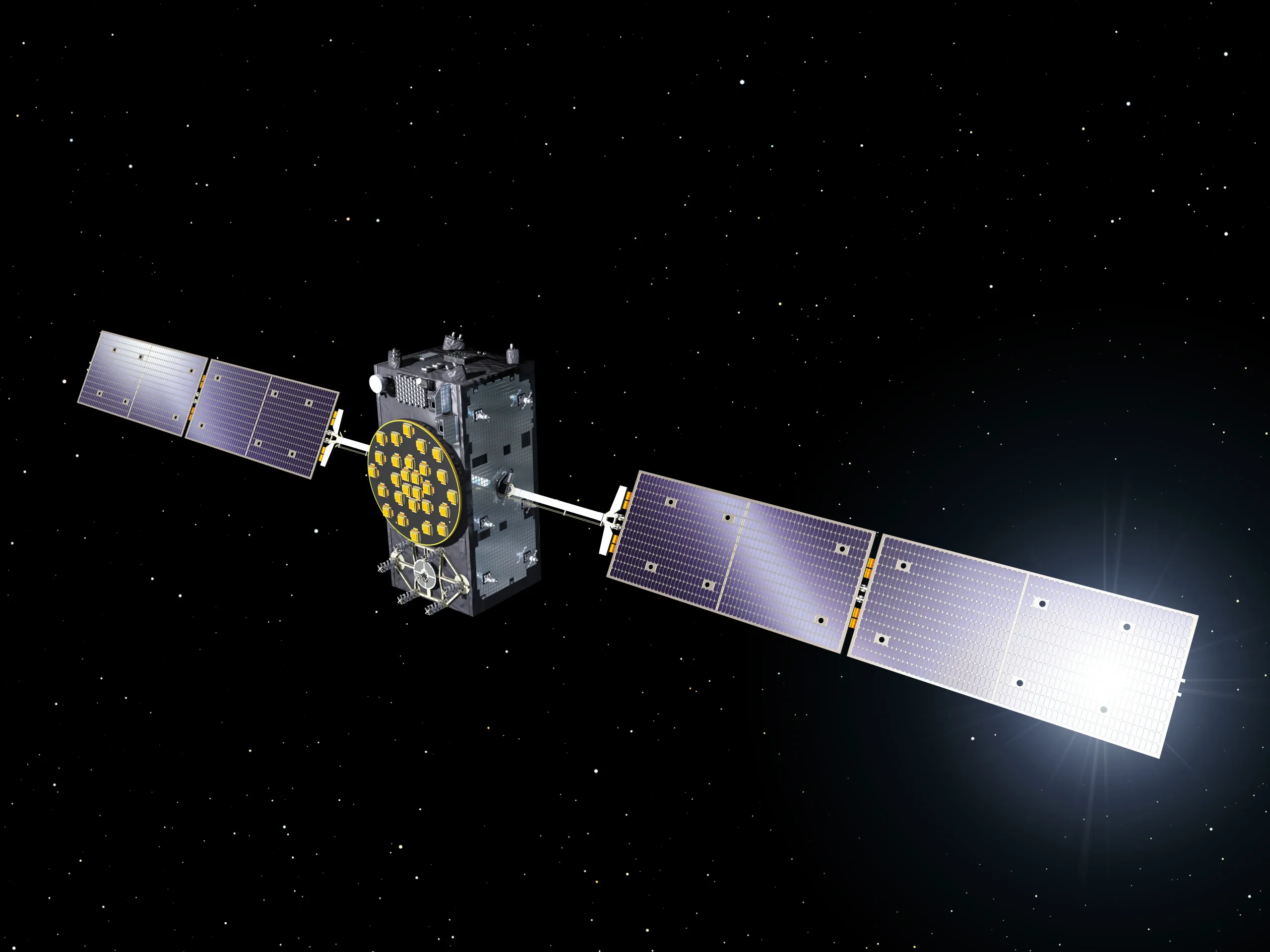
From navigating city streets to tracking delivery parcels, accurate positioning and timing support a wide range of services which many European citizens use daily without attributing them to space. Galileo, the EU's own Global Navigation Satellite System (GNSS), provides Positioning, Navigation, and Timing (PNT) services used by more than 4.5 billion devices worldwide, including smartphones, in-car navigation systems, and wearable technologies. These services support navigation applications, public transport systems, emergency response operations, and a growing range of location-based services. Galileo’s PNT services also support sectors including telecommunications, banking, energy distribution, and transport infrastructure, helping systems which depend on highly precise timing and synchronisation to operate reliably.
Complementing Galileo, EGNOS improves the accuracy and reliability of navigation signals across Europe, reducing positioning errors to within a metre in many conditions. This level of precision is central to the safety of civil aviation. It is estimated that more than 80,000 flight delays and 20,000 diversions have already been avoided across Europe at EGNOS-equipped airports.
Protecting the infrastructure behind modern life
As European societies grow more dependent on space-based services, protecting the infrastructure which supports them has become increasingly important. The Space Situational Awareness (SSA) component of the EU Space Programme helps monitor and assess risks in and from space, supporting the continuity of services which citizens, businesses, and public authorities rely upon every day.
SSA monitors hazards including collisions between satellites and space debris, space weather events such as solar storms, and near-Earth objects including asteroids and comets. These activities help in particular to protect satellites and the services they support, including communications, navigation, and Earth Observation.
Space weather events, for example, can affect not only satellites in orbit but also infrastructure on Earth, including electricity grids and communication systems. By improving understanding of these risks and helping operators respond to them, SSA contributes to the resilience and reliability of both space-based services and critical infrastructure on Earth.
Bringing EU Space closer to citizens
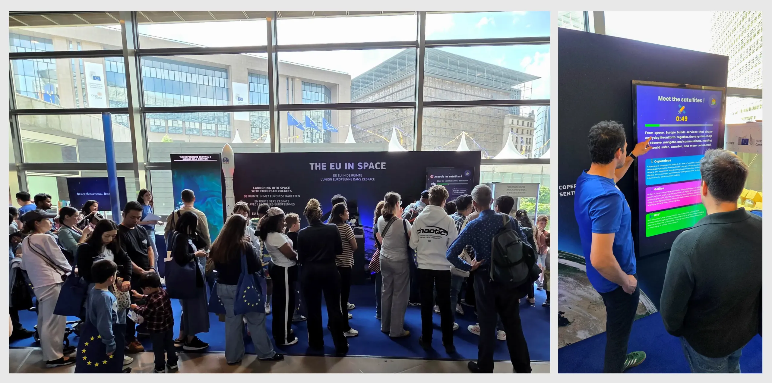
Each year, Europe Day marks the anniversary of the Schuman Declaration and opens the doors of EU institutions to the public. In 2026, as in previous years, this celebration served as a reminder of what European cooperation has built across seven decades, including infrastructure which now extends beyond the continent's borders and into orbit.
The EU space policy and programmes are clear examples of what European cooperation can make possible. By pooling expertise, investments, infrastructure, and requirements, the EU and its Member States have built shared capabilities which no single Member State could deliver in the same way alone. This common approach also helps ensure that space-based data and services are more scalable, comparable, interoperable, and available across Europe.
Sustaining these capabilities requires continued and increased investment at EU level. The defence and space window of the proposed European Competitiveness Fund allocates EUR 131 billion to space, security, and defence within the EU's next long-term budget for 2028 to 2034, representing five times more funding at EU level than the previous financial framework. This investment is designed not only to maintain existing infrastructure but to grow the EU space economy and reinforce European capabilities in security and defence, building on the recognition that space infrastructure is as much a strategic asset as it is a public service.
During Europe Day activities at the European Commission Berlaymont Building in Brussels, 18,000 visitors were able to explore how the EU space policy and programmes support everyday services relating to navigation, environmental monitoring, emergency response, secure communications, and space safety. Through exhibitions, demonstrations, and discussions with staff and experts, members of the public were given a closer look at the infrastructure and services operating behind many aspects of modern life across Europe.