
OBSERVER: How EU space data supports disaster response
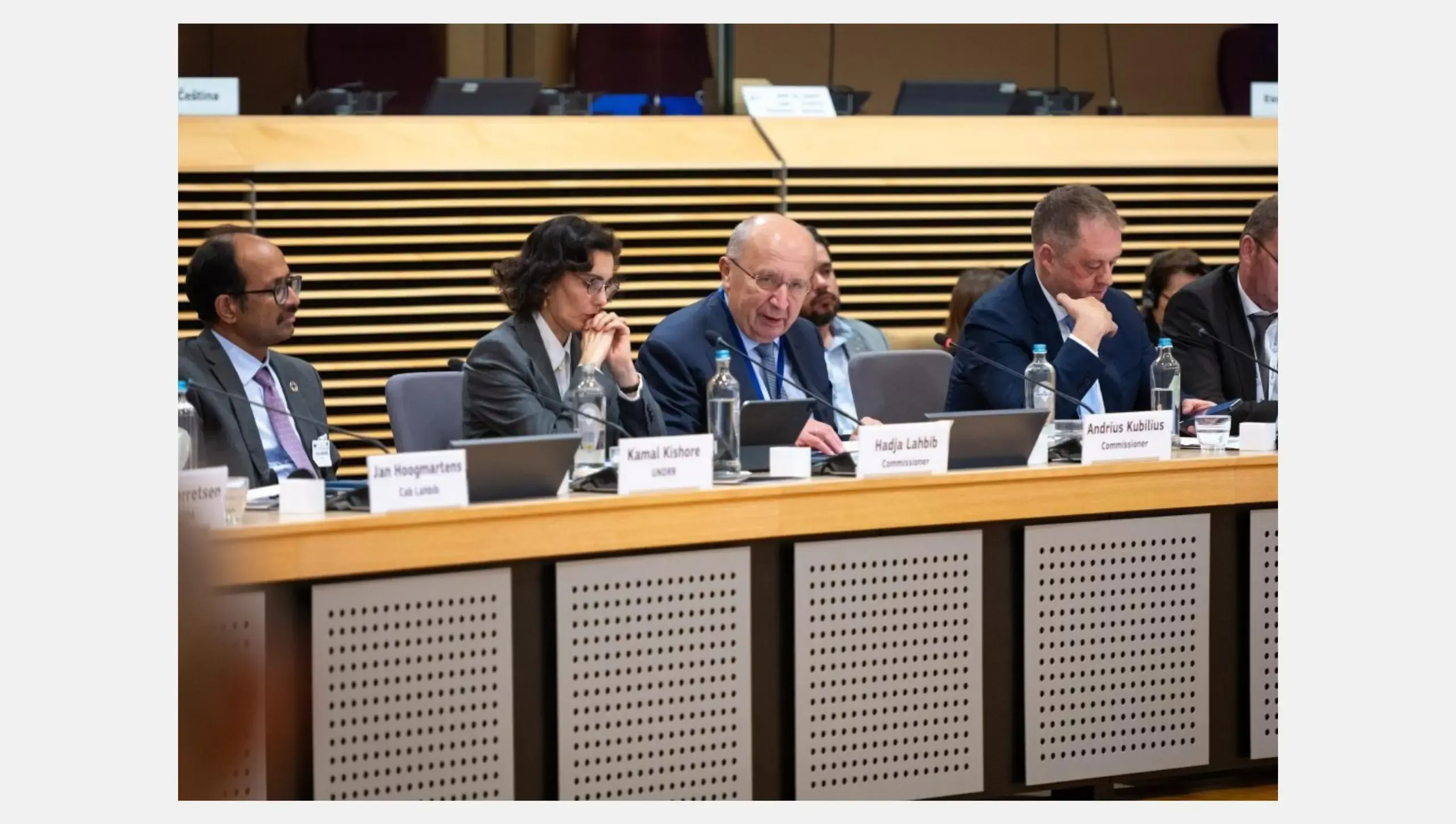
On 14 October 2026, the European Commission held the first cross-regional dialogue on space technologies and disaster risk management in Brussels, with regional disaster management bodies from Latin America and the Caribbean, Asia, and Africa. A temporary exhibition was organised as part of the event. It presented recent disasters, and paired for each of them a Copernicus satellite image or emergency map with photos of the response on the ground. At the event, Commissioners Andrius Kubilius and Hadja Lahbib presented a Compass on Space and Disaster Risk Management, which calls for closer international cooperation. In this Observer, we look at how the EU Space Programme supports disaster preparedness and response.
Marking the International Day for Disaster Risk Reduction, the European Commission convened its first cross-regional dialogue on space technologies and disaster risk management (DRM) in Brussels on 14 October 2026. Regional disaster management bodies from Latin America and the Caribbean, Asia, and Africa participated in the event, among them the Caribbean Disaster Emergency Management Agency, the ASEAN Coordinating Centre for Humanitarian Assistance on Disaster Management, and the Southern African Development Community’s Humanitarian and Emergency Operations Centre.
Andrius Kubilius, European Commissioner for Defence and Space, and Hadja Lahbib, European Commissioner for Equality, Preparedness and Crisis Management, participated in the dialogue alongside Kamal Kishore, Special Representative of the UN Secretary-General for Disaster Risk Reduction, and Thomas Byrne, Ireland’s Minister of State for European Affairs and Defence. The dialogue aimed to strengthen international cooperation to anticipate and reduce the impact of natural hazards. The discussions explored how data from space-based initiatives such as Copernicus, the Earth Observation (EO) component of the EU Space Programme, could improve early warning systems and support the resilience of the most vulnerable communities.
Through Copernicus, Europe’s eyes on Earth, we provide critical and timely information to help authorities anticipate disasters, assess their impact and respond when every minute counts.
— Andrius Kubilius
European Commissioner for Defence and Space
Mapping damage to support disaster response
An exhibition held alongside the dialogue presented disasters which struck Asia, Africa, Latin America, and Europe between 2024 and 2026. For each of them, photos of the response on the ground stood next to satellite images or maps from Copernicus. The maps were produced using data from the Copernicus Emergency Management Service (CEMS), which provides rapid damage assessments within hours after a disaster.
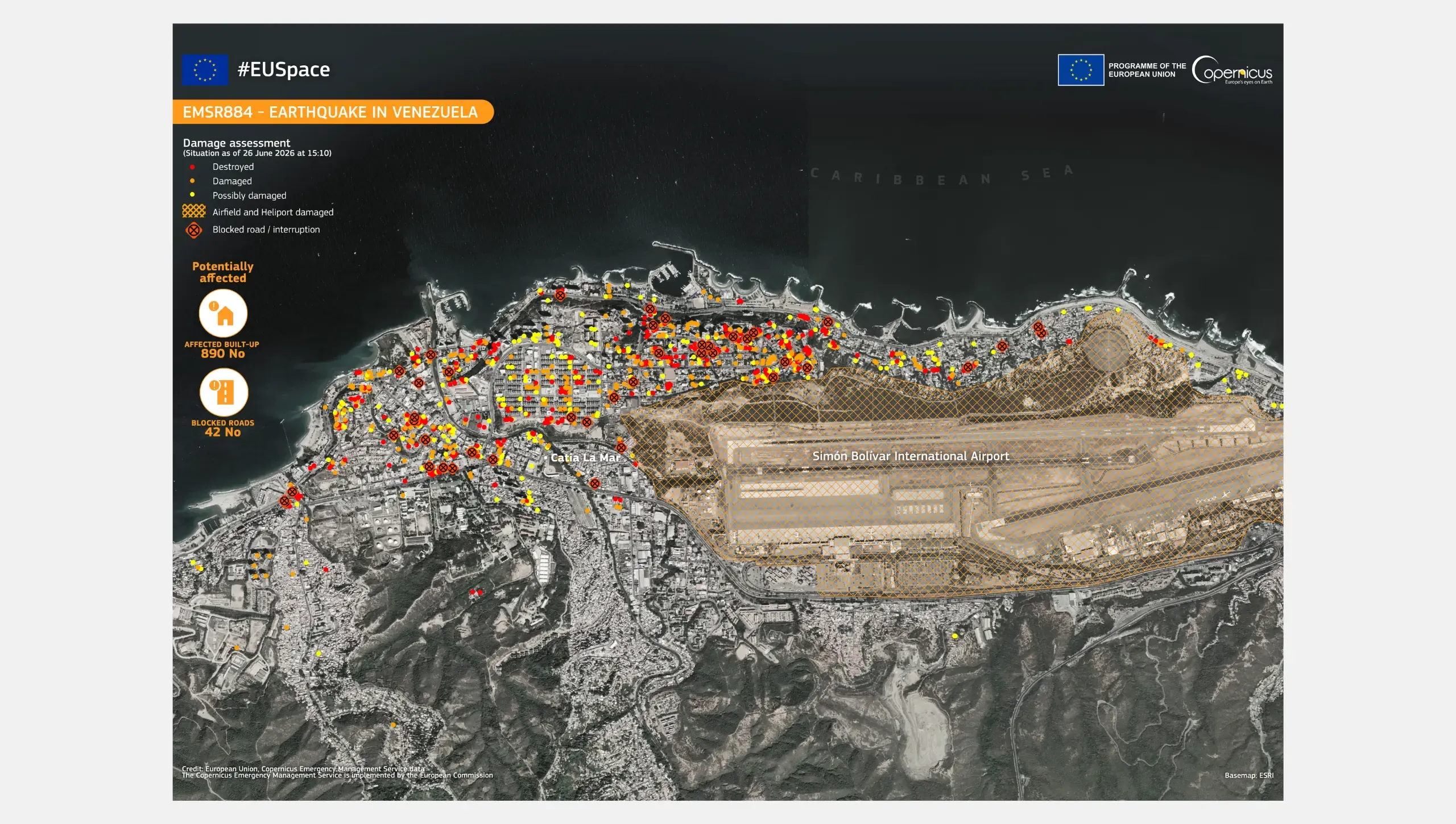
On 24 June 2026, two earthquakes of magnitude 7.2 and 7.5 struck northern Venezuela. CEMS analyses of the coastal town of Caraballeda showed 890 buildings and 42 roads affected, as well as damage to the Simón Bolívar International Airport. The EU coordinated the deployment of around 750 responders, mobilised assistance from 18 EU countries and Türkiye, and released €15 million in humanitarian aid.
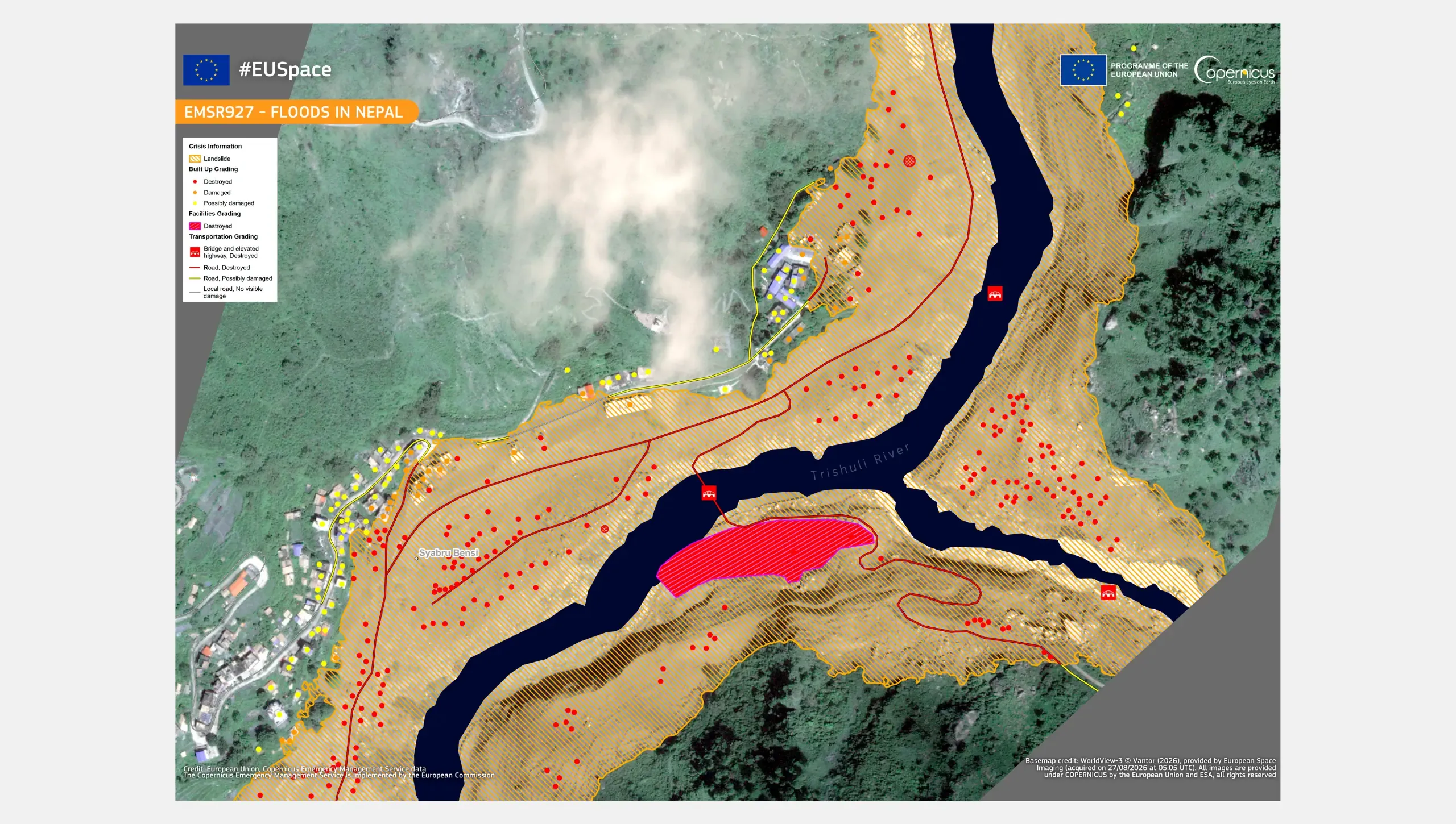
On 26 August 2026, a flash flood triggered by a glacier collapse swept down from Tibet into the Rasuwa District in northern Nepal. Copernicus Sentinel-2 images from 12 and 27 August show wide traces of flooding along the river path following the flood, with pale sediment across the valley floor. A CEMS product over the town of Syapru Besi identified more than 240 destroyed buildings and 32 damaged ones. The EU provided €2.5 million in humanitarian funding and shelter supplies.
In northern Mozambique, Tropical Cyclone Chido made landfall on 15 December 2024. A CEMS map of the Pemba coast identified more than 32,000 destroyed and damaged buildings. The EU later mobilised €5 million from a €17 million humanitarian allocation in 2025, for the households hardest hit by Chido and two subsequent cyclones.
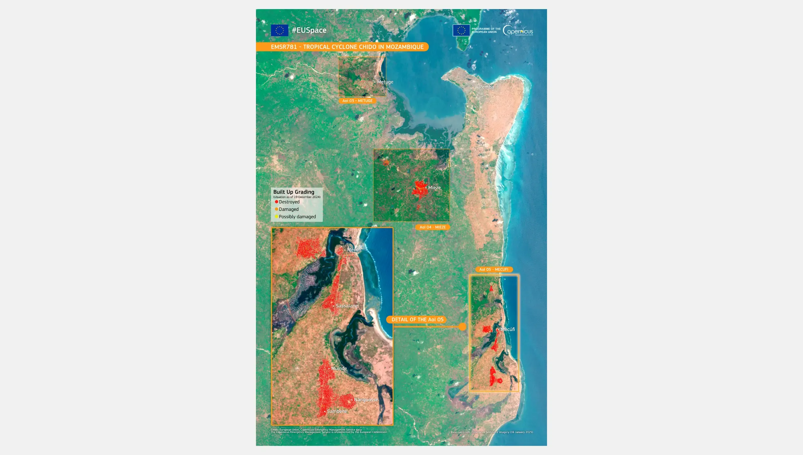
Maps of this kind indicate to responders where damage is concentrated, which helps them decide where to send teams and supplies in priority.
Seeing through smoke and clouds
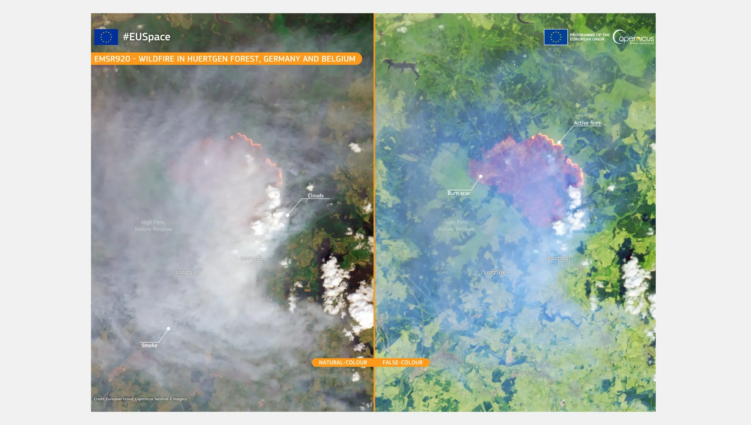
The exhibition also showed how the sensors onboard different Copernicus satellite missions suit different hazards. On 14 August 2026, a wildfire broke out in the High Fens, an upland nature reserve in eastern Belgium. A Sentinel-2 image from 16 August uses infrared bands to reveal the burn scar through the smoke. By that date, about 3,000 hectares had burned, making it the largest wildfire on record in Belgium. The EU coordinated firefighting aircraft, technical teams, and experts from six countries.
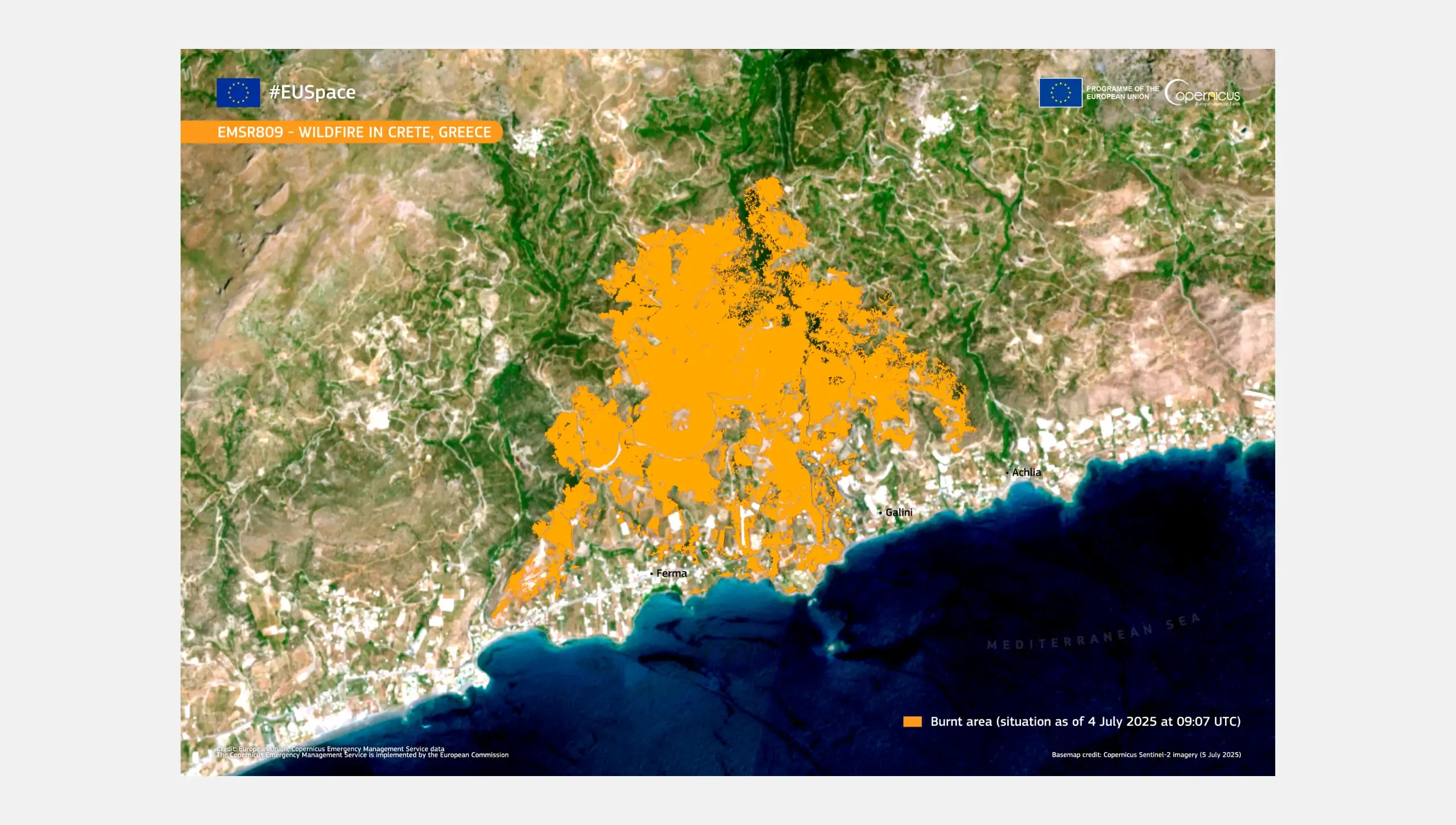
In Greece, during a severe wildfire season in the summer of 2025, Sentinel-2 captured smoke rising from a fire on the island of Chios, and CEMS mapped the extent of the Achlia fire, which led to the evacuation of around 5,000 residents.
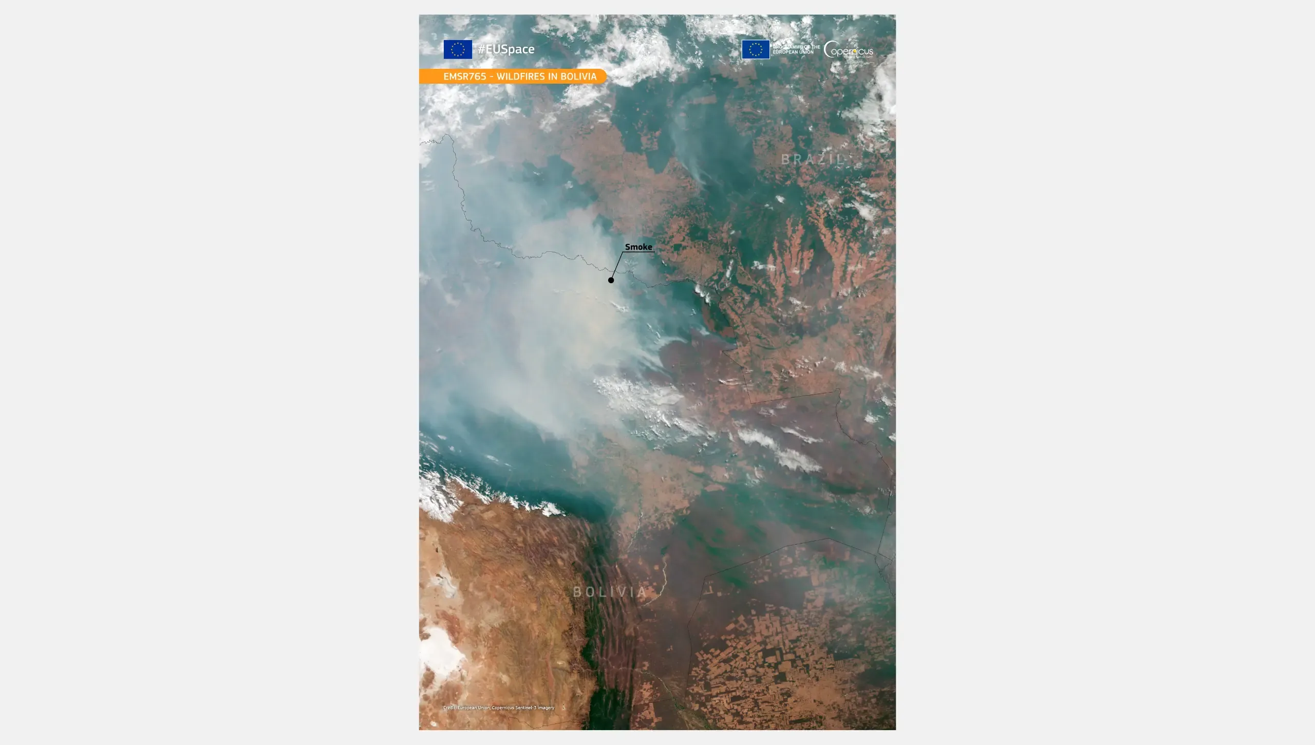
Bolivia faced its most destructive fire season on record in 2024. On 28 August, authorities reported more than 35,000 hotspots. Sentinel-3 acquired an image of the smoke plume spreading across the region. Through the European Union Civil Protection Mechanism, Spain sent 8 experts and 41 firefighters to support local responders.
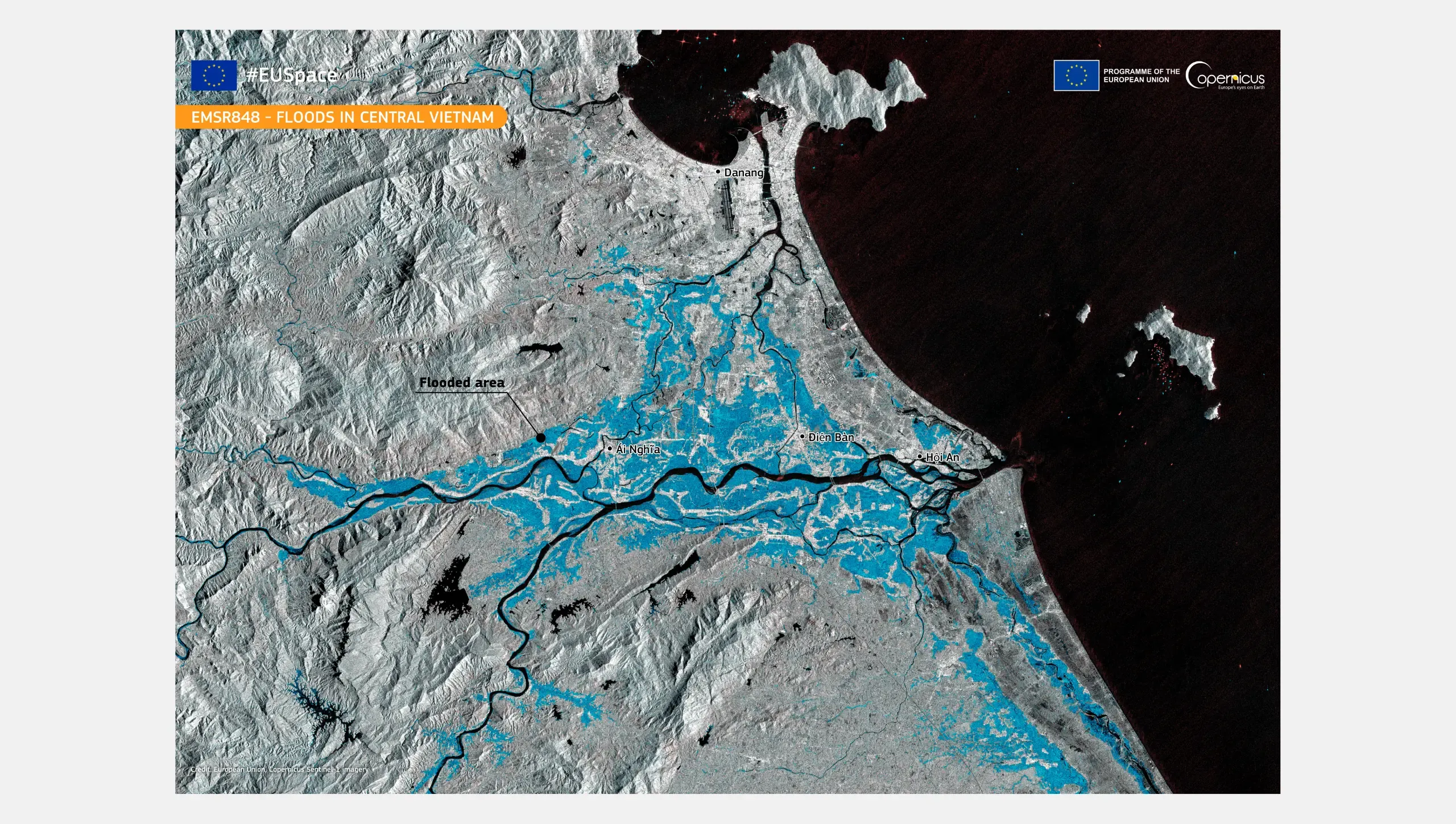
Floods bring a different challenge, as heavy rain usually arrives with thick cloud. When severe flooding struck central Vietnam in late October 2025, Copernicus maps based on Sentinel-1 data showed the flooded areas along the Vu Gia and Thu Bồn rivers. Sentinel-1 carries a synthetic aperture radar, which can image the surface through clouds and at night. The EU released over €800,000 in humanitarian aid for drinking water and cleaning supplies.
From data to action
The dialogue also looked at other components of the EU Space Programme. Galileo, the EU’s Global Navigation Satellite System, provides precise positioning for teams in the field. Its Search and Rescue Service helps locate distress beacons, while the Galileo Emergency Warning Satellite Service (EWSS), which will soon enter into operational service, is designed to broadcast emergency alert messages, generated by national authorities. When ground networks fail, Governmental Satellite Communications (GOVSATCOM) and the upcoming Infrastructure for Resilience, Interconnectivity and Security by Satellite (IRIS²) are designed to provide secure satellite connectivity for public authorities.
At the conclusion of the dialogue, Commissioners Kubilius and Lahbib presented the Compass on Space and Disaster Risk Management. The Compass stresses the need to translate risk data into actionable information, for instance in support of alerts by competent authorities. It also calls for strengthening regional systems, national authorities, and local communities so that information from space supports preparedness and anticipatory action. It points to closer technical cooperation with non-EU countries and regional organisations, including better forecasting and early warning, wider sharing of data and expertise, and training and technical visits.
The real power of space technology is not what we can see from above, but the lives we can protect below.
— Hadja Lahbib
European Commissioner for Equality, Preparedness and Crisis Management
‘When a river is about to flood, families don’t need a hazard map,’ said Commissioner Lahbib. ‘They need a clear warning, from someone they trust, in time to get to safety. First responders need to know when to open shelters and help people evacuate. That is why we are working with our partners to turn satellite data into action on the ground.’ As stated by the Compass, engagement among international partners will continue, so that preparedness helps protect the most vulnerable and warnings lead to early action.