Aftermath of Nepal flash flood
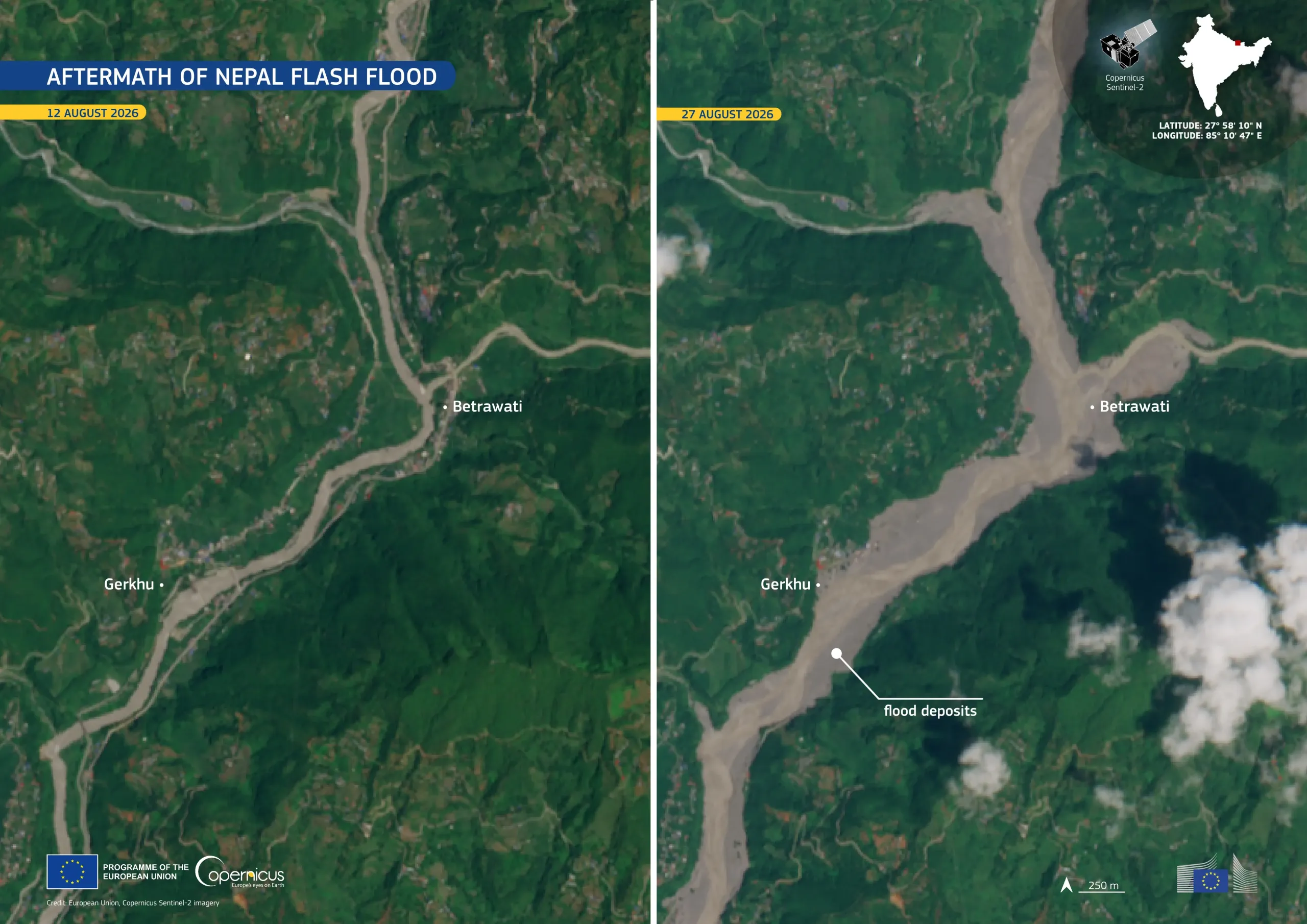
A severe flash flood struck northern Nepal on 26 August 2026, entering Rasuwa District from the Tibet side and travelling downstream through the Bhote Koshi–Trishuli river system. The flood caused widespread damage to settlements and critical infrastructure, including roads, bridges, and hydropower facilities. The 42-km road between Betrawati and the Rasuwagadhi border crossing was reported damaged, with several bridges along the route swept away.
This comparison of images acquired by one of the Copernicus Sentinel-2 satellites shows the area around Betrawati and Gerkhu before and after the event. On 12 August 2026, the river followed a relatively narrow channel through densely vegetated hills. By 27 August 2026, the river course appeared markedly wider, with extensive pale brown sediment deposits visible. These deposits covered parts of the valley floor and extended beyond the earlier river margins.
The Copernicus Emergency Management Service (CEMS) Rapid Mapping component has been activated (EMSR927) to provide flood extent and damage assessment emergency mapping. More information is available here.