EU Common Security and Diplomacy Policy (CSDP) missions are sometimes deployed for peacekeeping operations. The Copernicus Security Service (CSS) is helping peacekeepers prepare for different scenarios through detailed use cases as part of the Support to EU External and Security Actions (SESA) component which is operated by the European Union Satellite Centre’s (SatCen).
The challenge
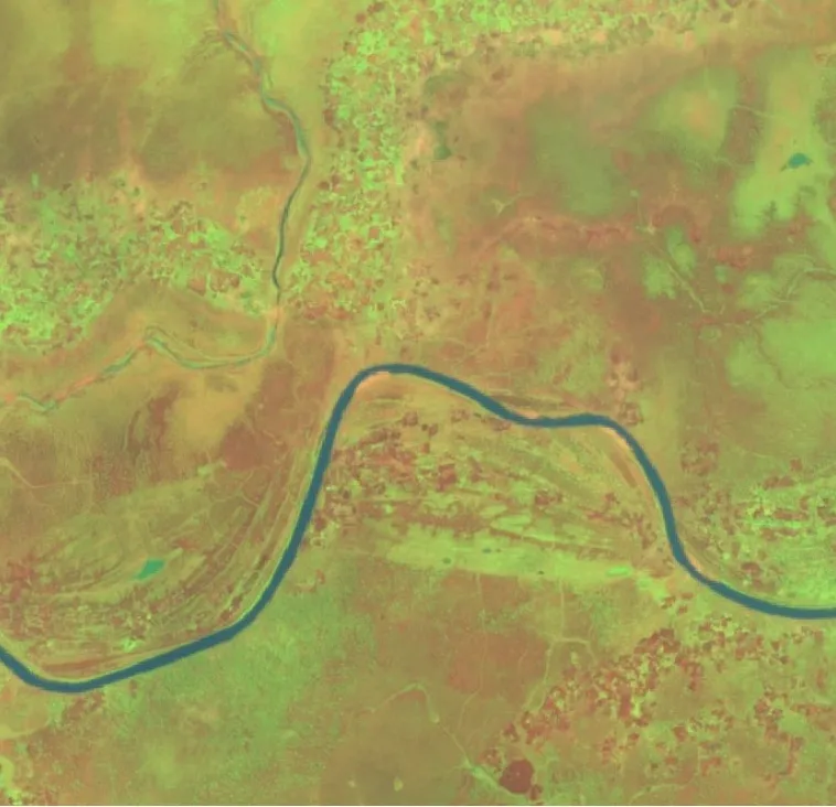
CSS SESA completed an analysis which is particularly useful for CSDP missions and operations: It mapped a region where two rival communities – one agrarian, the other pastoral – share increasingly scarce natural resources. Climate change is accelerating desertification, intensifying the dry season and straining the land further. As water and arable land diminish, the agrarian community is being pushed to the brink of conflict with its pastoral counterpart.
The solution
CSS SESA’ case study provided key insights for decision makers and actors to better understand pastoral and agricultural land use during the dry season and the trend in desertification. These activities helped them better target their conflict-prevention efforts.
Results and impacts
Thanks to Copernicus satellite data, CSDP users were able to assess how land use was influencing the conflict and to intervene in time. In this way, the CSS-SESA service demonstrated how precise area analysis delivers valuable contributions to conflict resolution.
Overall, the Copernicus Security Service component on Support to EU External and Security Actions (SESA) enables users engaged in peacekeeping operations to monitor a wide range of human activities on the ground. This capability helps reduce operational costs and limit the number of dangerous situations faced by peacekeepers.