Wildfires in Europe are becoming more severe and more frequent. That’s why the mapping and monitoring products provided by the Copernicus Emergency Management Service (CEMS) will become increasingly important to our preparation for and response to these events. In 2023, CEMS was vital in supporting EU and national-level responses to a devastating series of wildfires.
Key figures
hectares were burnt in fires larger than 30 hectares, as tracked by CEMS in July and August
first responders, 62 vehicles, and 16 rescEU planes mobilised via the EU Civil Protection Mechanism
individual fires mapped on-demand in July and August by CEMS to aid the response
The challenge
2023 was a challenging year for the Mediterranean area. It saw the largest wildfire ever recorded in the EU, impacting humans and wildlife alike from the shores of the Black Sea to the Atlantic coast. 41% of the burnt areas were within Natura 2000 sites, which designate areas with significant biodiversity. The fires particularly damaged the Canary Islands, Rhodes, Sicily and many other Mediterranean islands.
The solution
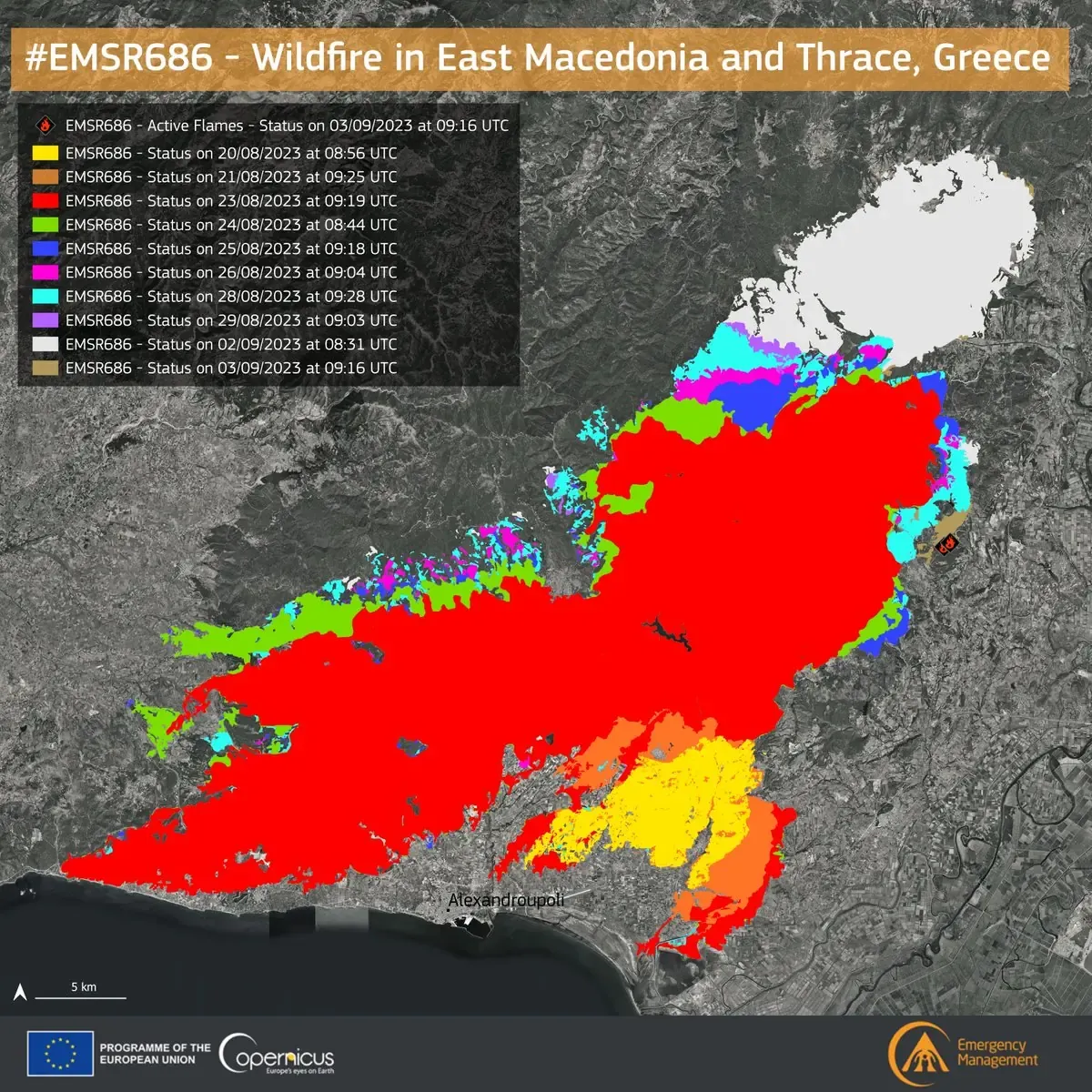
The CEMS European Forest Fire Information System (EFFIS) continuously monitored the impacts of the fires during and after they occurred.
By the end of August, EFFIS had recorded a total of 1 273 fires exceeding 30 hectares in size within the EU. In addition, CEMS On-demand mapping provided detailed mapping for 22 significant fires in several countries in July and August.
Using its Exposure mapping component, CEMS helped produce estimates of the affected population, buildings, and infrastructure in the affected areas.
Results and impacts
CEMS supported the EU’s rapid response to the fires, which assisted Greece in the largest rescEU aerial firefighting operation ever undertaken. The EU mobilised 11 airplanes and a helicopter to join the five Greek rescEU planes already operating. An additional 407 first responders and 62 vehicles supported the response via the EU Civil Protection Mechanism.