The Bowknot bend, carved by the Green river, USA
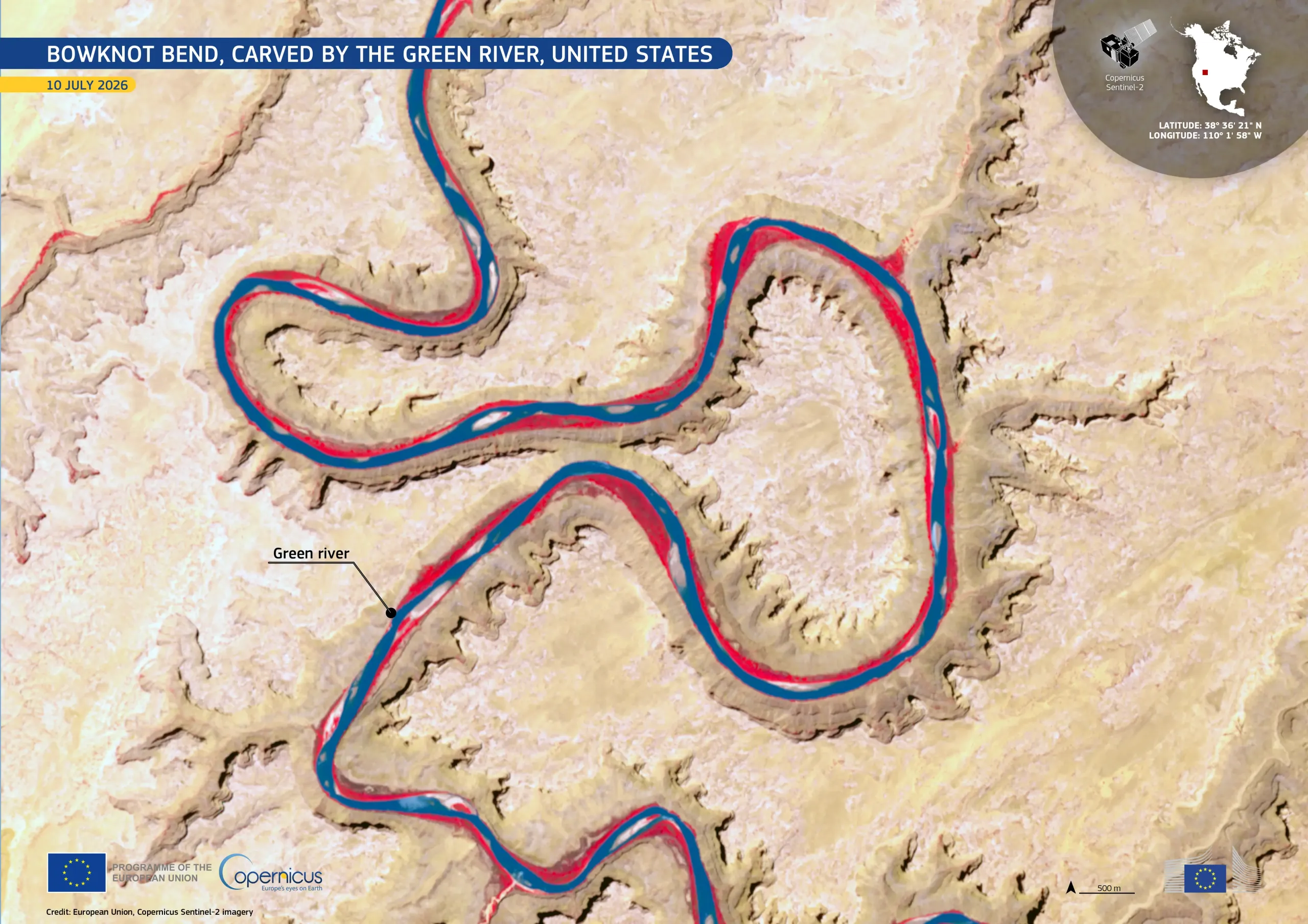
Bowknot Bend lies in the arid landscape of eastern Utah, north of Canyonlands National Park, in the United States. It marks the point where the Green River flows into a deeply entrenched meander, flowing around a narrow rocky saddle before returning close to its starting point. Continued erosion may eventually one day cut through the saddle, shortening the river’s course.
Acquired by one of the Copernicus Sentinel-2 satellites on 10 July 2026, this false-colour image highlights the winding river in dark blue. Vegetation along the channel and across parts of the canyon floor appears bright red, contrasting with the pale sandstone plateaus, steep cliffs, and exposed rock surrounding the meanders.
Copernicus Sentinel-2 data support the monitoring of river systems, riparian areas, and changing landforms, contributing to environmental assessment and long-term observation of erosion processes.