Heavy rainfall triggers floods across western Ecuador
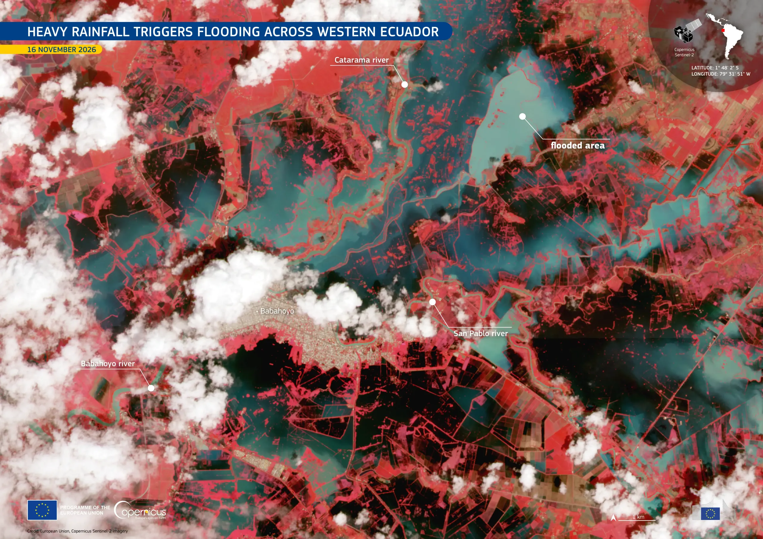
Between 12 and 14 November 2026, heavy rainfall caused flooding across parts of western Ecuador, particularly in the Guayas Province. The cities of Guayaquil and Milagro were among the affected areas. The Copernicus Emergency Management Service (CEMS) Rapid Mapping component has been activated (EMSR936) to provide flood extent and damage assessment emergency mapping.
Acquired on 16 November 2026 by one of the Copernicus Sentinel-2 satellites, this false-colour image shows extensive flooding around the city of Babahoyo, in the Los Ríos Province, north-east of the city of Guayaquil. Flooded areas appear in shades of dark blue and turquoise, contrasting with the reddish tones of vegetation. Large areas of inundated land are visible along the Catarama, San Pablo, and Babahoyo rivers.
Copernicus Sentinel data support the monitoring of flood extent, help identify affected areas, and provide valuable information for emergency response and damage assessment.