The Carpathian Mountains arc, Romania
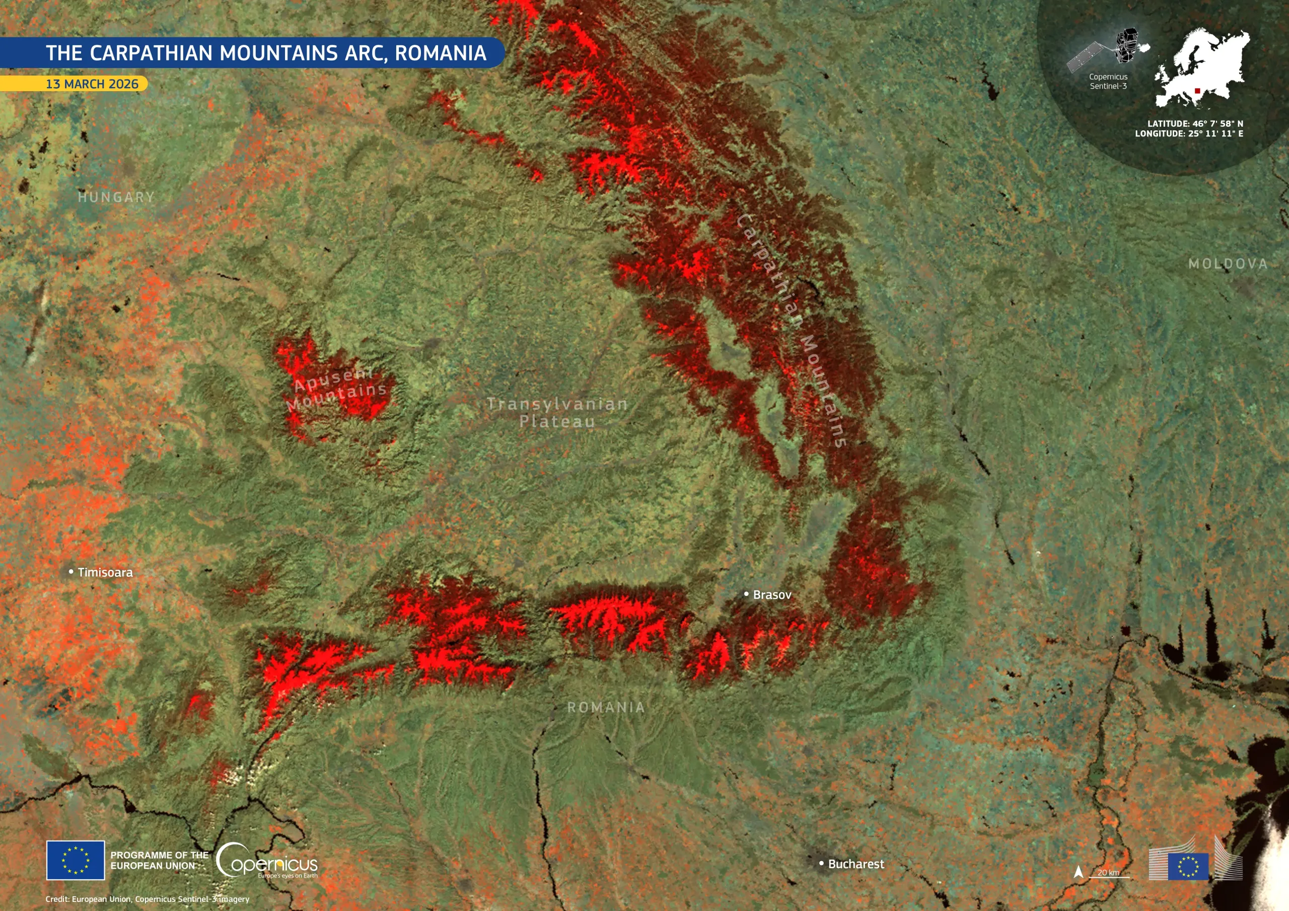
The Copernicus Sentinel-3 shortwave infrared bands make it possible to distinguish snow from clouds and bare ground, which is not always possible with the human eye.
This false-colour image was acquired by one of the Copernicus Sentinel-3 satellites on 13 March 2026, using three infrared channels from the SLSTR instrument. Snow, which reflects strongly in the near-infrared, appears in vivid red, clearly tracing the Carpathian arc. Snow cover extends from Romania’s northern border along the Eastern Carpathians and westwards across the Southern Carpathians, with a separate snow-covered area visible over the Apuseni Mountains. By contrast, the Transylvanian Plateau, enclosed by the Carpathian arc, and the surrounding lowlands appear largely snow-free.
The Copernicus Land Monitoring Service publishes global snow-extent data derived from Copernicus Sentinel-3 observations, supporting flood forecasting, hydropower planning, and water-supply management.