The Flinders Ranges reveal ancient geology in South Australia
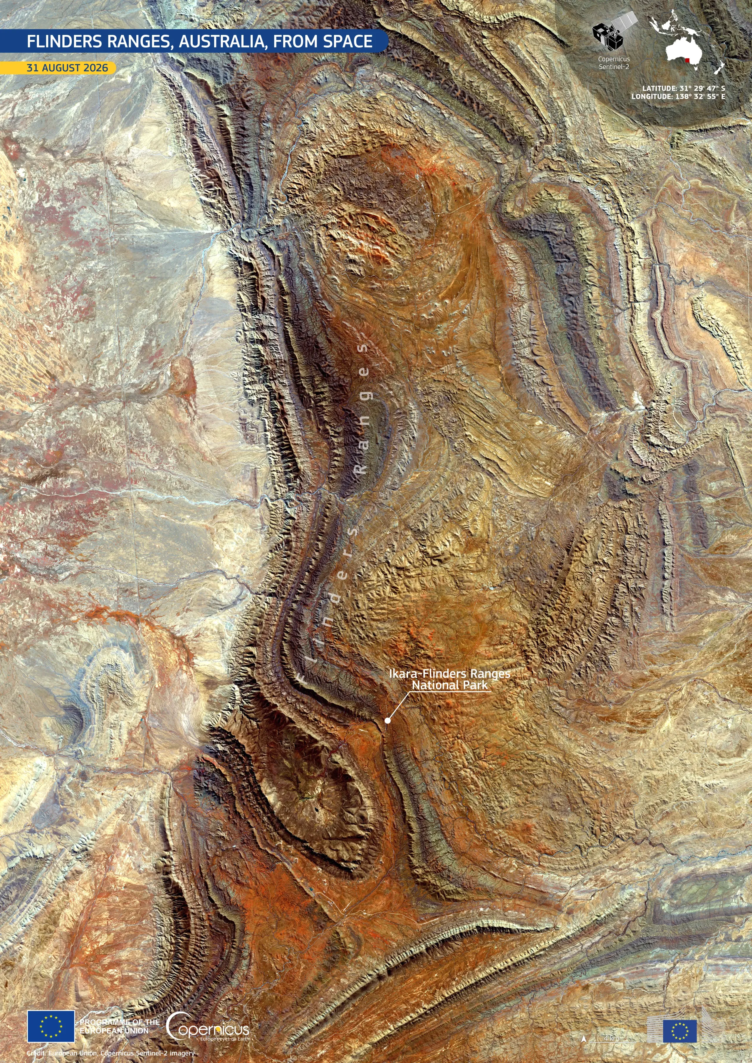
The Flinders Ranges, extend across the arid interior of South Australia, forming a landscape of folded ridges, valleys, and exposed rock formations. Part of the area is protected inside the Ikara-Flinders Ranges National Park, in which geological structures record hundreds of millions of years of Earth geological history.
Acquired by one of the Copernicus Sentinel-2 satellites on 31 August 2026, this false-colour image shows the ranges’ terrain. Parallel ridges and curved folds are visible, while variations in orange, brown, blue-grey, and pale tones reveal contrasts between exposed rock, soils, and sparse vegetation.
Copernicus Sentinel-2 data support the observation of remote and protected landscapes, providing information for monitoring land cover and vegetation conditions, and how these change over time.