Glaciers thin around Norway’s Longyearbyen as the Arctic warms
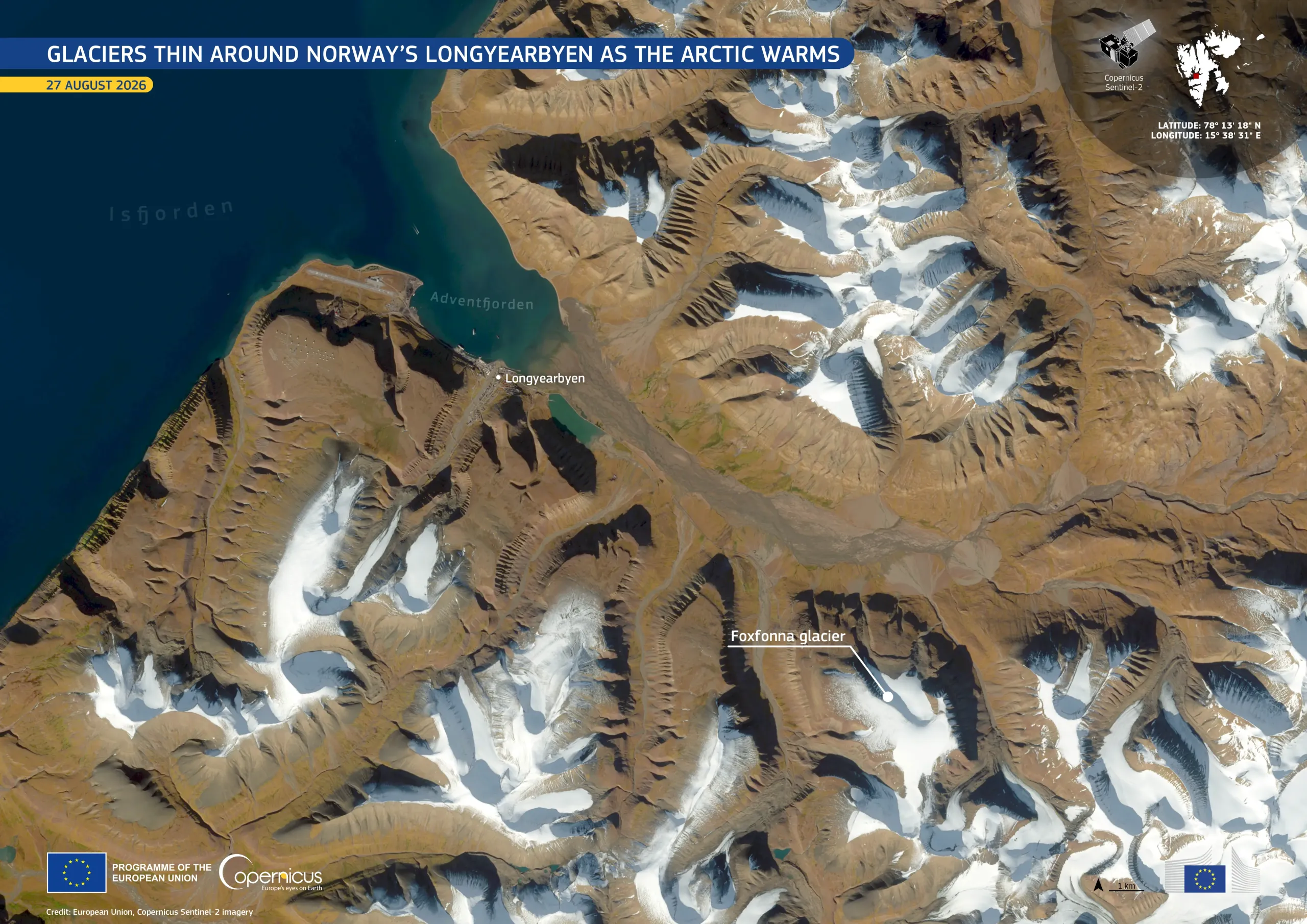
Longyearbyen, the largest settlement on the Norwegian archipelago of Svalbard, lies roughly halfway between mainland Norway and the North Pole. It is among the world’s northernmost settlements and is located in one of the Arctic’s fastest-warming regions. Permafrost, ground which remains at or below 0°C for at least two consecutive years, is thawing as temperatures rise. This thaw can affect local infrastructure and water resources. The surrounding glaciers are also thinning and retreating at an increasing rate. According to glaciologists at the University Centre in Svalbard, the Foxfonna glacier loses between 1 and 4 metres of ice thickness annually.
This image, acquired by one of the Copernicus Sentinel-2 satellites on 27 August 2026, shows Longyearbyen, surrounded by mountains and glaciers, on the shore of Adventfjorden. The Foxfonna glacier is visible to the south-east of the settlement. Patches of white ice and snow contrast with the brown, largely snow-free terrain and the dark blue water of the fjord.
Copernicus Sentinel-2 data support the monitoring of Arctic glaciers and snow cover, providing information for tracking glacier retreat, assessing environmental change, and planning climate adaptation measures in polar regions.