Ice loss affects Canada's Barnes Ice Cap
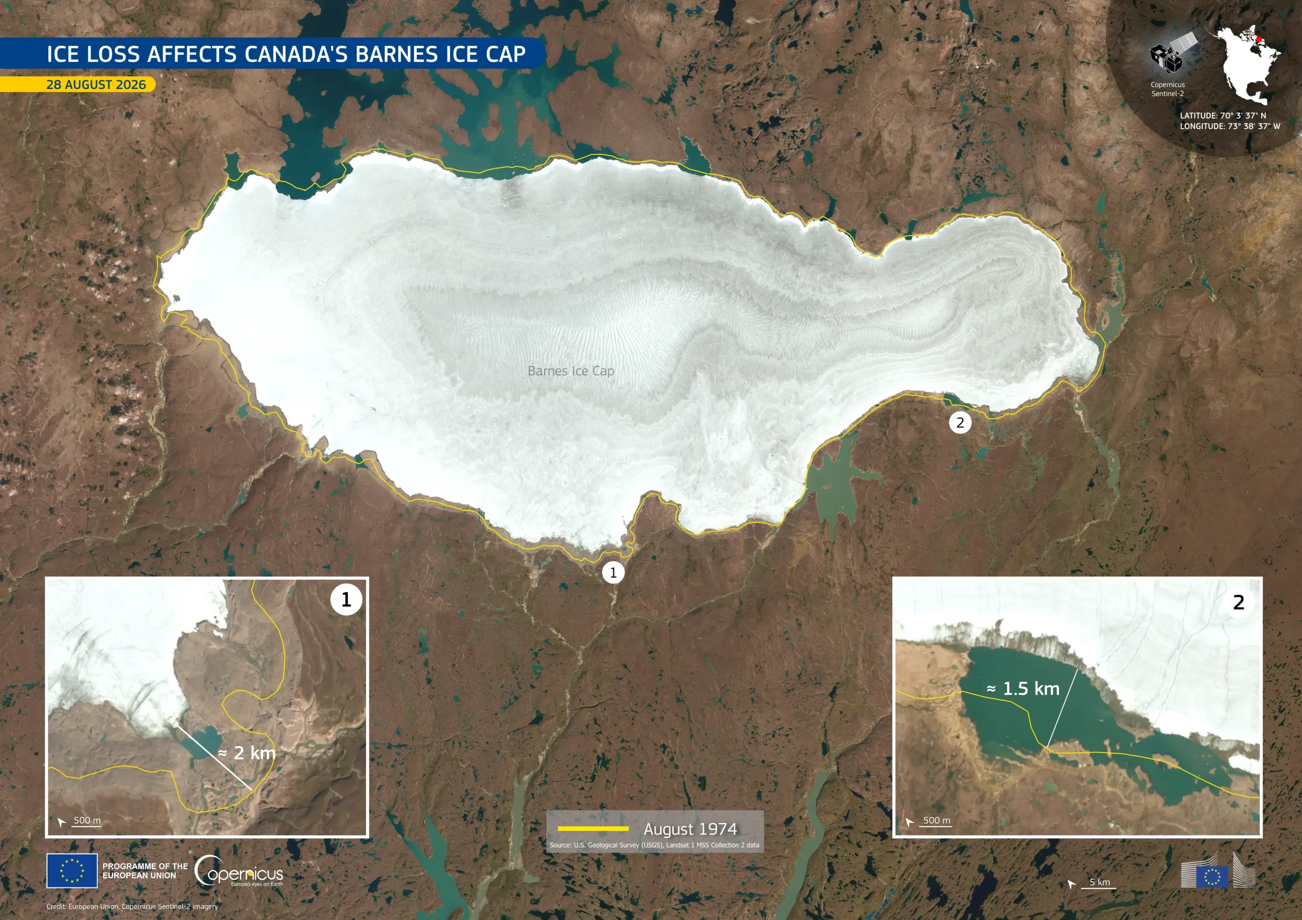
The Barnes Ice Cap, located on Baffin Island in the Canadian Arctic, is the last remaining fragment of the Laurentide Ice Sheet, which once covered much of North America. A recent study published in the Science journal suggests that the ice cap began expanding approximately 2,000 years ago, and that this expansion potentially marked the onset of a new glacial period. According to the study, human-induced warming reversed this trend around 1960, and the ice cap has been shrinking since.
This image, acquired by one of the Copernicus Sentinel-2 satellites on 28 August 2026, shows the Barnes Ice Cap surrounded by exposed brown soil, with turquoise lakes along parts of its edge. The yellow outline marks the ice cap’s extent in August 1974, extracted from US Landsat 1 satellite imagery. The two insets show areas where the ice edge retreated by about 2 km and 1.5 km between 1974 and 2026.
Copernicus Sentinel-2 data support the monitoring of glaciers and ice caps, helping scientists measure changes in ice extent and understand how the ice responds to rising temperatures.