Lava flows reshape Indonesia's Anak Krakatau island
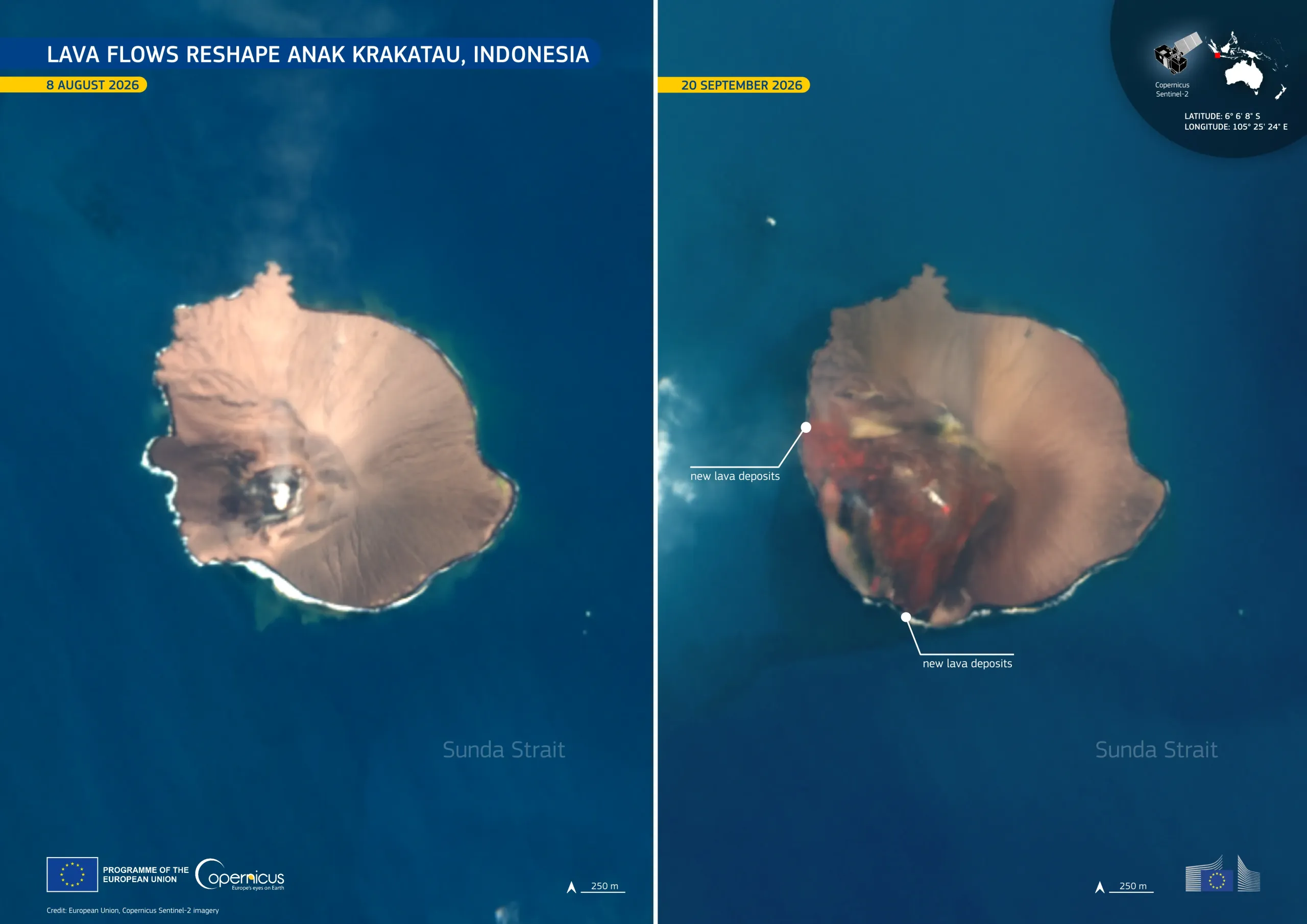
Anak Krakatau, a volcanic island in the Sunda Strait between Java and Sumatra, erupted continuously for 25 hours between 4 and 6 September 2026. According to Indonesia's Geological Agency, the eruption produced lava flows towards the north-west, west, and south-west from the active vent. The fresh volcanic material changed the shape of the island's western sector.
These Copernicus Sentinel-2 images, acquired on 8 August (left) and 20 September 2026 (right), show the island before and after the eruption. In the first image, pale brown volcanic deposits cover most of the cone. In the second, extensive dark red-brown lava deposits extend across the southern and western sectors, and new material along the coastline have added approximately 0.2 km2 of land to the island.
Copernicus Sentinel-2 data support the monitoring of volcanic islands and rapid surface changes, helping to map the extent of lava deposits, assess changes to volcanic landforms, and track the evolution of active eruptions.