Low water levels affect passenger transport on the Untersee between Germany and Switzerland
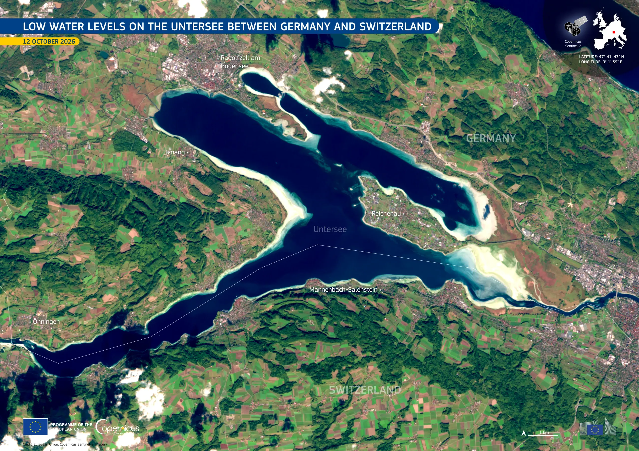
Lake Constance, on the borders of Germany, Switzerland, and Austria, has two main basins. The larger Obersee, or Upper Lake, is linked by a short stretch of the Rhine to the smaller Untersee, or Lower Lake, which Germany and Switzerland share. Since the beginning of the summer of 2026, water levels across Lake Constance have been well below average. On 1 October 2026, German passenger boat services on the Untersee were suspended as the waters were no longer deep enough for the boats to operate. The suspension affects four landing stages, including Radolfzell and Reichenau Island. On 6 October 2026, the water level was about 90 centimetres below the long-term average, according to the environmental agency of the German State of Baden-Württemberg.
This image, acquired by one of the Copernicus Sentinel-2 satellites on 12 October 2026, shows the Untersee and its surroundings. Along the shoreline, particularly around Reichenau Island and in the eastern part of the lake, light-coloured areas mark shallow water and exposed lake bed.
Copernicus data support the monitoring of changes in lake shorelines and water extent, providing useful information for water resource management, ecosystem protection, and navigation planning.