Flood models reveal where water could rise highest in Iniesta, Spain
Floods pose serious risks to communities, homes, and livelihoods. On 13 October, the International Day for Disaster Risk Reduction highlights this year's theme, “Resilience Starts at Home”, which focuses on understanding and preparing for risks in areas where people live.
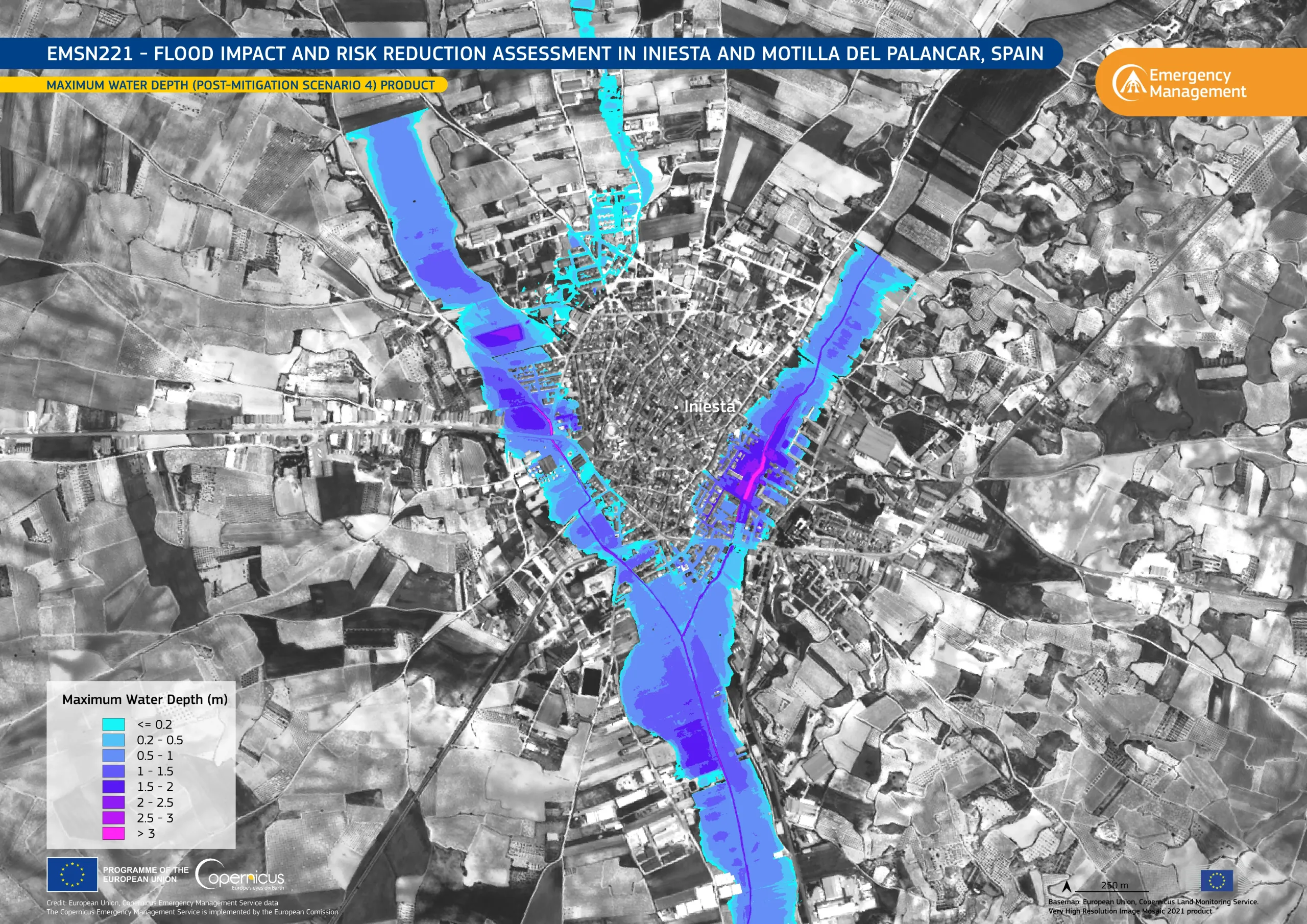
This visualisation, produced using data from Copernicus Emergency Management Service (CEMS) Risk and Recovery Mapping activation EMSN221, shows modelled maximum flood water depth in Iniesta, a town in the province of Cuenca, in central Spain. The visualisation represents the worst case flood scenario which was modelled taking existing mitigation measures into account. Flooded areas range from cyan, indicating shallower waters, to purple and magenta, representing greater depths. The activation also modelled the same scenarios without these mitigation measures. Comparing the two helps authorities evaluate how effective the measures are, identify areas exposed to flooding, and plan land use.
The Copernicus Emergency Management Service provides geospatial information to support national and local authorities in analysing flood hazards and strengthening flood preparedness and risk management.