
Low water levels on the Waal River in the Netherlands
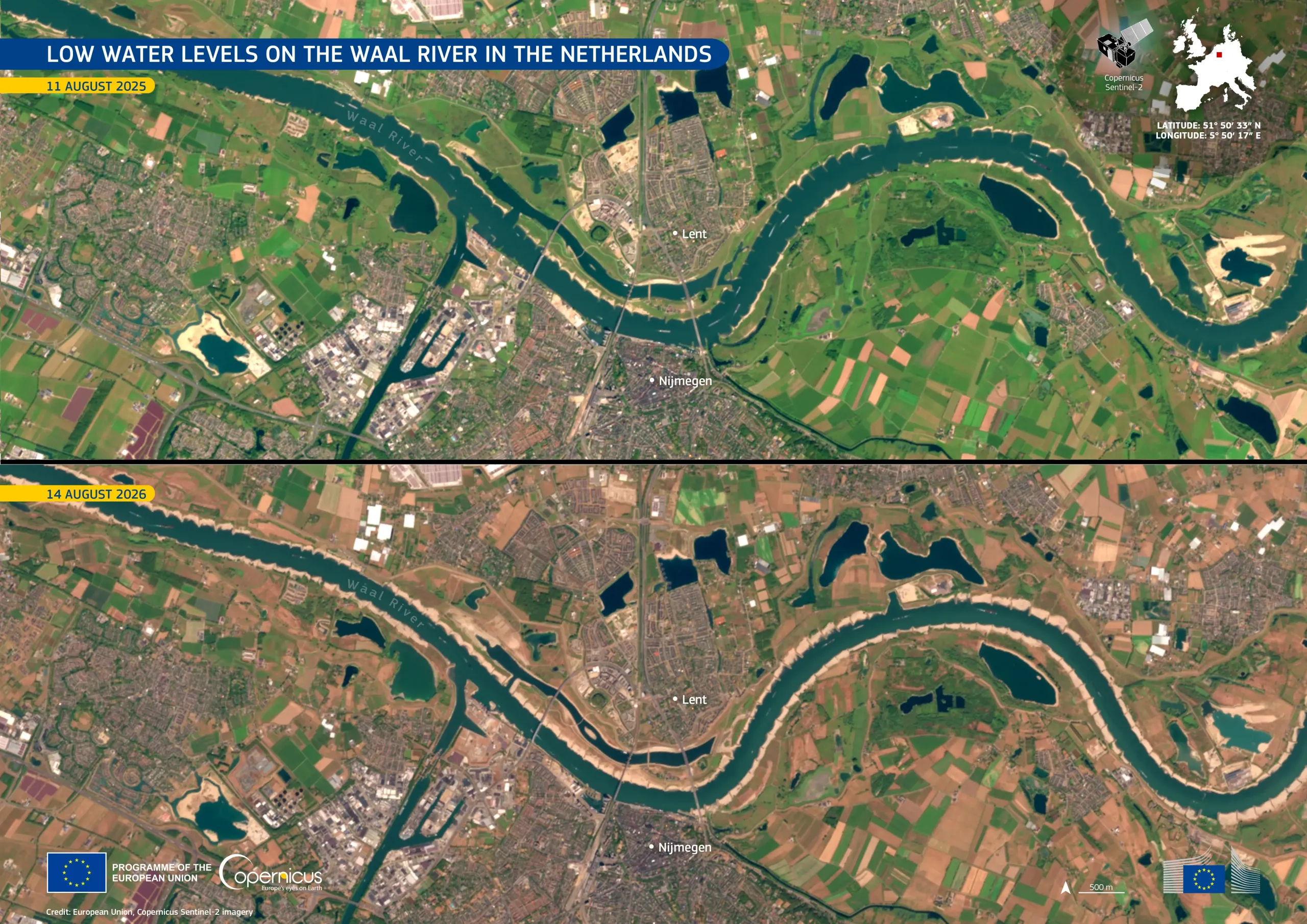
The Waal, in eastern Netherlands, is the largest Dutch branch of the Rhine and an important inland shipping route. Prolonged dry conditions across the Rhine basin have reduced flows to exceptionally low levels, with the Netherlands in a water shortage situation since 16 July 2026.
These images, acquired by the Copernicus Sentinel-2 satellites on 11 August 2025 and 14 August 2026, show the Waal River near Nijmegen. Compared with the same period in 2025, the 2026 image shows wider exposed riverbanks along several river sections.
Copernicus Sentinel satellite data provide useful information for monitoring changes in river extent and surface-water conditions. These data support drought assessment, water-resource management, and monitoring of inland waterways under low-flow conditions.
![Download [WEBP, 1.04 MB]](https://eu-space.europa.eu/sites/default/files/2026-08/20260821_Drought%20Netherlands_0.webp)