Mangroves of the Guayas Estuary, Ecuador
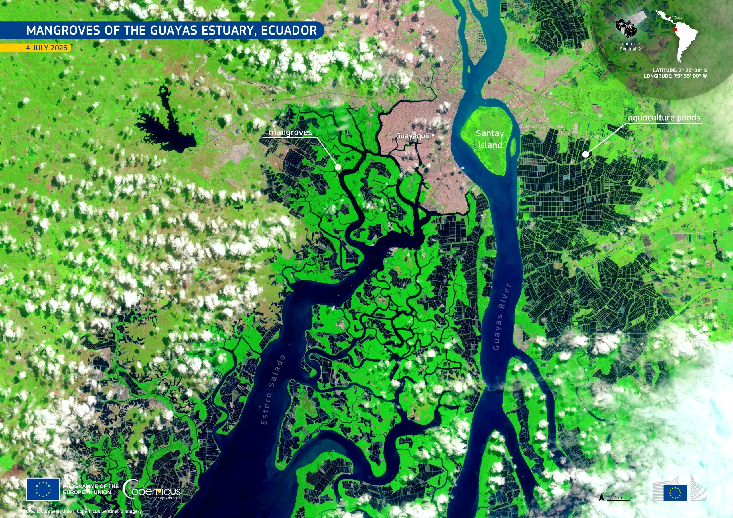
To mark the International Day for the Conservation of the Mangrove Ecosystem celebrated on 26 July, this image shows the mangroves and wetlands surrounding Santay Island in the Guayas Estuary, in western Ecuador. Part of the estuary is home to Ecuador’s most extensive mangrove area. Despite lying beside Ecuador’s largest city and main port, Santay Island preserves mangroves and other wetland habitats which provide a habitat to more than 100 bird species.
Acquired by one of the Copernicus Sentinel-2 satellites on 4 July 2026, this false-colour image shows vegetation in shades of light and bright green. Mangrove forests are visible in deep shades of green and irregular patterns along the tidal channels of the Guayas Estuary, which appear in dark blue in the image. Guayaquil is visible as a dense pink-grey urban area, while the extensive geometric features to the east and west correspond to aquaculture ponds, in an estuary where shrimp, mollusc and fish farming is performed.
Copernicus Sentinel-2 imagery supports regular mapping of mangrove extent, aquaculture areas, and changes along tidal waterways, providing information for wetland management and conservation.