The Moon's shadow sweeps across the Arctic Ocean
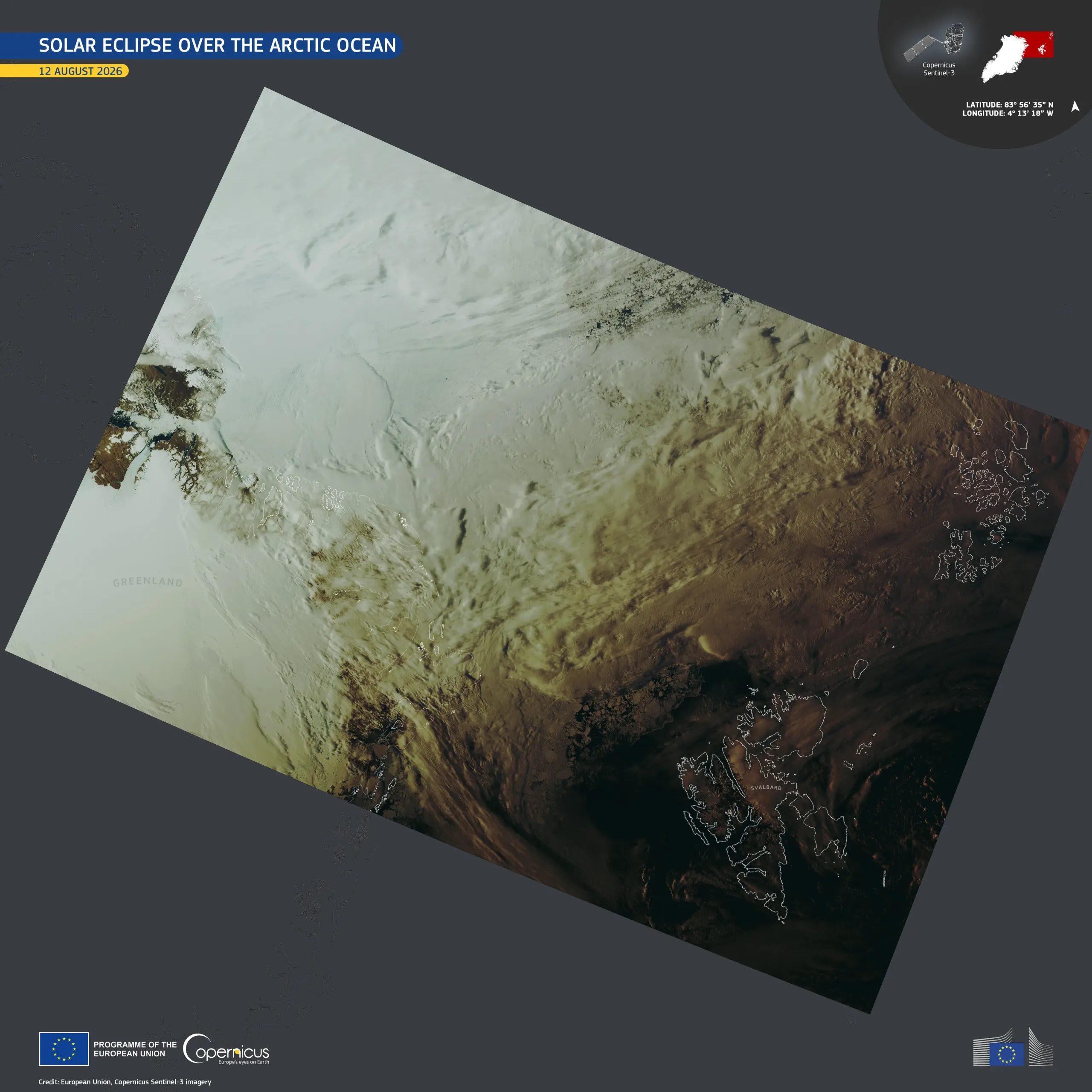
On 12 August 2026, a total solar eclipse crossed the Arctic Ocean, eastern Greenland, western Iceland, and the northern half of Spain. The area covered by the full eclipse was at most 294 kilometres wide, and the high Arctic remained outside of it, under the far broader partial shadow.
This visualisation combines two images acquired by one of the Copernicus Sentinel-3 satellites between 17:31 and 17:36 UTC into a single view about 2,300 kilometres wide, spanning from northern Greenland to the Svalbard Archipelago and Franz Josef Land. The shading follows the eclipse’s path. Over northern Greenland the Moon covered about 26% of the Sun, and the ice still showed in bright white. Over the seas around Svalbard it covered about 88% of the Earth’s natural satellite, and clouds and water showed in a deep brown twilight. Between the two extremities of the image the light reaching the surface drops almost eightfold.
Copernicus Sentinel-3 data support the daily observation of cloud cover, sea ice, and ocean colour across the polar regions, contributing to weather forecasting, maritime safety, as well as long-term ecosystem and climate monitoring.