Multiple wildfires prompt national emergency in Spain
The Spanish Government has declared a national emergency on 23 July in response to the severity and simultaneity of large wildfires across the country.
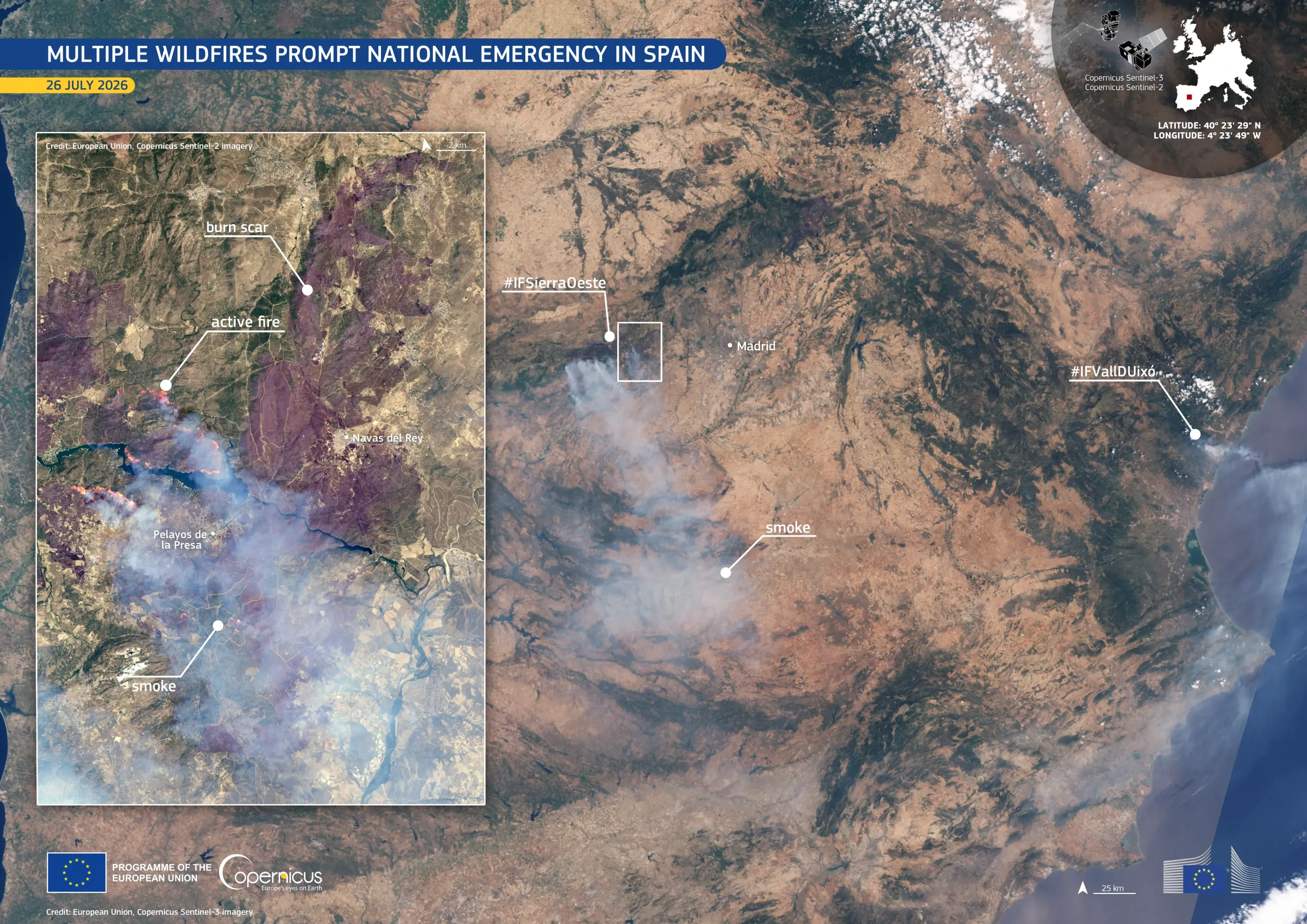
Two fire fronts are currently the top priority. The first, west of Madrid (#IFSierraOeste), formed when several fires which began around Almorox, Villa del Prado, and San Martín de Valdeiglesias merged into a single large fire affecting more than 27,000.hectares. The second (#IFVallDUixó) is located in the Province of Castellón, around la Vall d'Uixó, approximately 50 kilometres north of Valencia.
More than 100,000 people have been evacuated or instructed to remain indoors across the affected regions. Hundreds of firefighters, Military Emergency Unit (UME) personnel, fixed-wing aircraft, and helicopters have been deployed to contain the fires.
This Copernicus Sentinel-3 image, acquired on 26 July 2026, shows dense grey smoke spreading across central and western Spain, while the inset Copernicus Sentinel-2 image captures an active fire front within the eastern #IFSierraOeste perimeter, west of Madrid.
The Copernicus Emergency Management Service (CEMS) Rapid Mapping component has been activated to support the monitoring and management of the fires. More information is available here.