Powerful waves cause hazardous conditions on California beaches
On 14 November 2026, powerful waves struck the coast of California causing flooding in coastal areas and hazardous conditions on several beaches. The US National Weather Service had issued warnings for dangerous surf and strong rip currents. Several piers were closed across the state, and an evacuation warning was issued for areas around the town of Capitola, in Santa Cruz County.
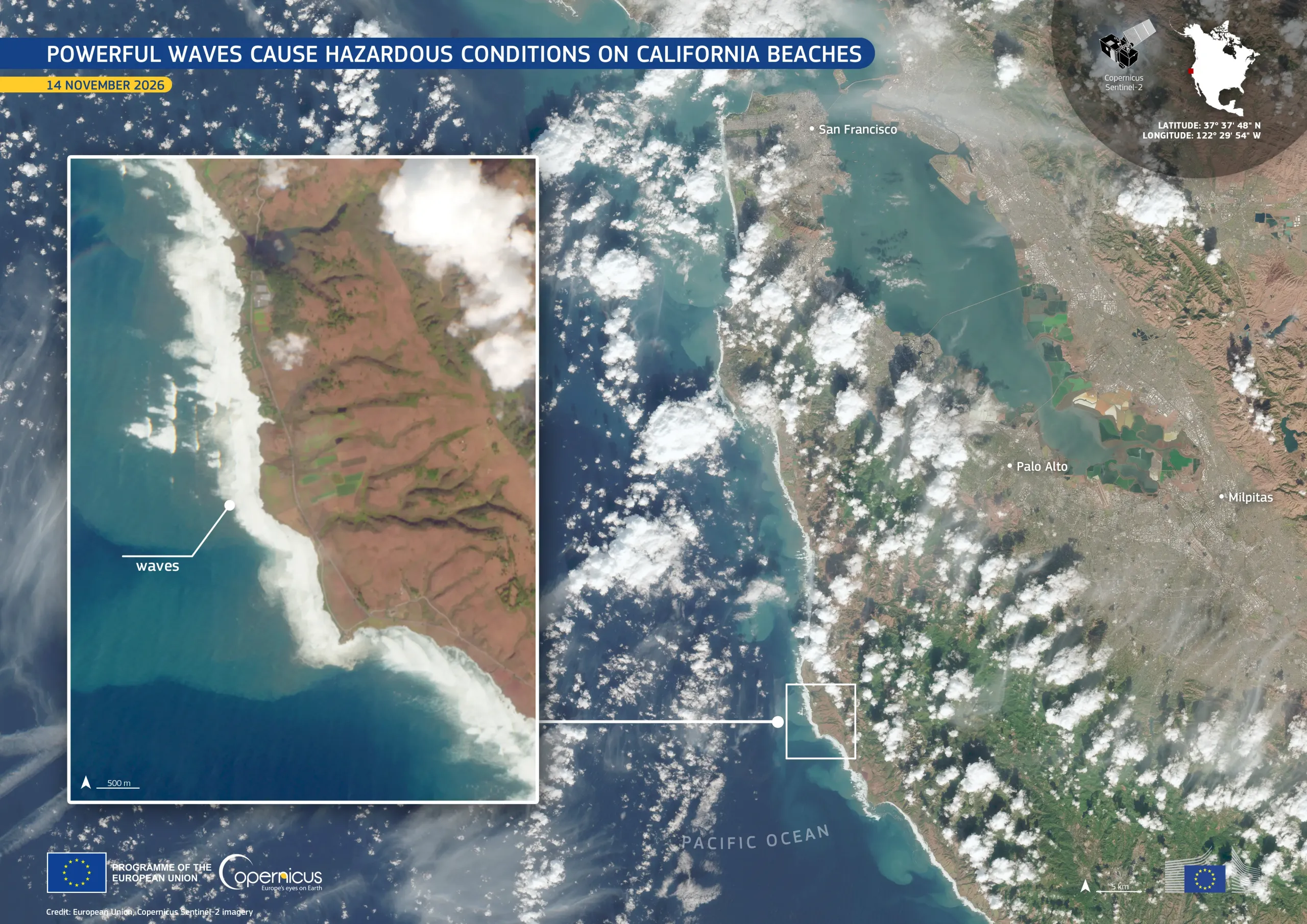
This image, acquired by one of the Copernicus Sentinel-2 satellites on 14 November 2026, shows ponding surf along the Pacific coastline south of San Francisco. The inset shows waves forming wide bands of white foam which stand out against the dark blue and turquoise water.
Copernicus Sentinel-2 data support the monitoring of shorelines by providing information on how they change over time, including after storms, and contribute to coastal risk assessment and management.