The River Slaney meets the Irish Sea at Ireland’s Wexford Harbour
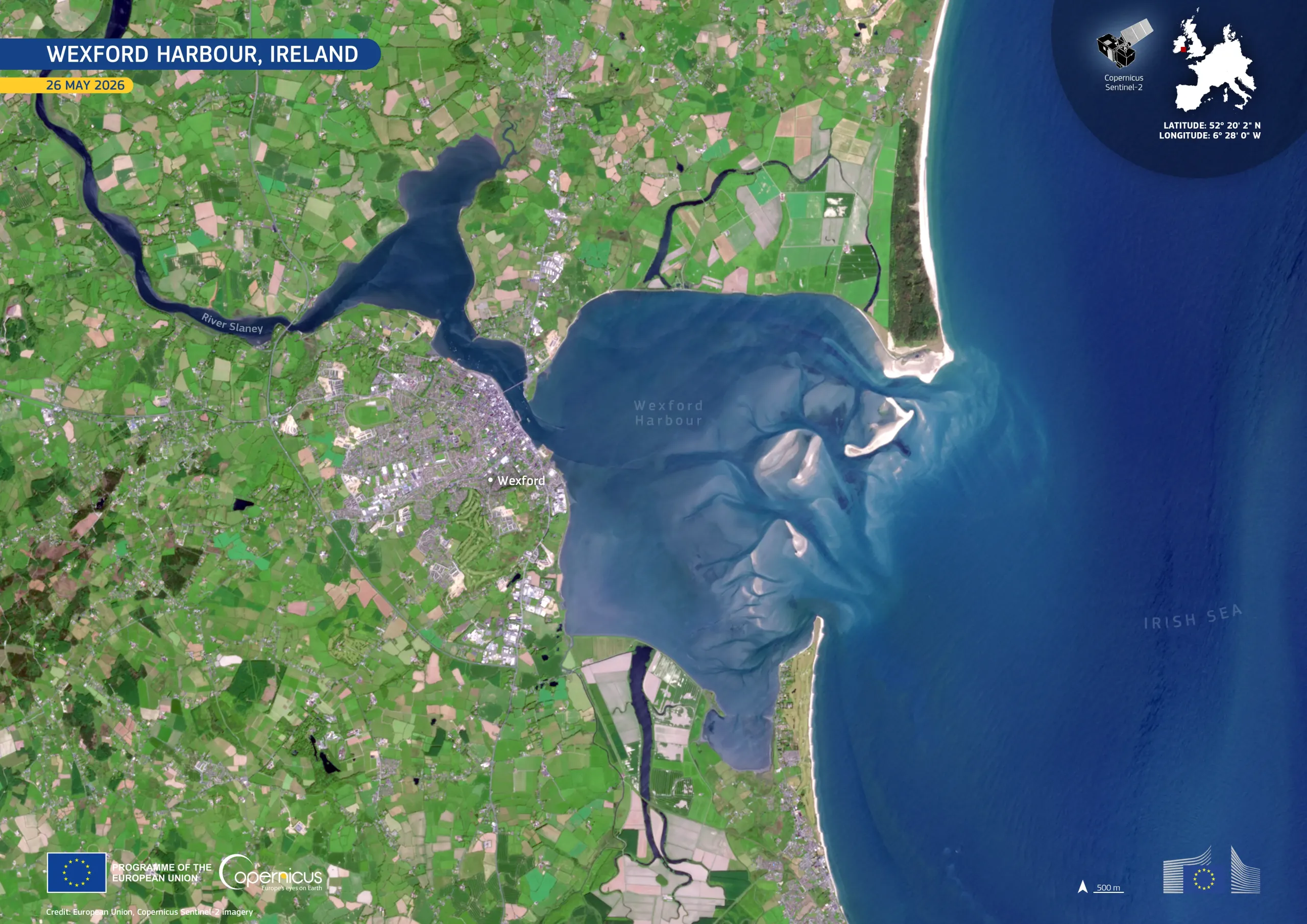
Wexford Harbour, a natural harbour in County Wexford on the south-east coast of Ireland, lies at the mouth of the River Slaney, where the river flows into the Irish Sea. The area includes extensive tidal flats, sandbanks, coastal wetlands, agricultural land, and the town of Wexford.
This image, acquired by one of the Copernicus Sentinel-2 satellites on 26 May 2026, shows the harbour and surrounding coastline in natural colour. The bright sandbanks and shallow waters stand out near the harbour mouth, while the patchwork of agricultural fields inland contrasts with the darker waters of the harbour and the Irish Sea.
Copernicus Sentinel-2 provides high-resolution optical imagery which supports coastal monitoring, land cover mapping, and observation of dynamic environments such as estuaries, wetlands, and sediment-rich coastal zones.