Sandbanks emerge along Germany’s Rhine after months of low water
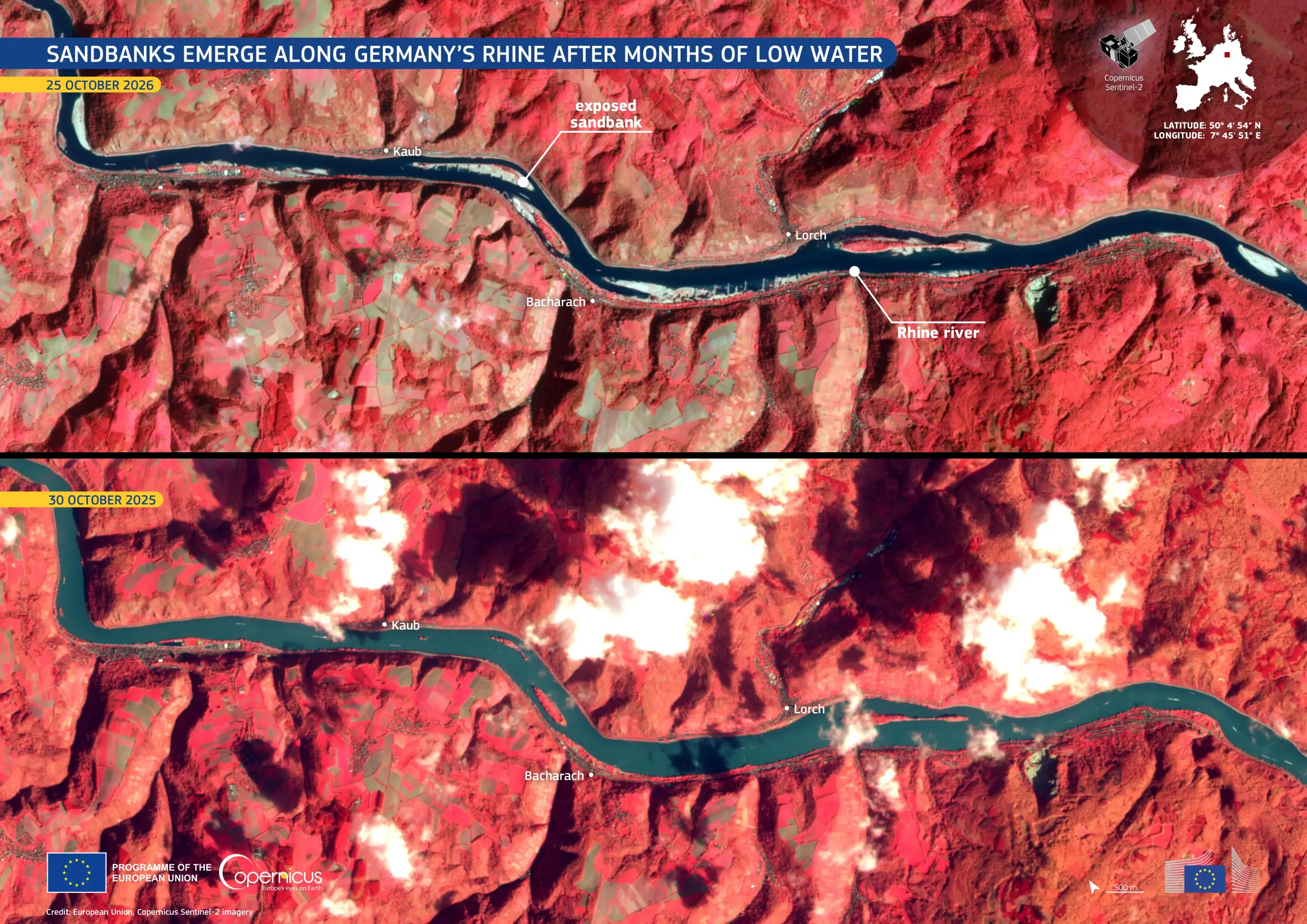
Throughout much of 2026, the River Rhine has been affected by unusually low water levels following a dry spring and a hot summer. In late September, water levels, as measured by the gauge at Kaub, around 30 km south-east of Koblenz, fell to a record low. Readings at Kaub are a key reference for shipping on the river. On 26 October 2026, the gauge read 0.55 m. This figure is a reference value used for navigation rather than the actual depth of the river, but levels this low still limit the loading capacity of vessels.
These Copernicus Sentinel-2 false-colour images show the same stretch of the Rhine between Kaub and Bingen, Germany, on 25 October 2026 (top) and 30 October 2025 (bottom). In both images, the river appears in dark blue-green tones, while the surrounding vegetation is highlighted in red. In the 2026 image, large areas of exposed sandbanks are visible near Kaub and along other sections of the river. In the 2025 image, these areas are covered by water.
Copernicus Sentinel-2 data support the monitoring of river extent and exposed riverbeds, providing information for drought assessment, water resource management, and inland navigation.