Setúbal, Portugal, increases its resilience to floods
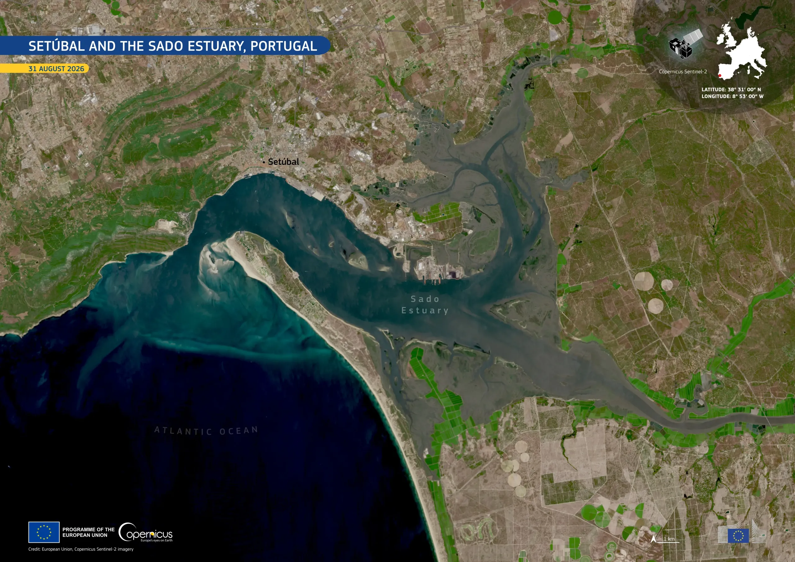
Located around 30 kilometres south of Lisbon, Portugal, the city of Setúbal sits on the Atlantic coast beside the Sado Estuary, a landscape of tidal flats and wetlands. During periods of intense rainfall, runoff from the surrounding higher ground can combine with elevated water levels in the estuary, increasing the risk of flooding in the city centre. To reduce this risk, Setúbal has implemented flood-resilience measures including retention basins which temporarily store excess rainwater and regulate flows towards the city and Sado Estuary.
This image, acquired by one of the Copernicus Sentinel-2 satellites on 31 August 2026, shows the Sado Estuary extending eastwards from Setúbal. These waters contrast with Setúbal’s densely built-up area and the surrounding agricultural and forested landscapes.
Copernicus satellite data support monitoring of urban and coastal environments by providing information on land cover, water bodies, and landscape change.