Severe drought affects France
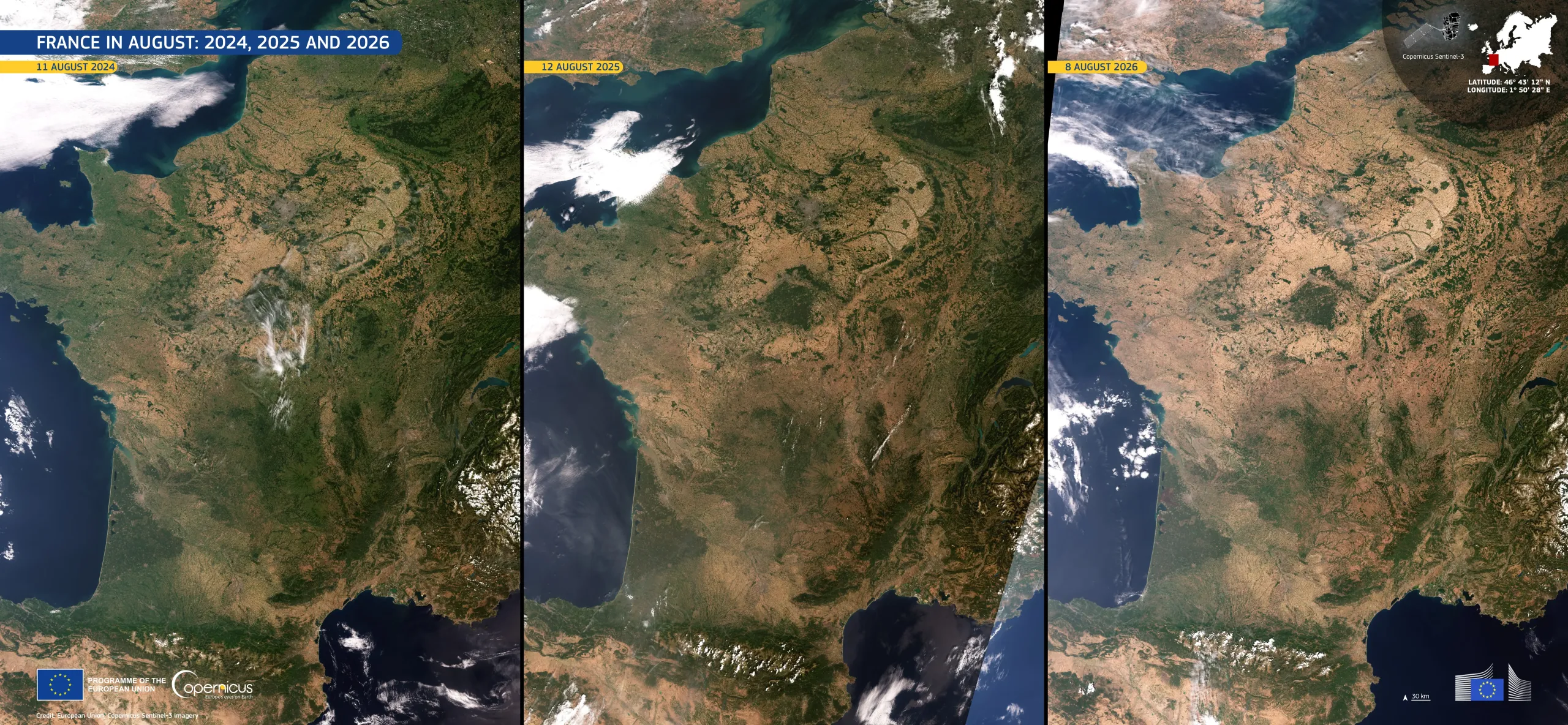
A severe drought has been affecting large parts of France this summer. According to the European Drought Observatory (EDO), more than 85% of the country was under drought warning or alert conditions in mid-July 2026, compared with around 65% at the same time in 2025, and less than 2% in 2024, a summer without widespread drought.
These Copernicus Sentinel-3 natural-colour images illustrate this contrast. In the image on the right, acquired on 8 August 2026, beige and ochre tones dominate the landscape from the Atlantic coast to the northern plains, with greener areas largely confined to forests and uplands. In the central one, acquired on 12 August 2025, pale brown areas spread across the west of the country and the Paris Basin. In the image on the left, acquired on 11 August 2024, green tones prevail, offering a clear point of reference.
EDO, part of the Copernicus Emergency Management Service (CEMS), provides systematic updated drought monitoring for Europe, supporting early warning, impact assessment, and water management decisions.