Super Typhoon Bavi sweeps past Guam and the Northern Mariana Islands
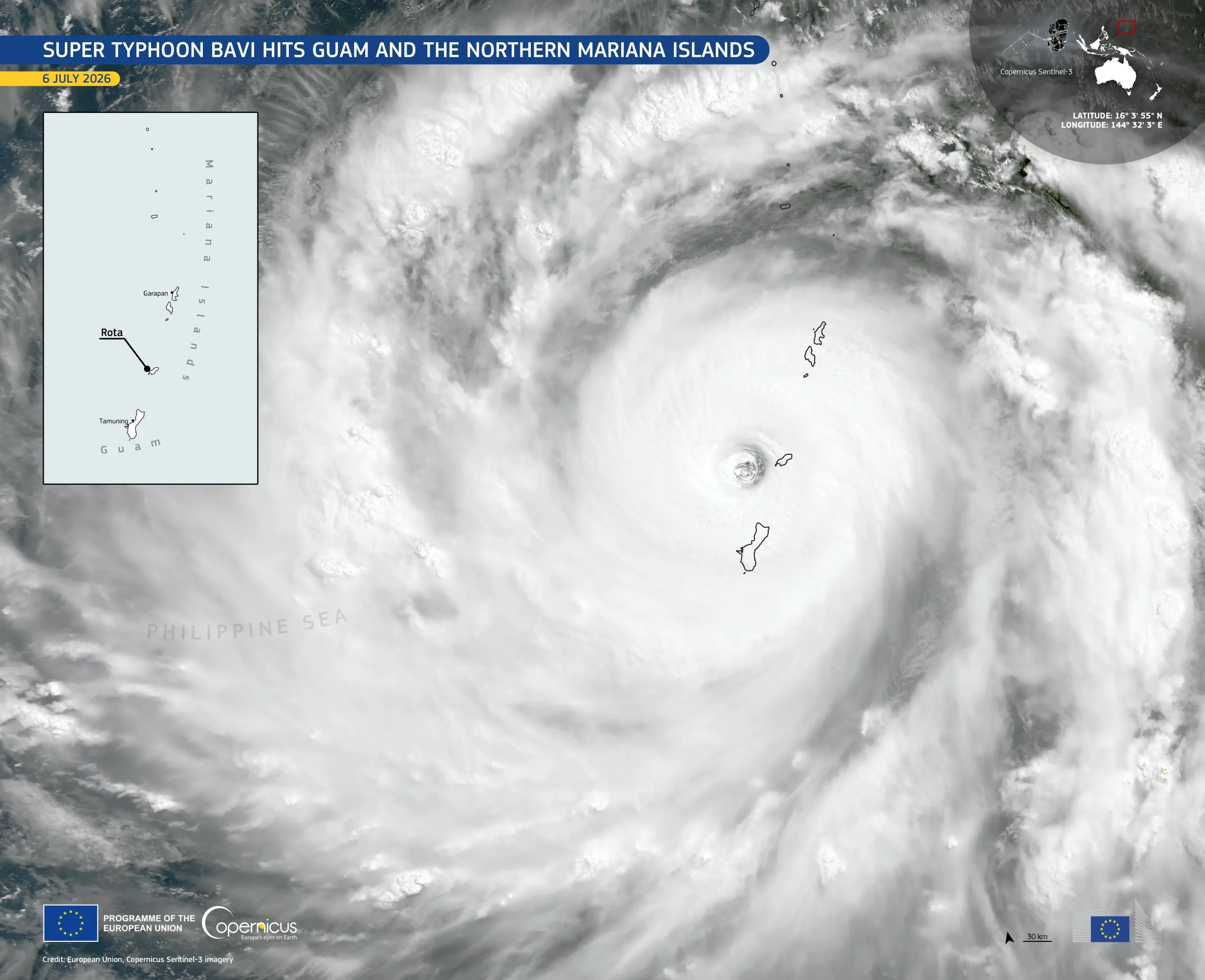
Super Typhoon Bavi crossed the Philippine Sea, passing near Guam and through the Northern Mariana Islands on 6 July 2026, bringing extreme winds and heavy rain to both territories.
This image, acquired by one of the Copernicus Sentinel-3 satellites on 6 July 2026 at 00:22 UTC, shows the eye of Bavi close to the island of Rota, part of the Northern Mariana Islands, where winds exceeded 240 km/h. The storm’s dense cloud bands obscured the islands of Guam, Tinian, and Saipan at the time of acquisition.
Copernicus data support emergency response efforts by contributing to damage assessment and disaster risk management across island and coastal regions.