Three Copernicus Sentinel satellite missions track floods in southern Brazil
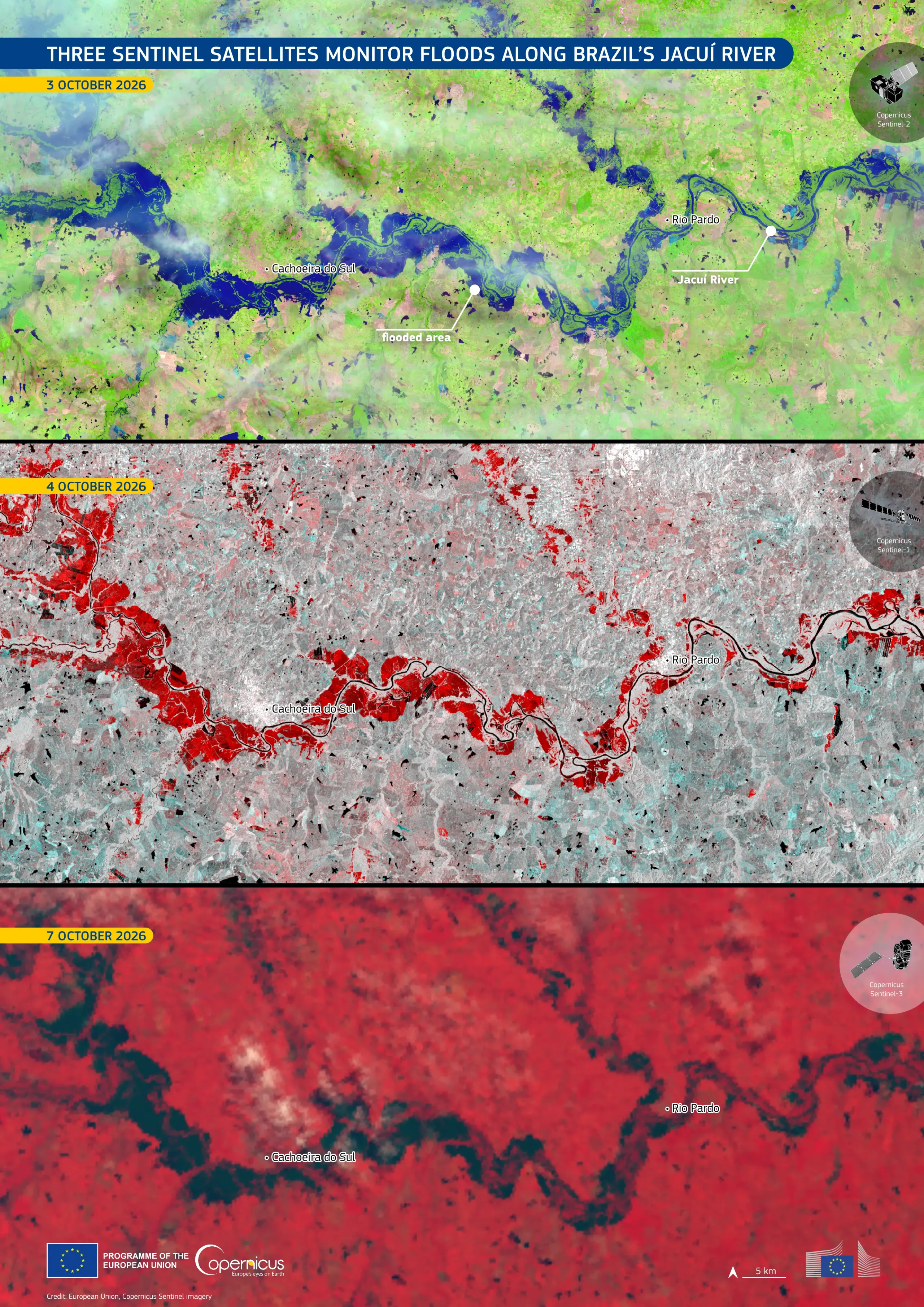
Since late September, severe storms in the state of Rio Grande do Sul, Brazil's southernmost state, have caused the Jacuí River to overflow, damaging homes and prompting the dispatch of rescue crews to support affected communities.
This series of Copernicus satellite images shows how three different Sentinel missions have observed the flooding over several days. The Copernicus Sentinel-2 false-colour image acquired on 3 October 2026 shows floodwaters in dark blue tones along the river and across surrounding low-lying areas. The Copernicus Sentinel-1 radar image acquired on 4 October highlights flooded areas in red, while the Copernicus Sentinel-3 false-colour image acquired on 7 October shows the continued presence of floodwaters, visible in dark tones against the surrounding red landscape.
Copernicus Sentinel satellite data enable the monitoring of flood extent over time, supporting the identification of affected areas, emergency response, and flood risk management.